Final Projects
SIGNAL IN THE NOISE: DESIGNING A MORE ACCESSIBLE FLOOD EVACUATION
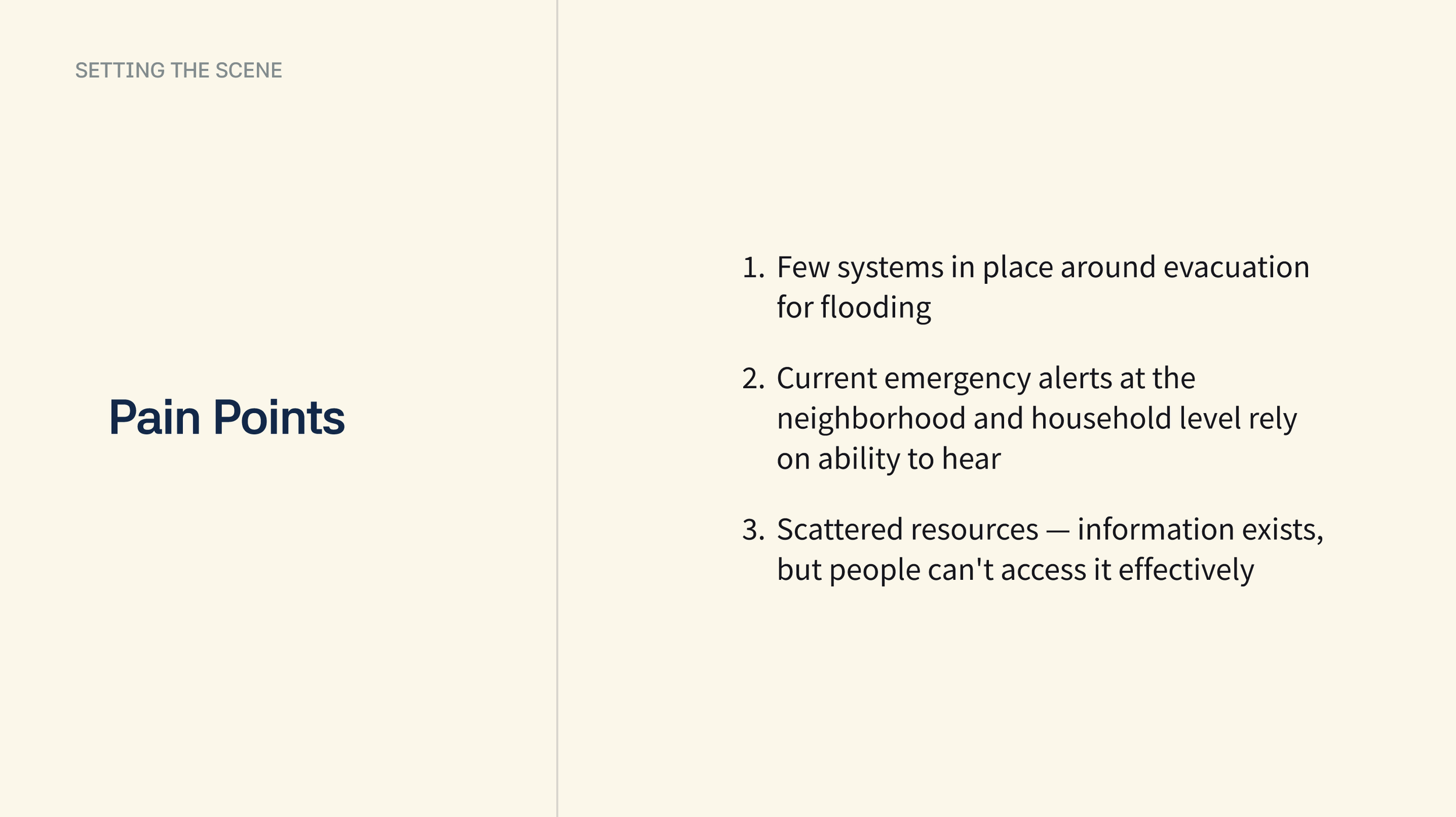
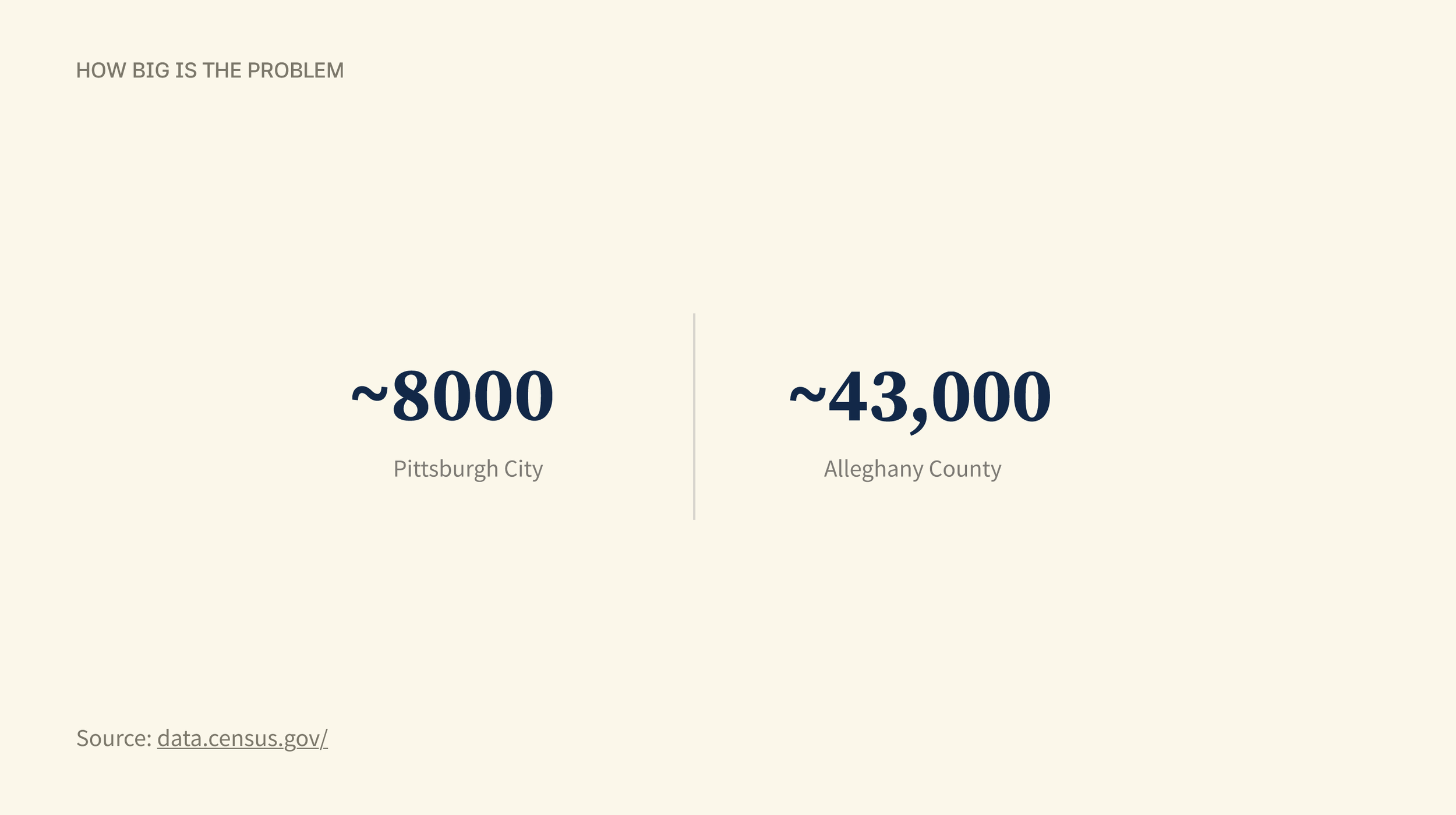
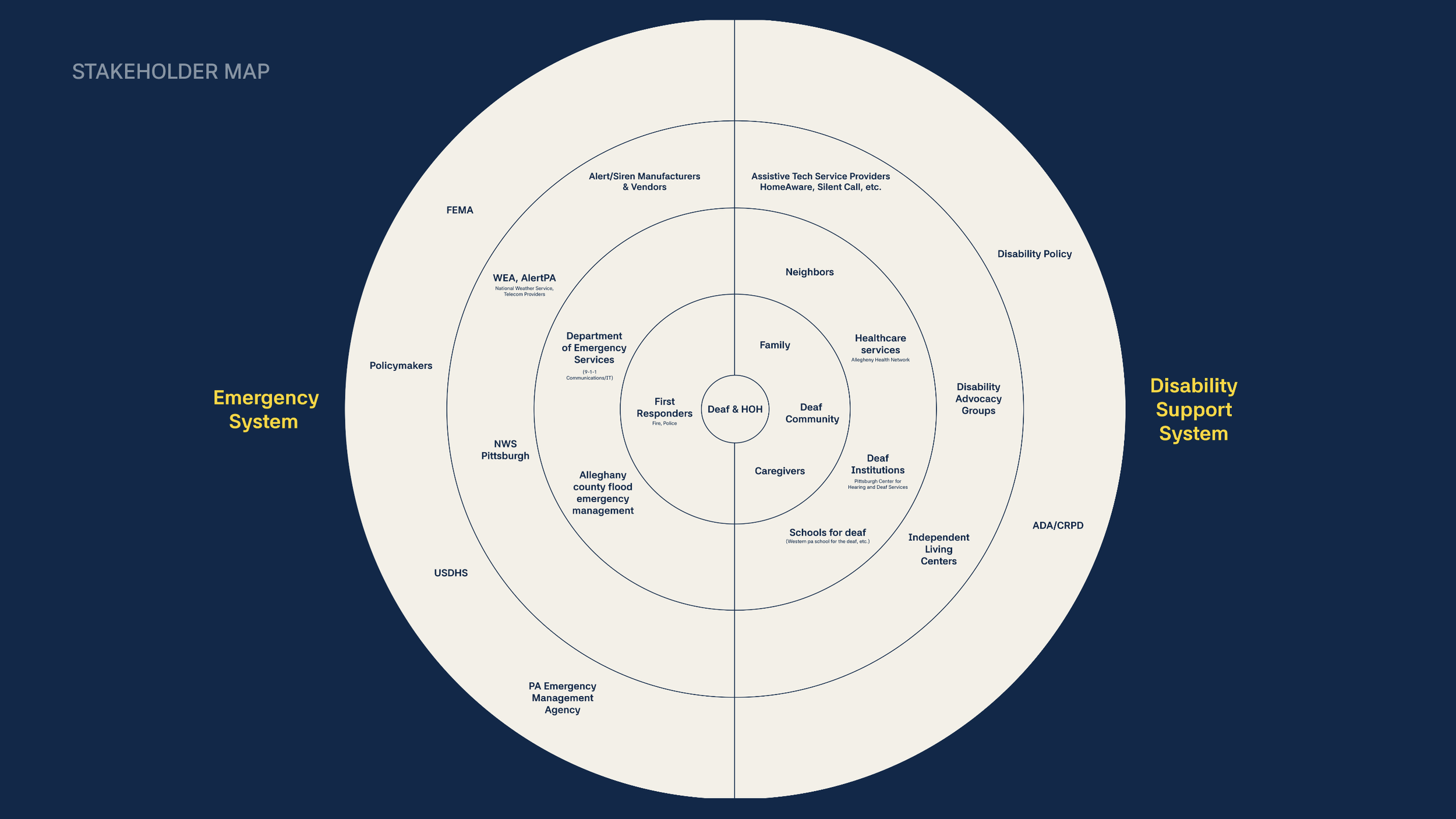
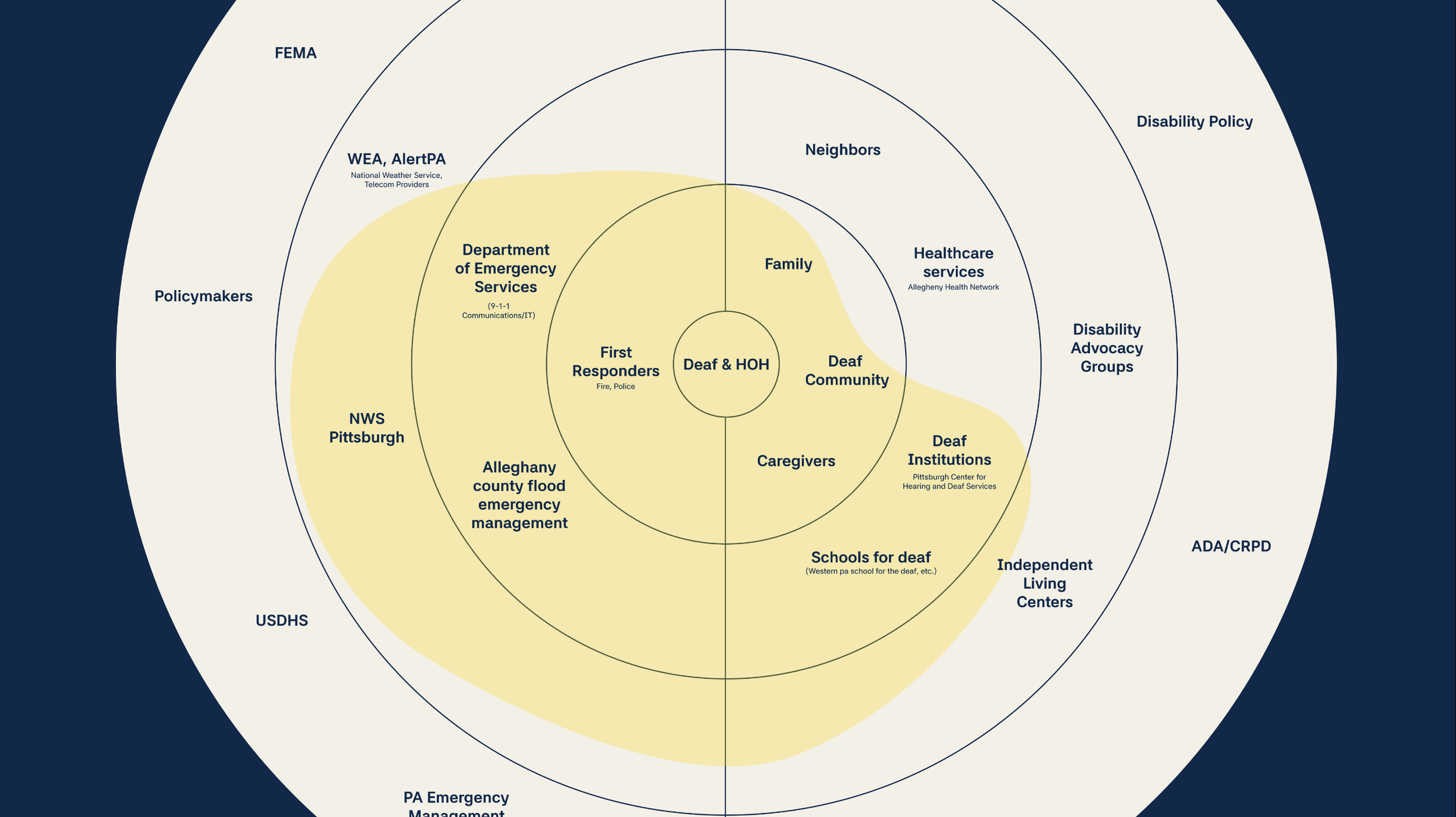
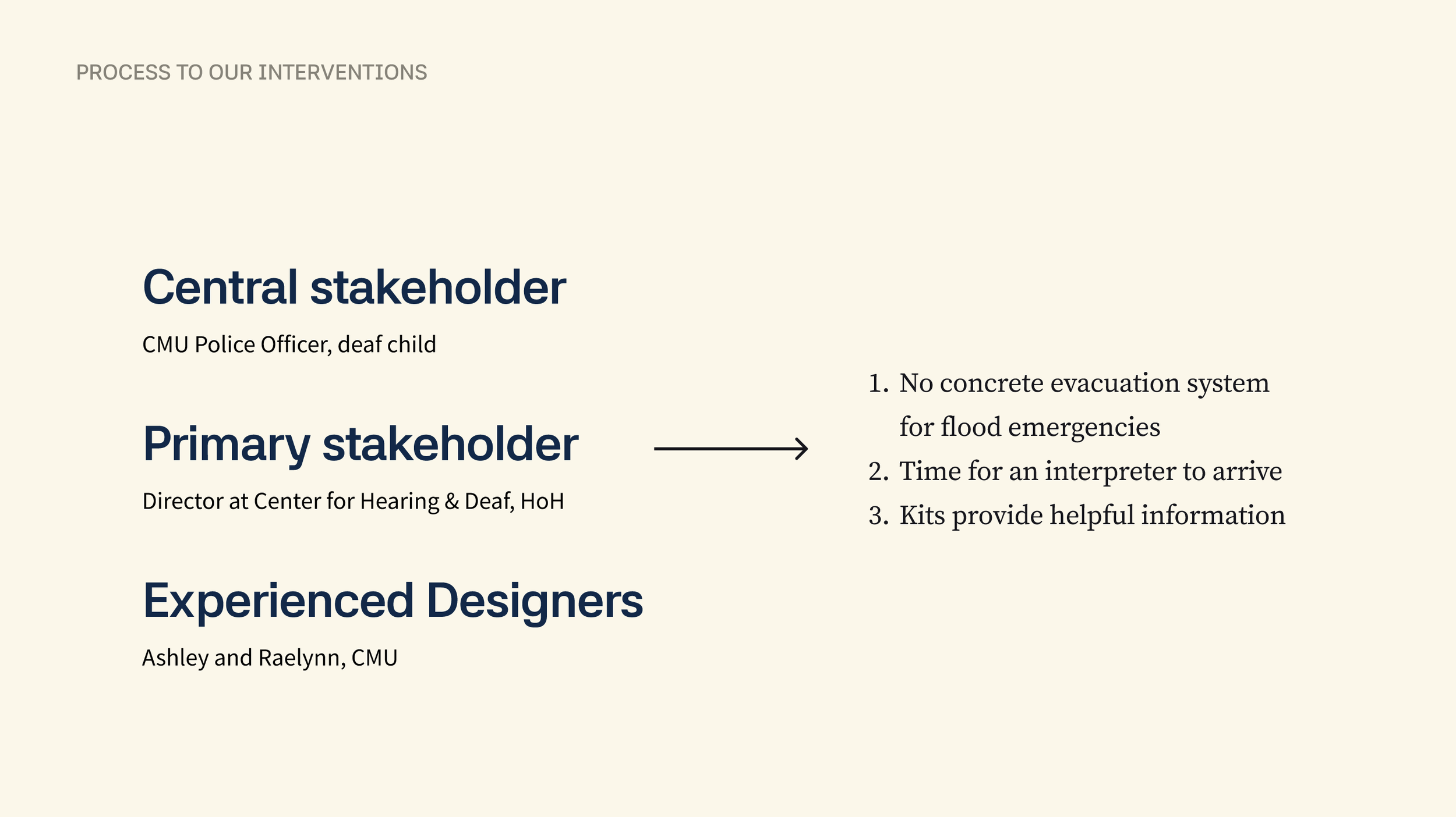
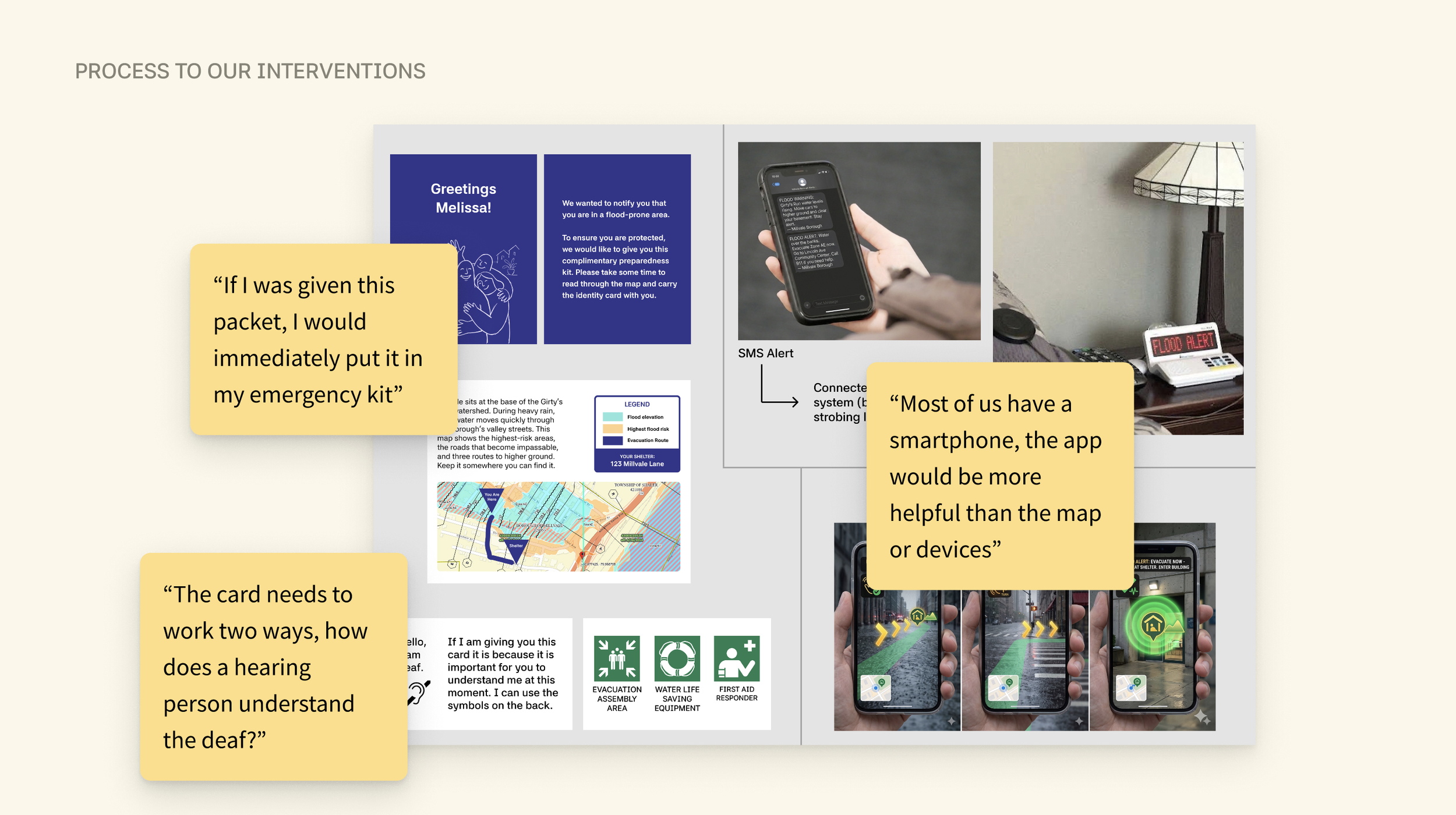
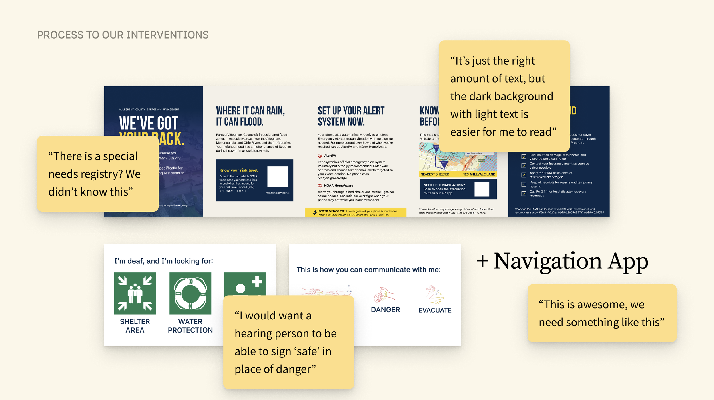
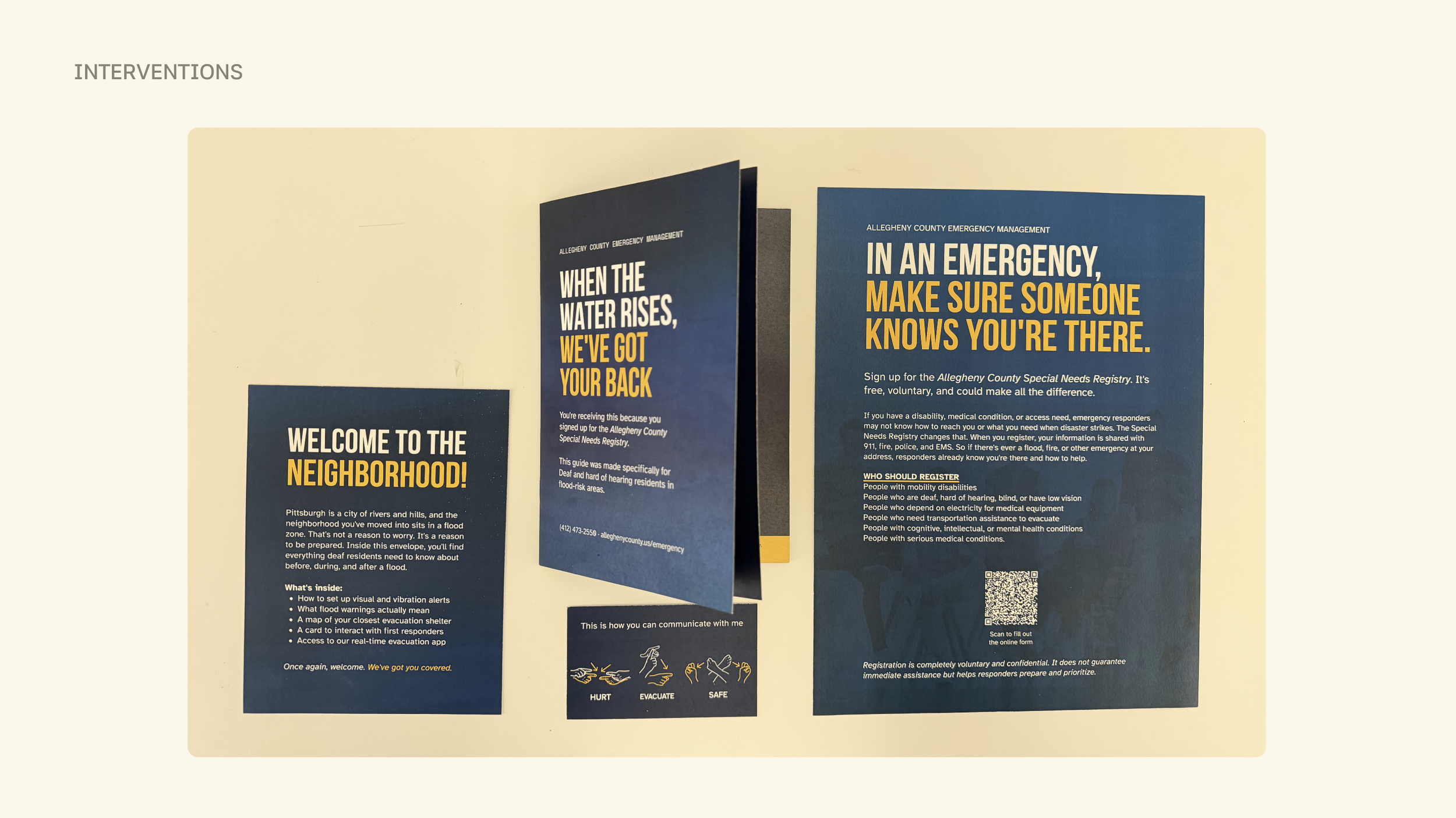
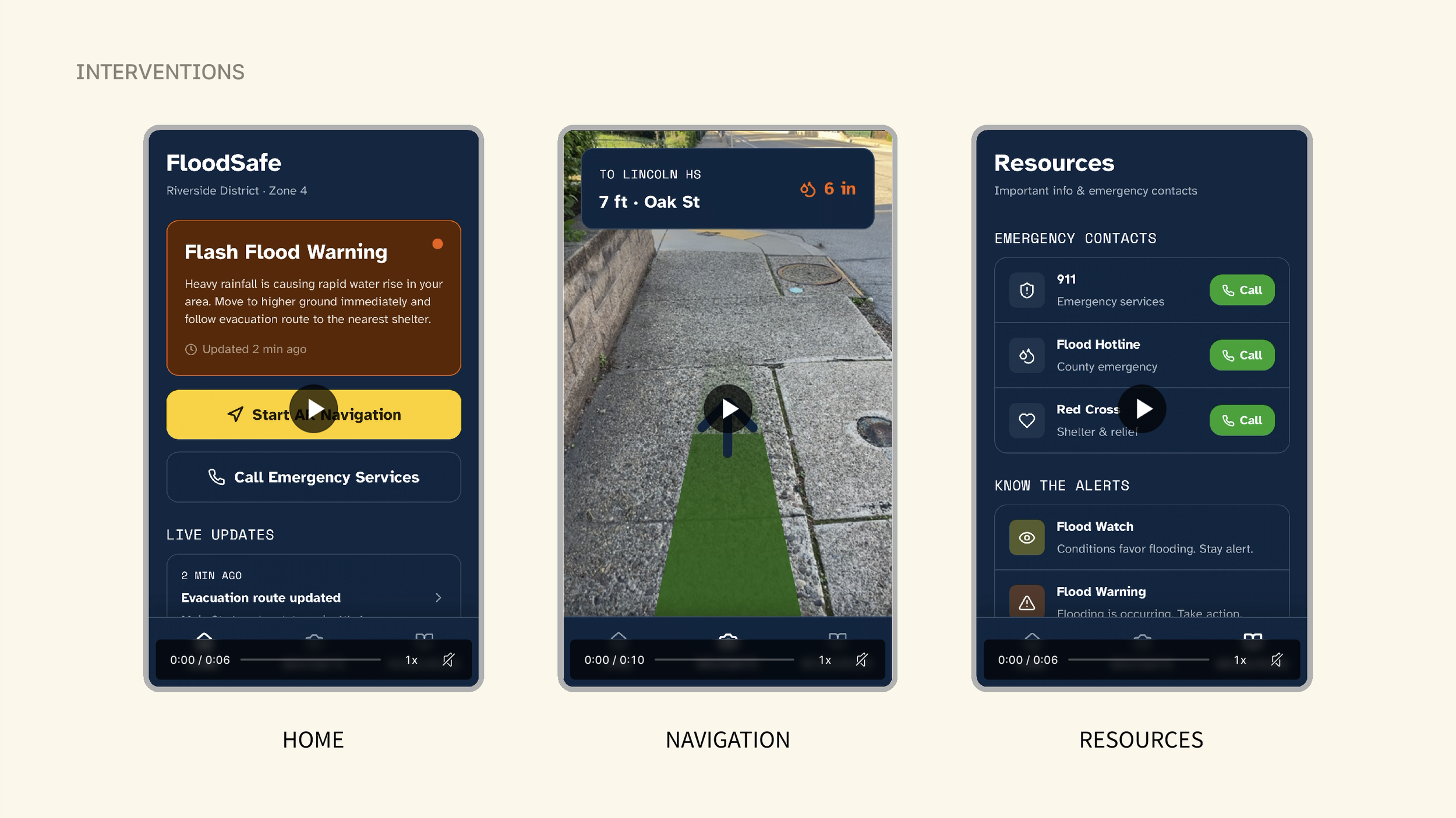
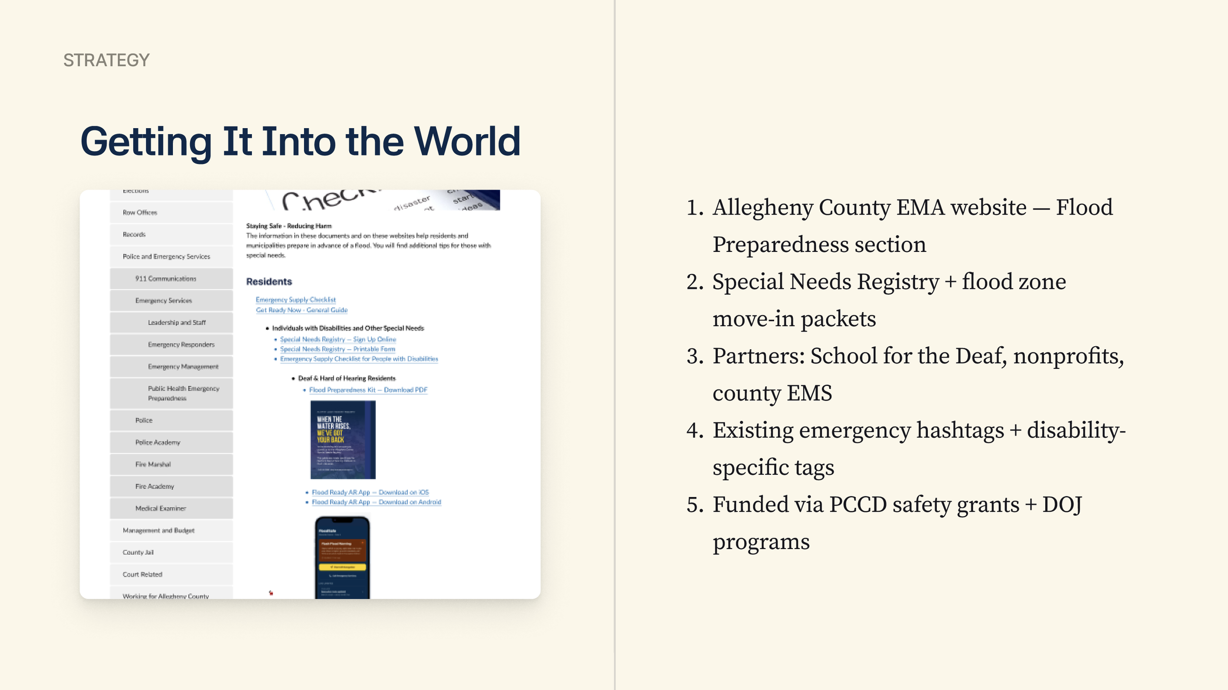
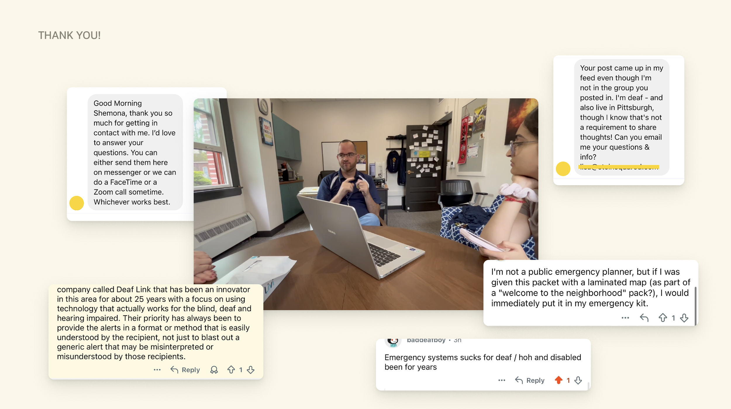
Every year, Pittsburgh floods. And every year, the city's deaf and hard-of-hearing residents face that emergency without the tools designed for them. Standard alert systems rely on sirens they cannot hear. Evacuation guidance assumes access to radio broadcasts and phone calls. For the estimated 43,000 deaf and hard-of-hearing residents in Allegheny County, that gap is not an inconvenience, it is a life-safety failure. Signal in the Noise is a three-part intervention designed to close that gap: a flyer to sign up for the special needs registry, a pre-season preparedness kit distributed to deaf and hard-of-hearing residents in flood-prone neighborhoods before a crisis hits, and an AR navigation app that guides residents to shelter in real time using their phone camera and live directional overlays. Grounded in foundational research with the Western Pennsylvania School for the Deaf, Center for Hearing and Deaf Services, CMU Police, and CMU Disability Resources, the project is designed around one principle: that emergency systems should work for everyone.
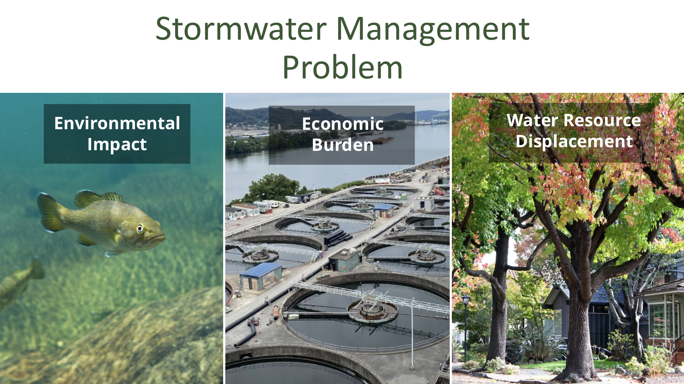
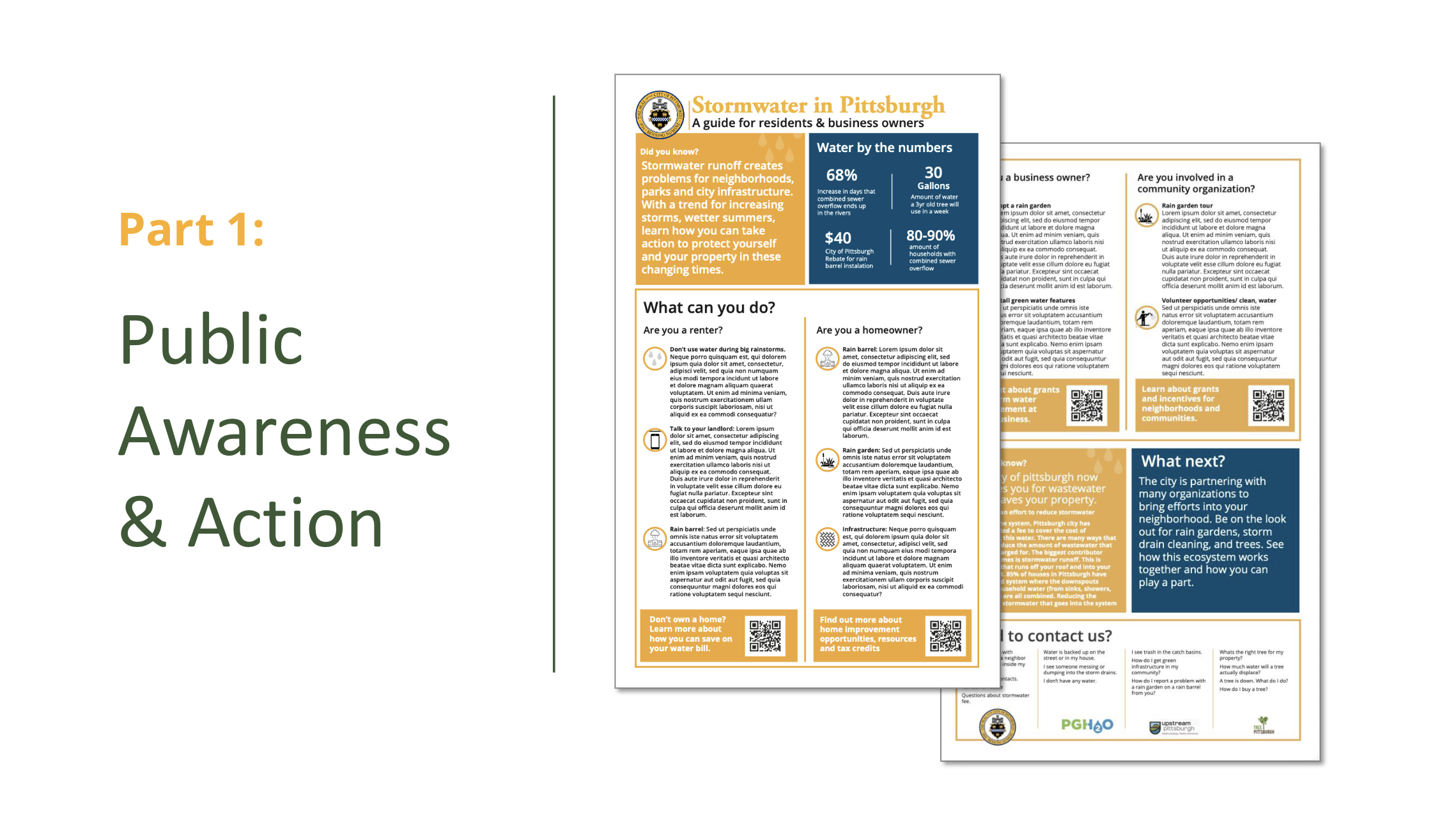
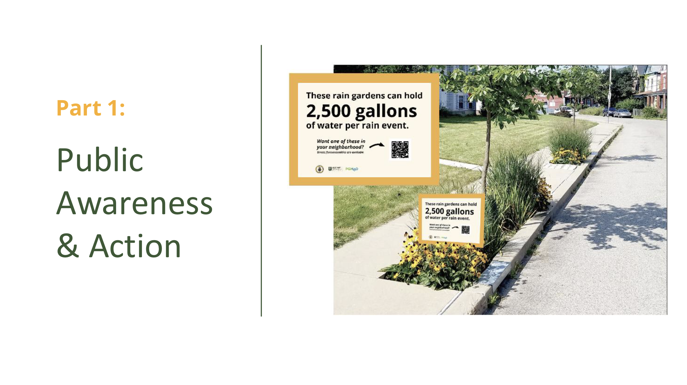
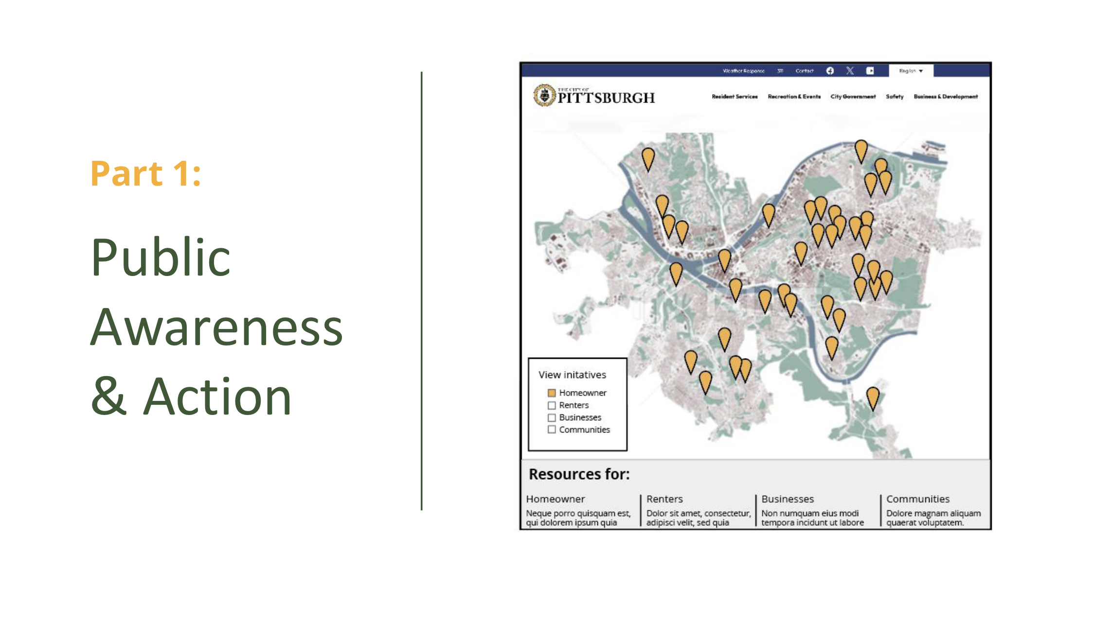
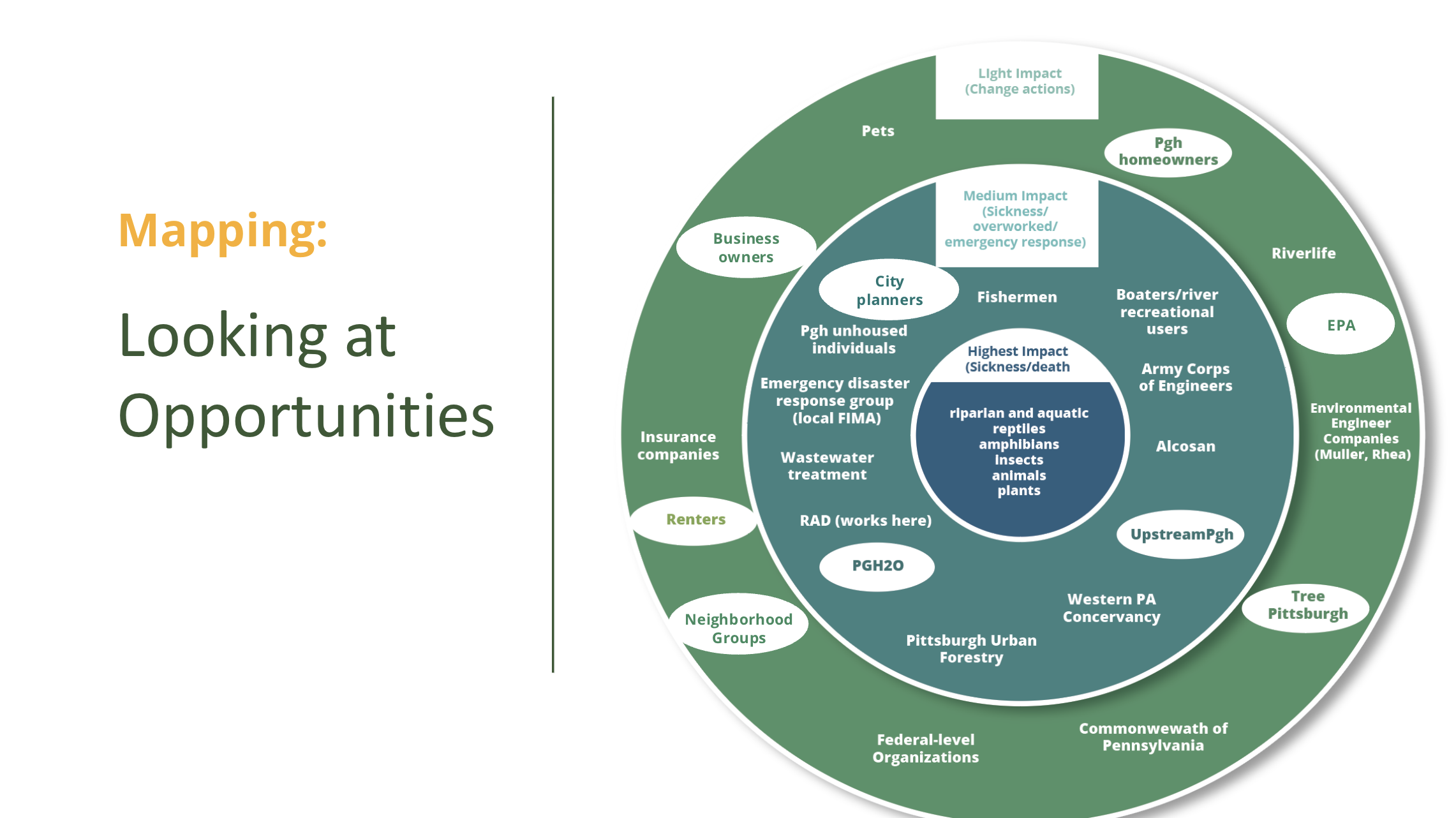
GREEN STORMWATER MANAGEMENT FOR PITTSBURGH’S CHANGING LANDSCAPE
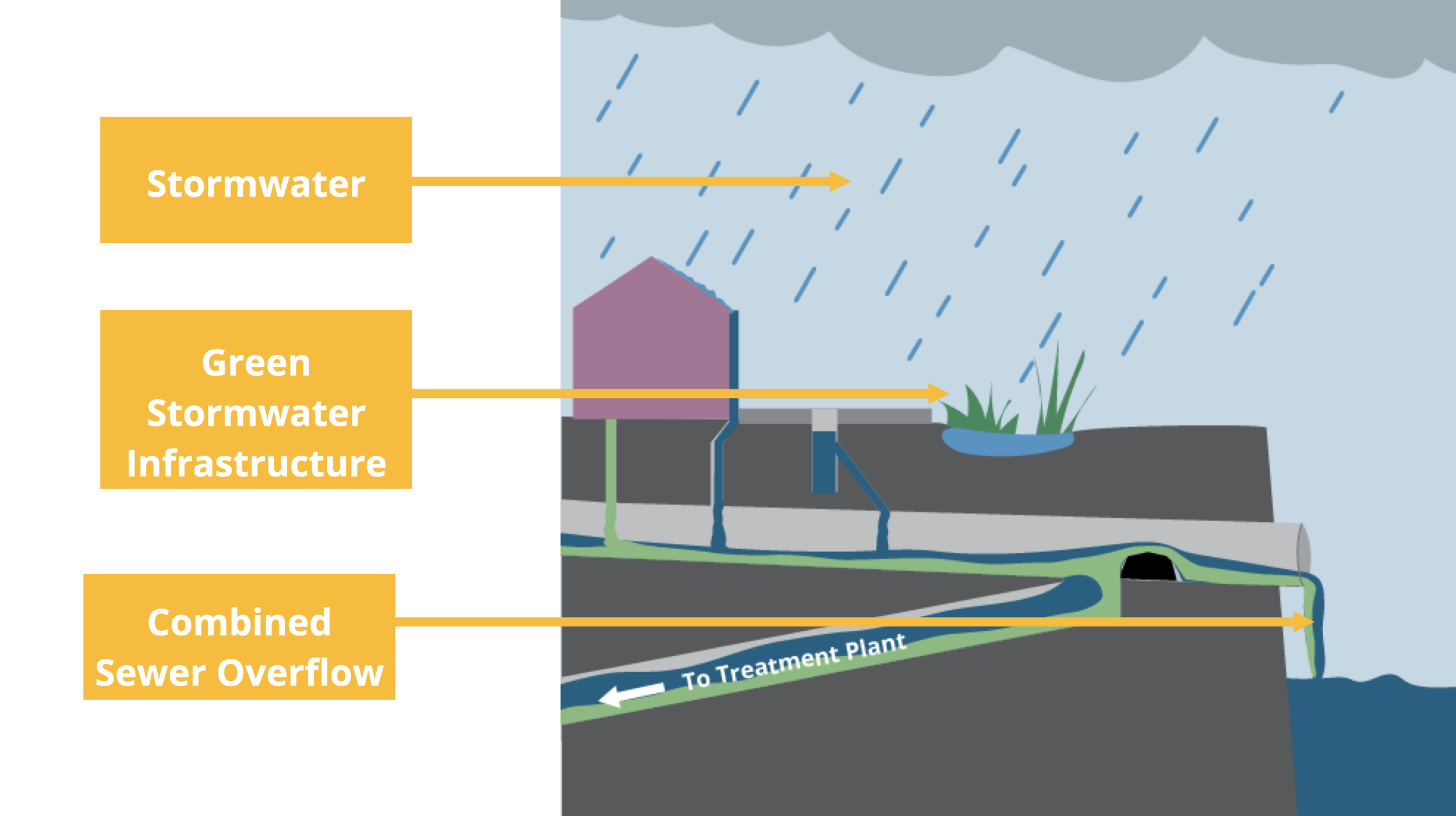
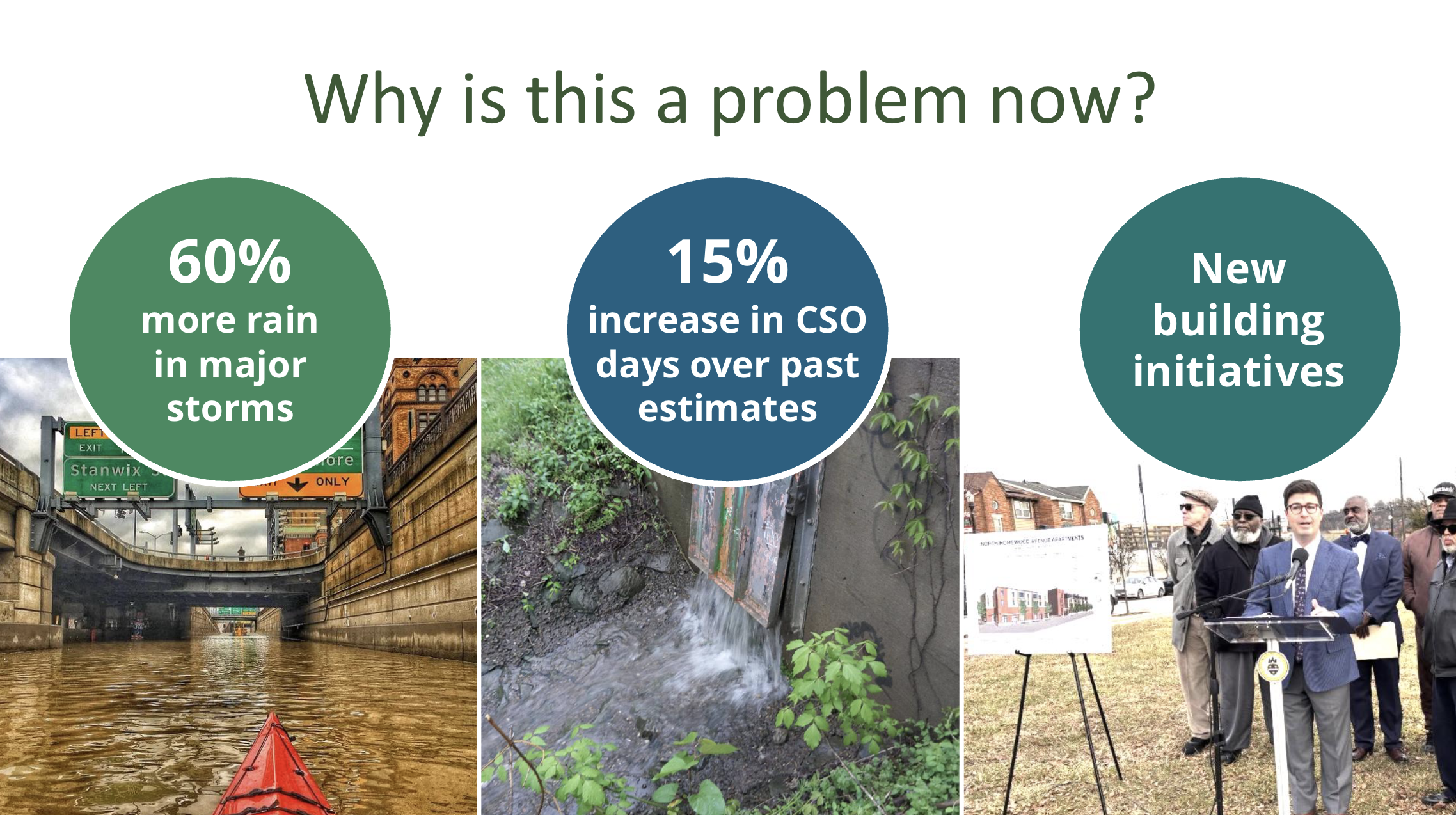
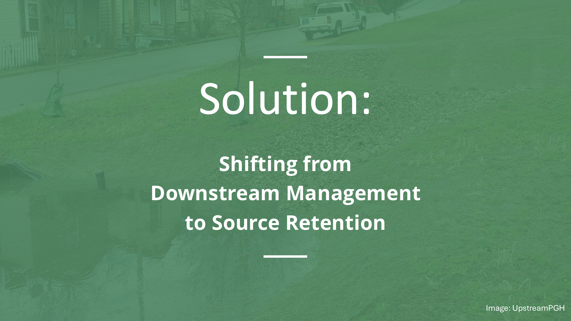
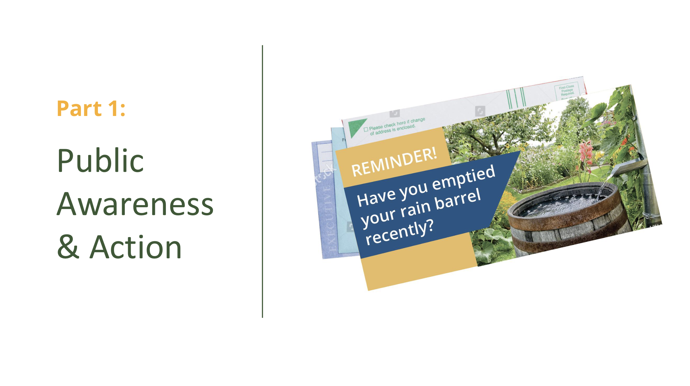
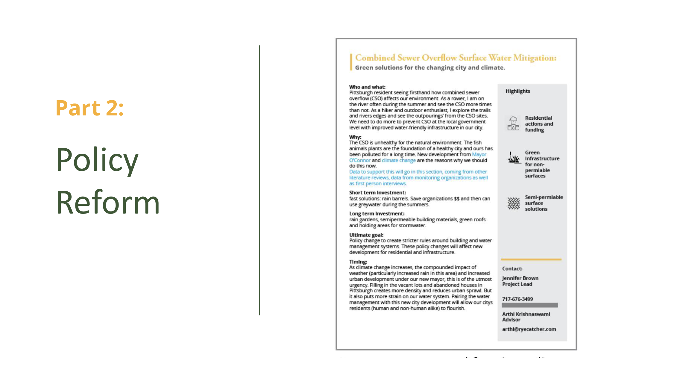
Combined sewer overflow is harmful to aquatic and riparian communities and costly to maintain for the city. Stormwater runoff is displaced from it’s upstream communities depriving them of a valuable resource. The solution to these problems is to retain stormwater in the areas it falls rather than managing it via grey water initiatives downstream. This can be achieved with two approaches. An awareness campaign for the city with tracks and action items for homeowners, renters, business owners and community activists will help create awareness and actionable items for residents. The second approach is policy change to require stricter water management on existing non-permeable surfaces, including parking lots, businesses and residential property.


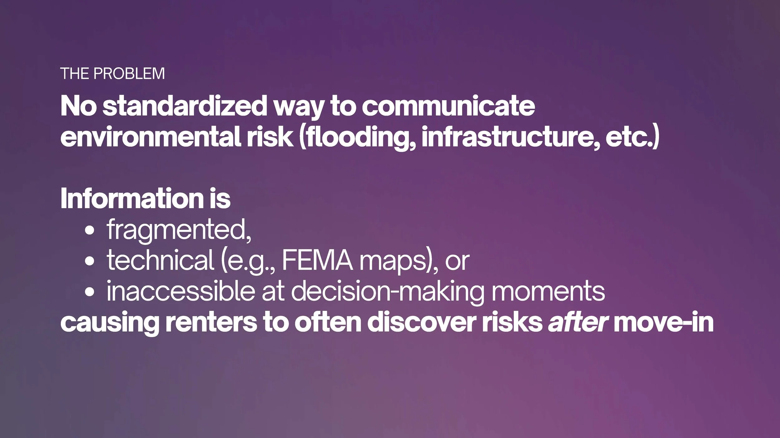
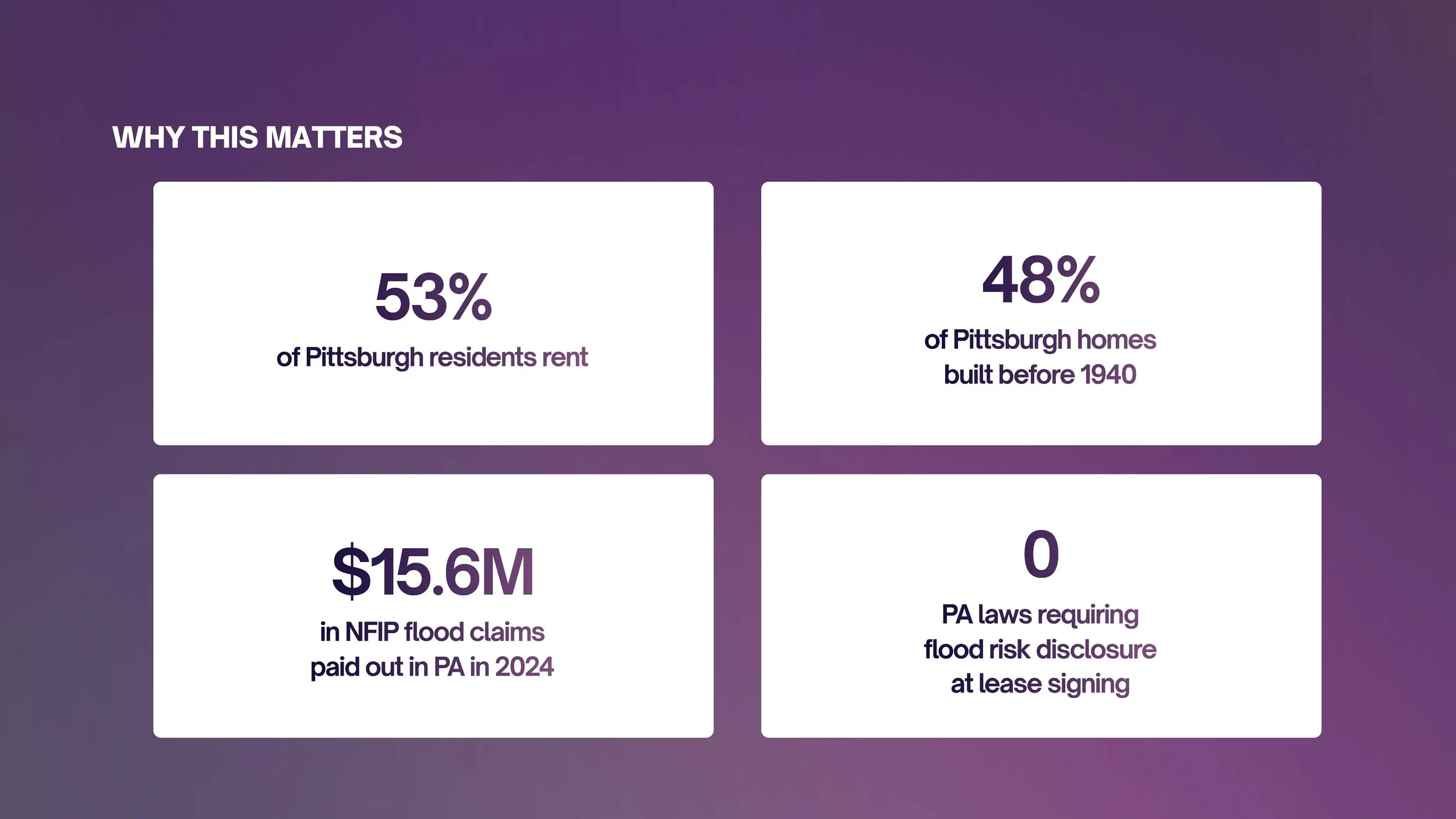
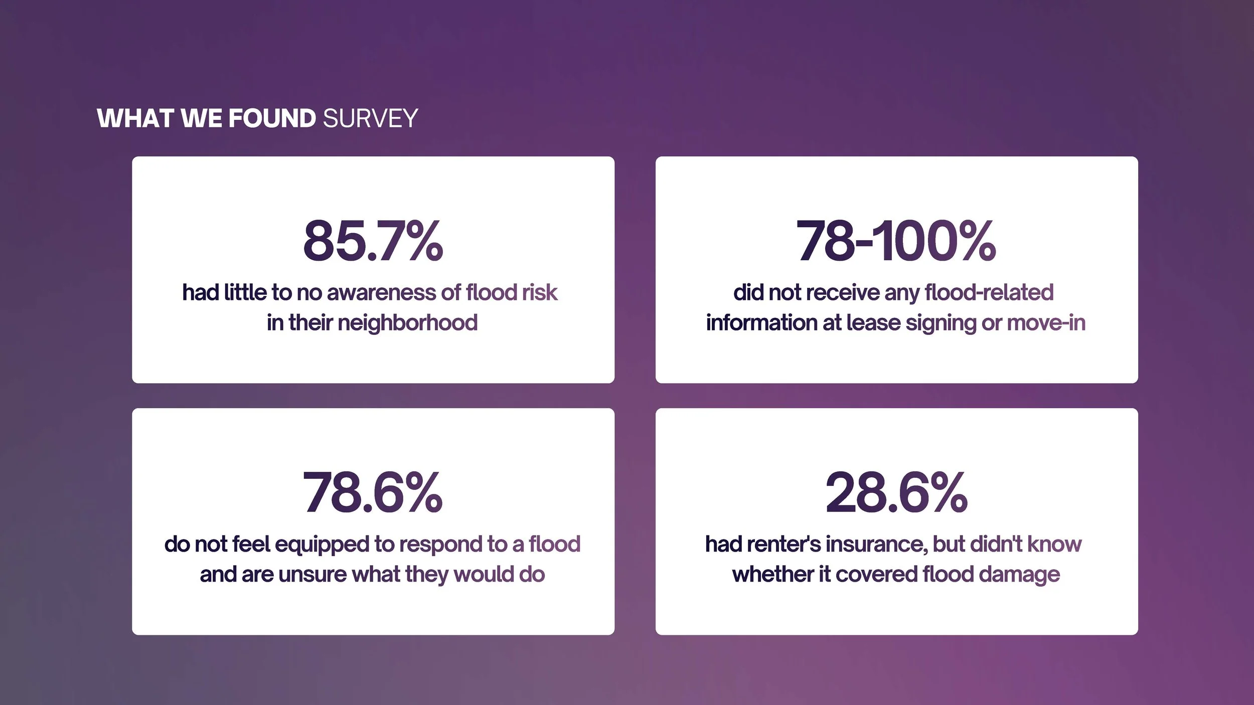
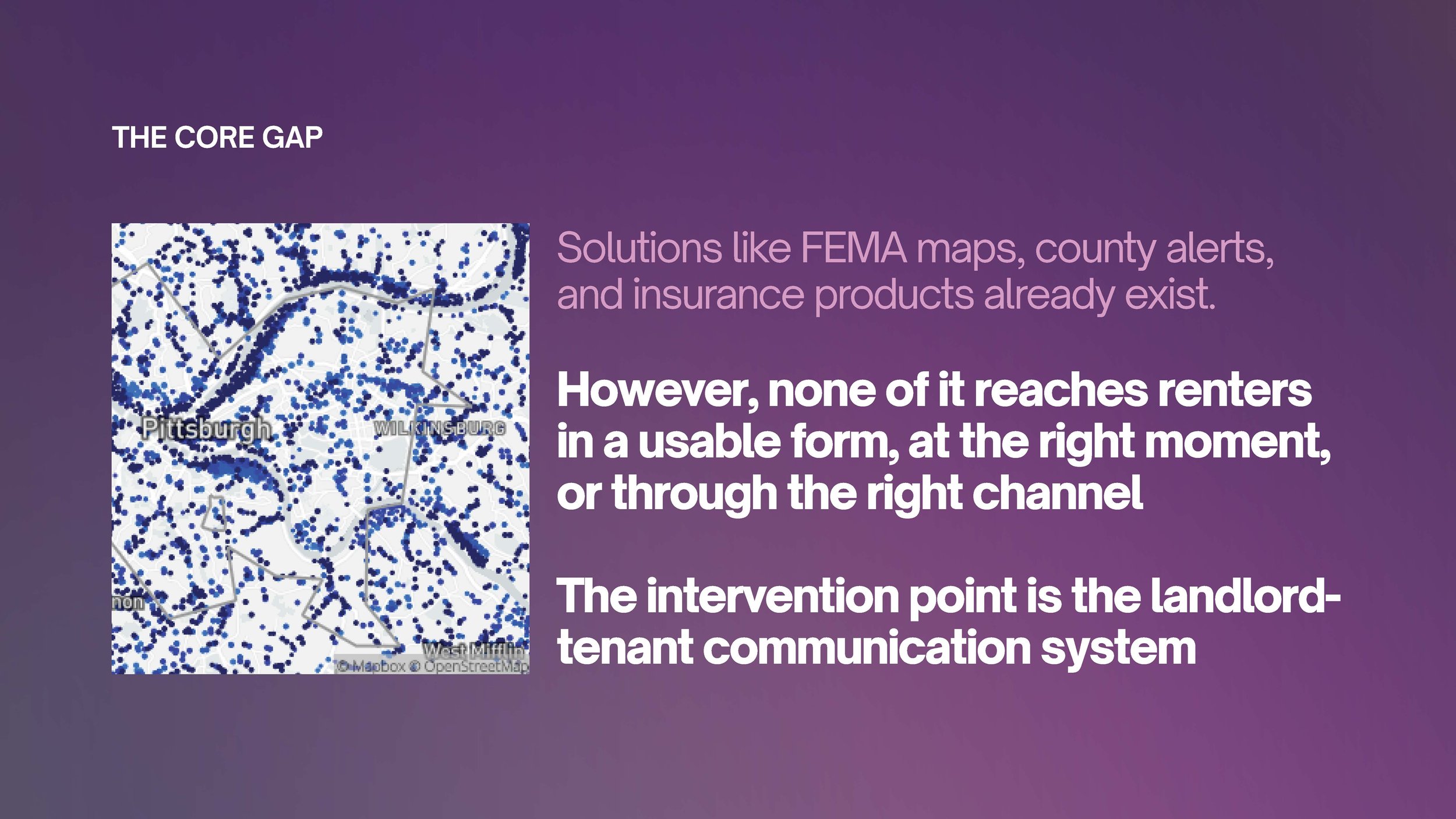
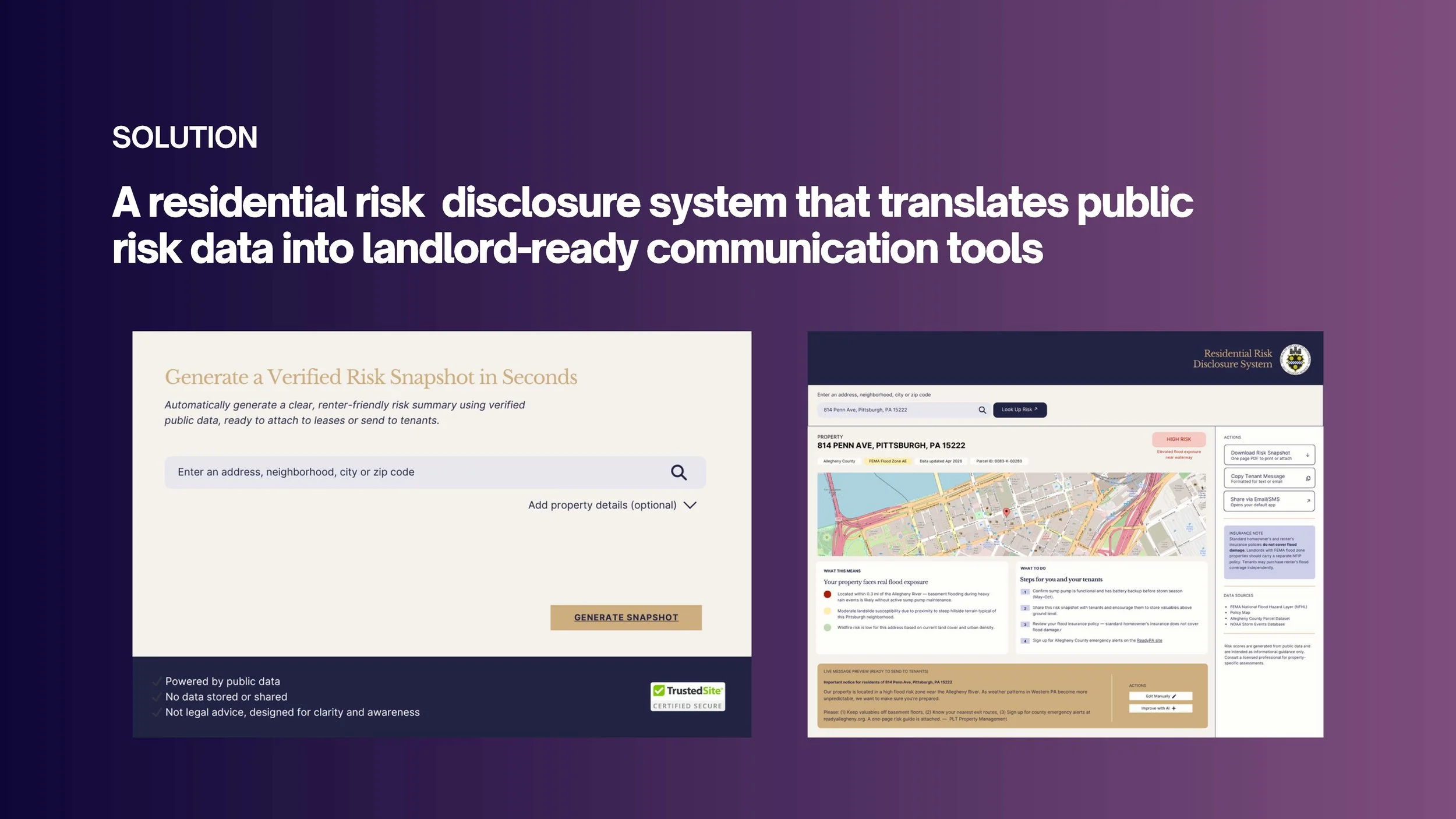
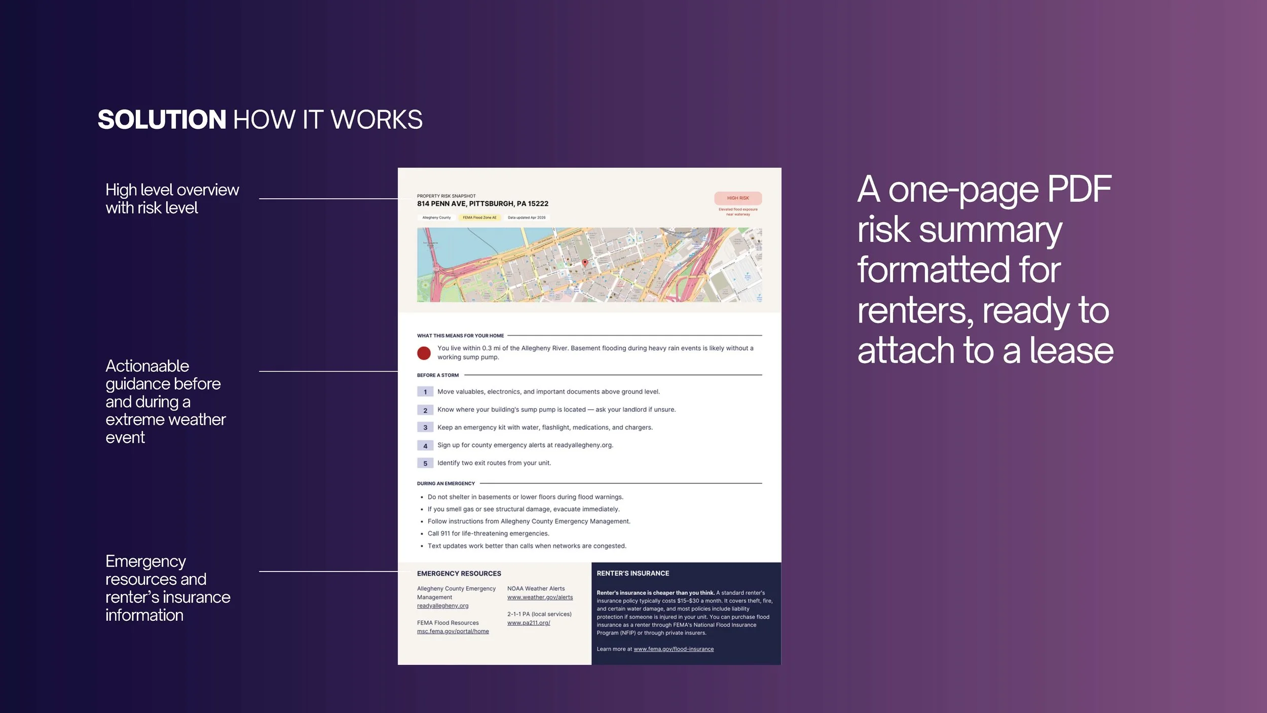
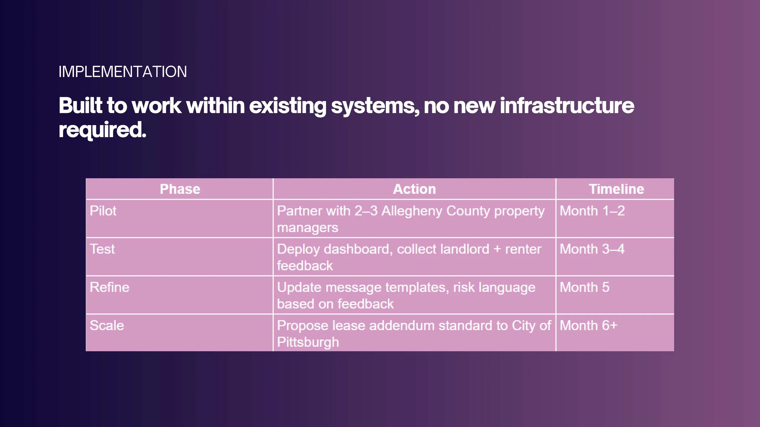
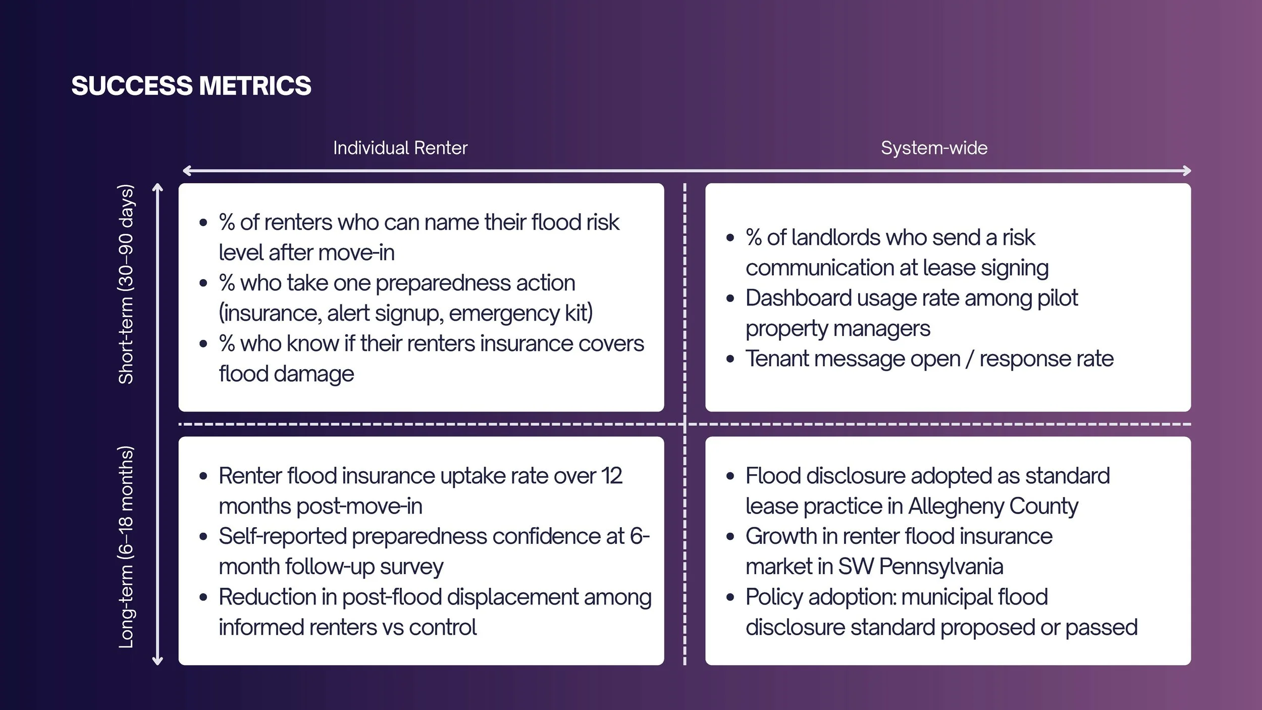
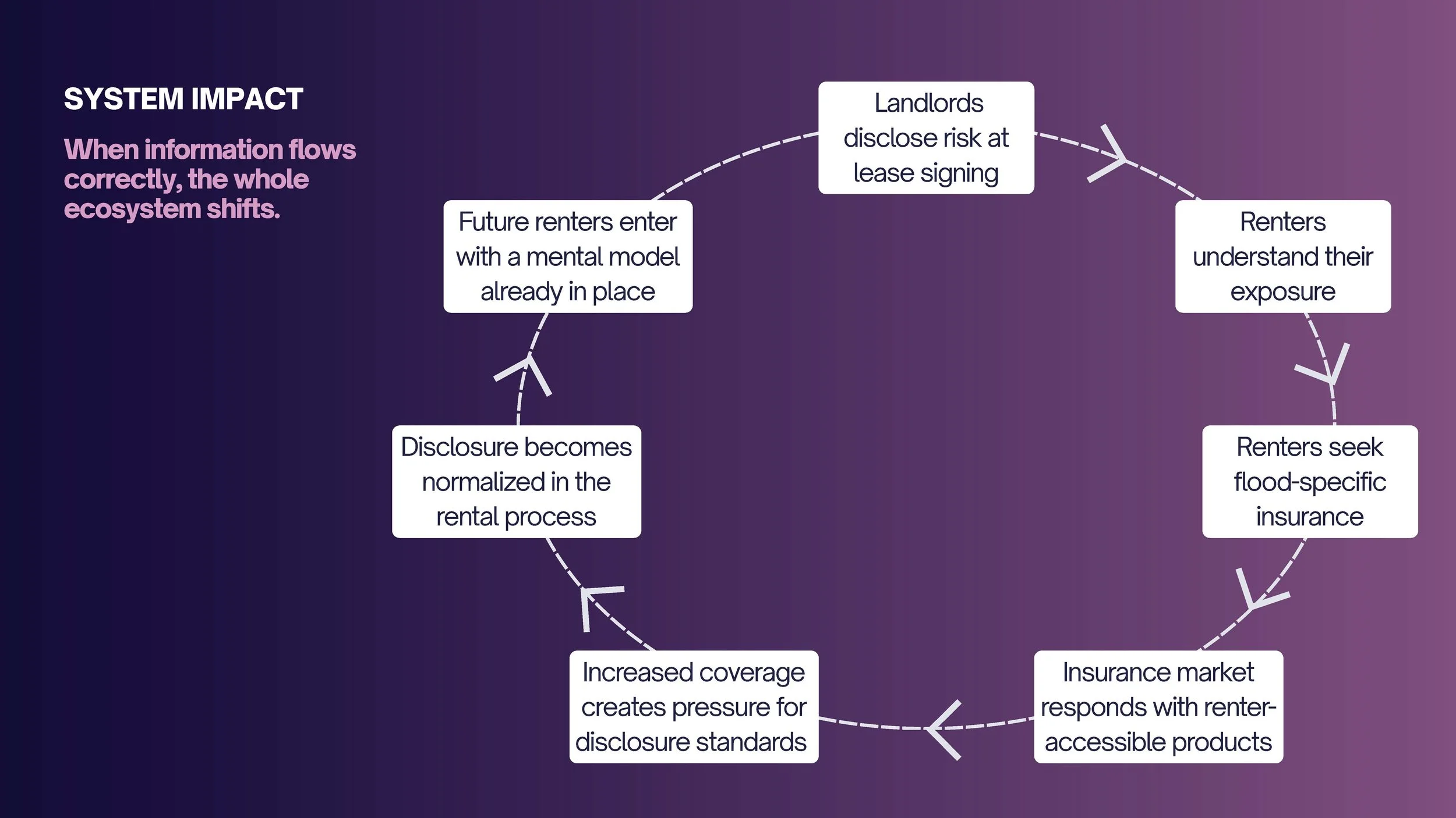
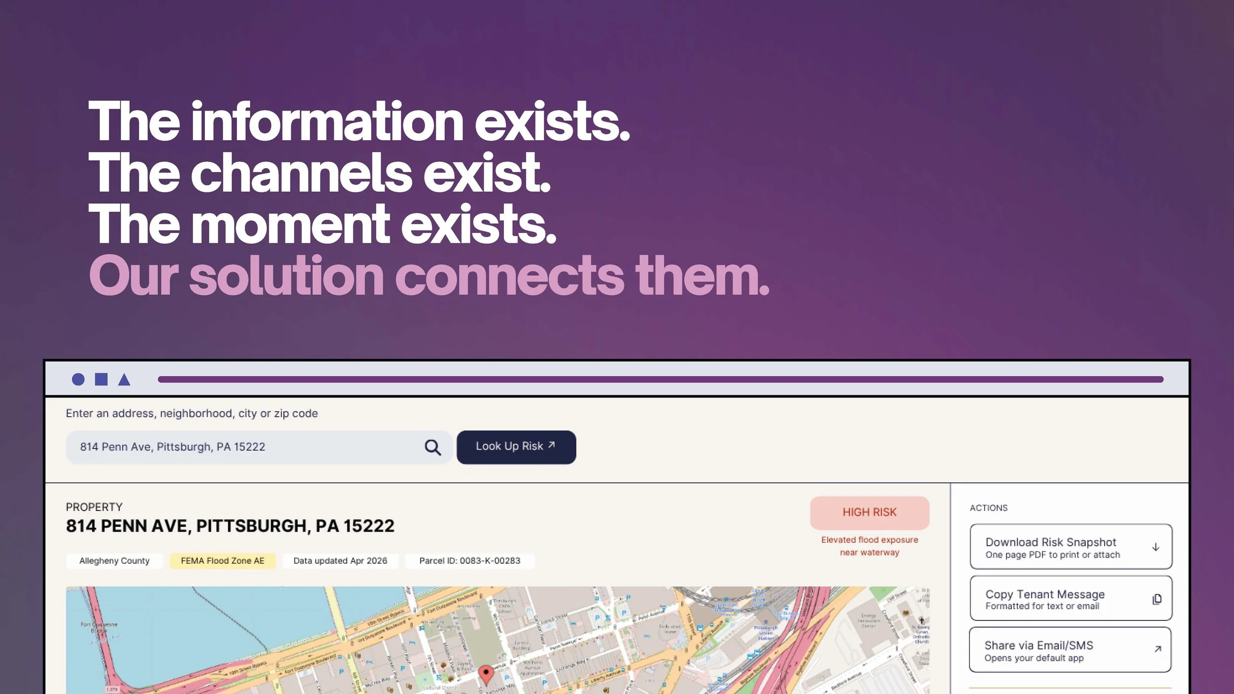
EMBEDDING FLOOD RISK INTO THE RENTAL ECOSYSTEM
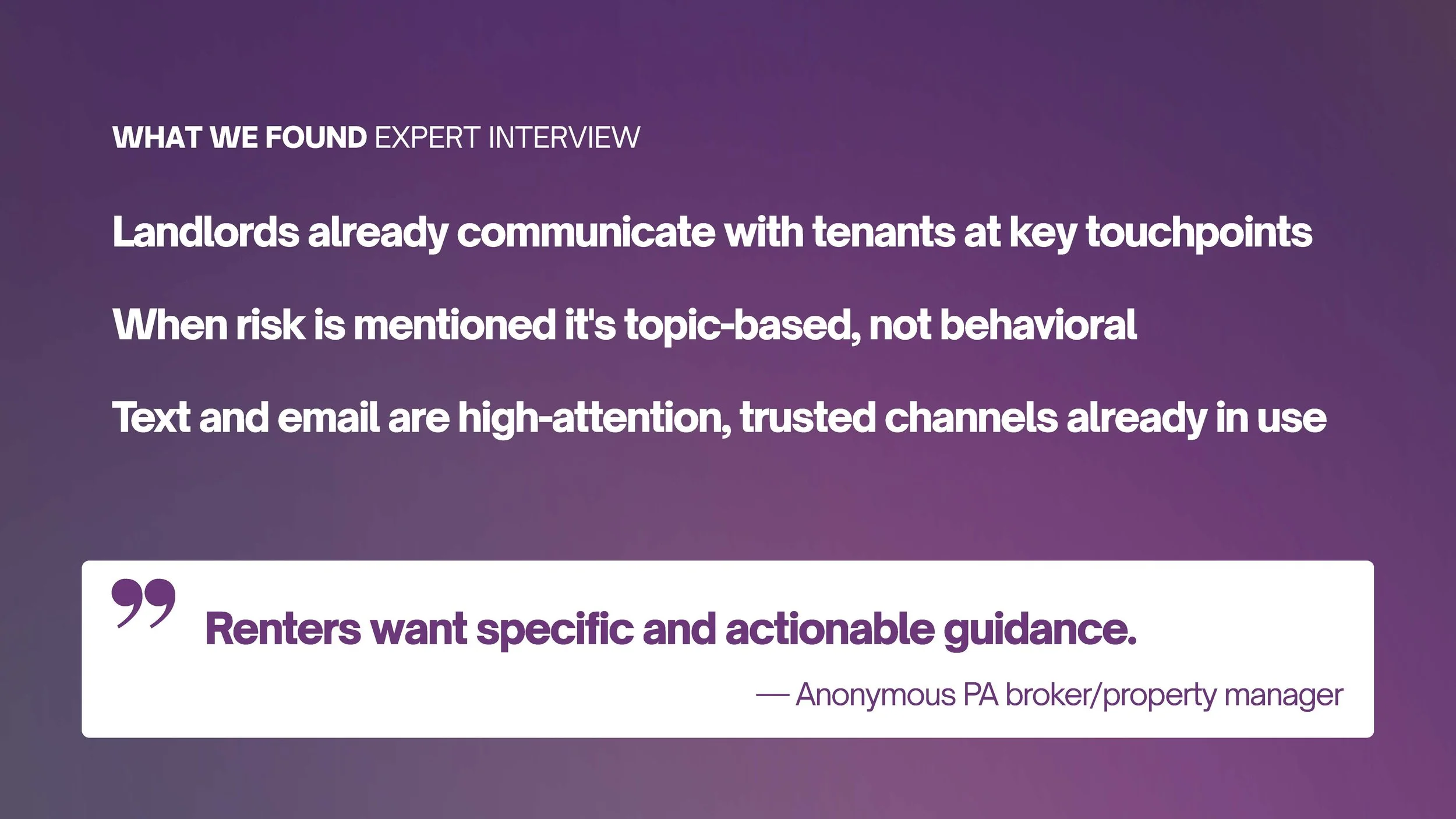
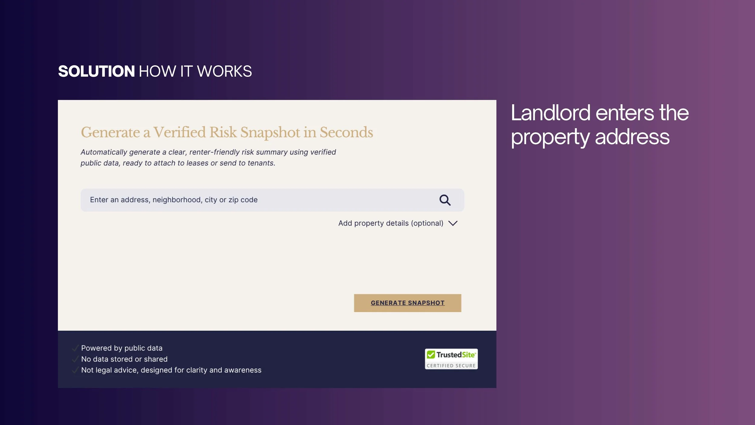
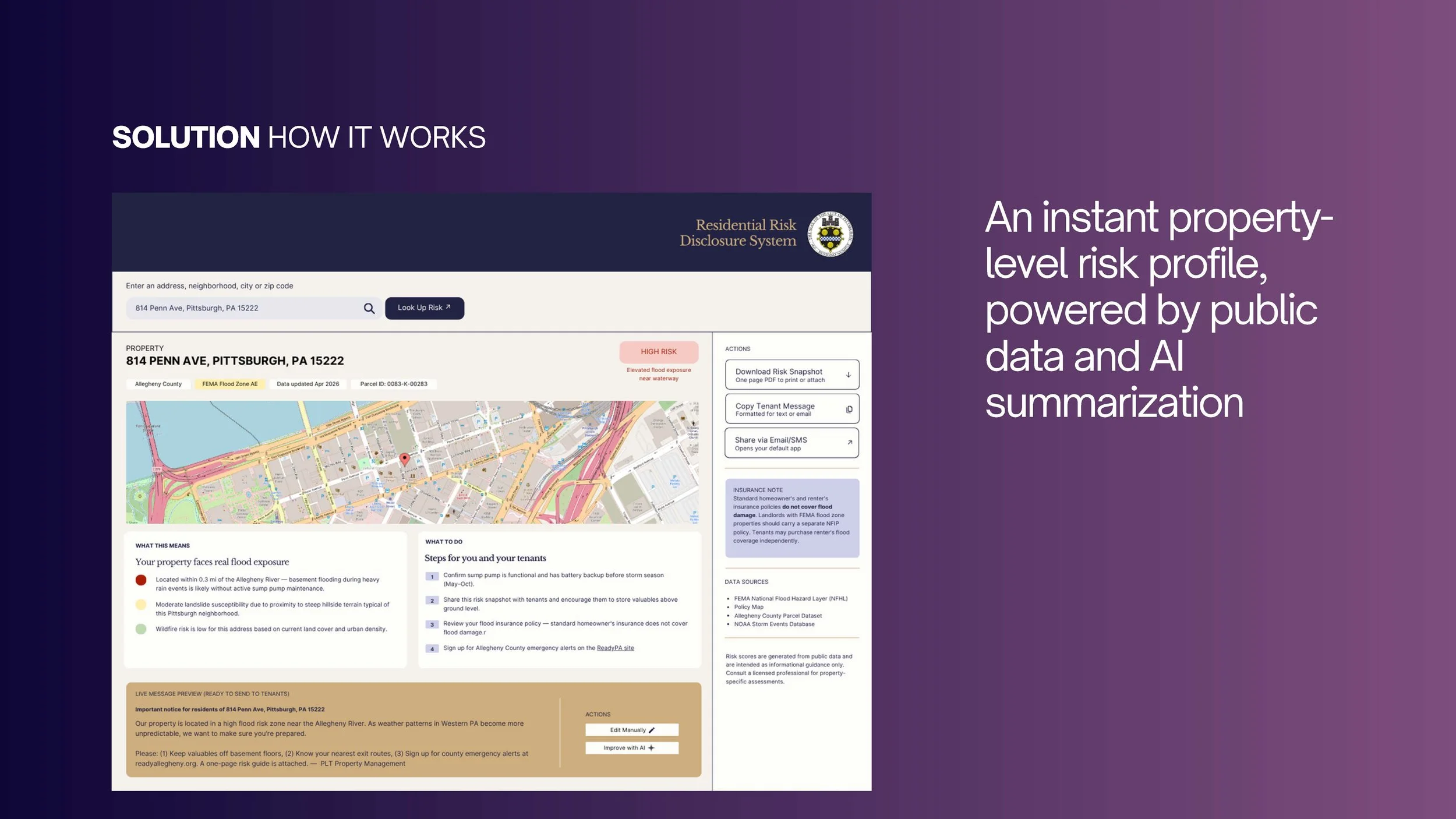
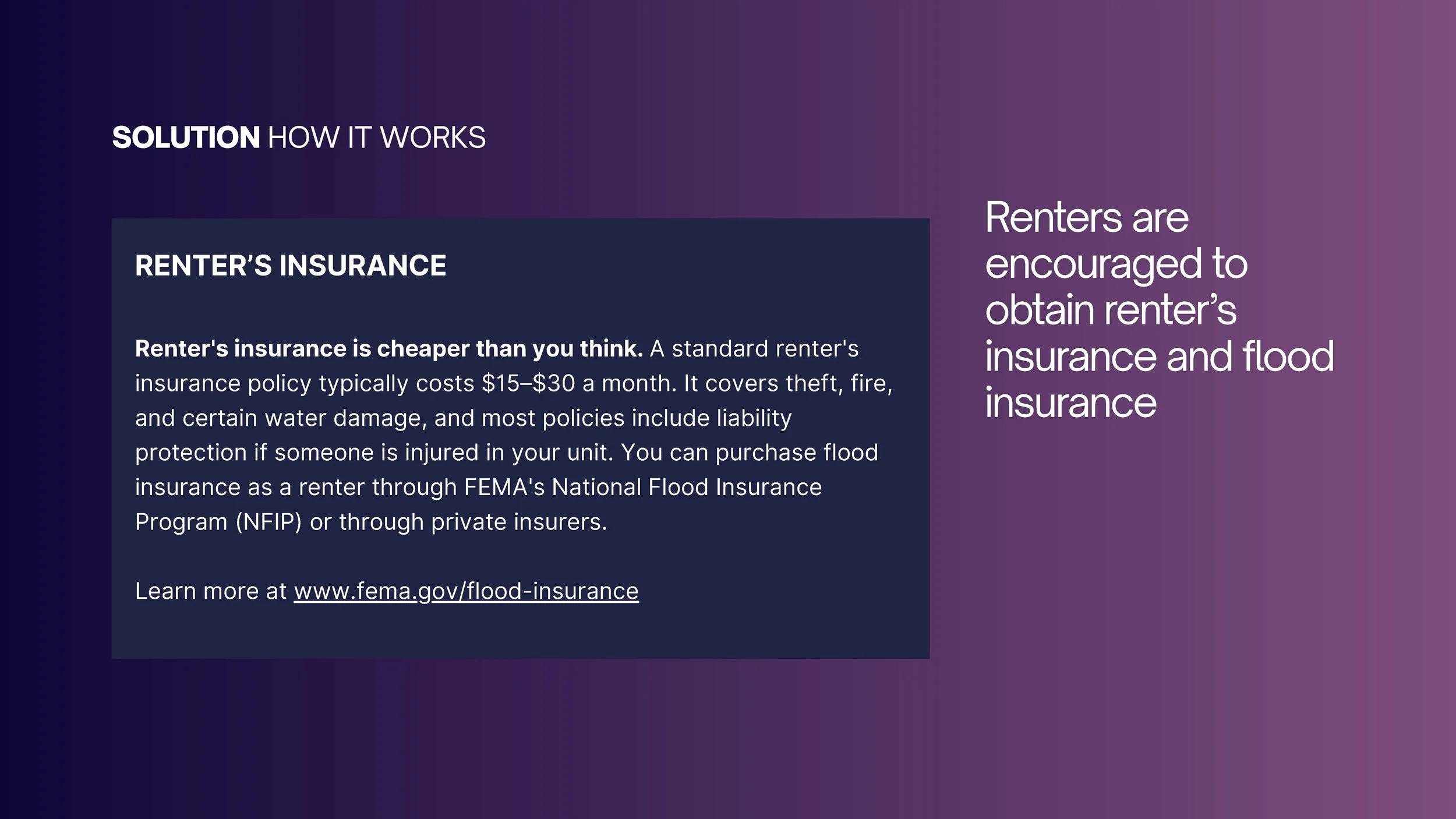
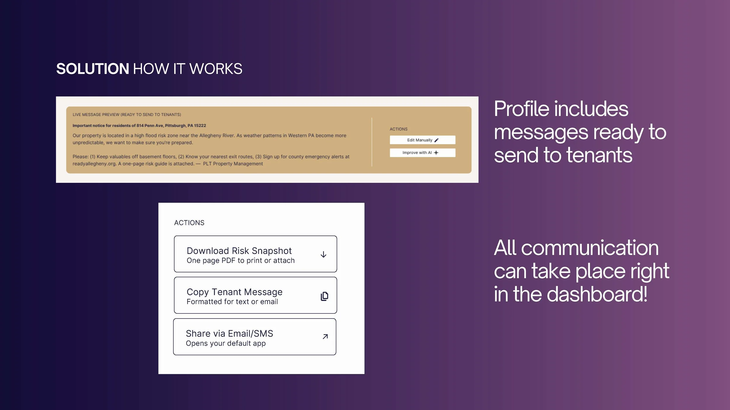
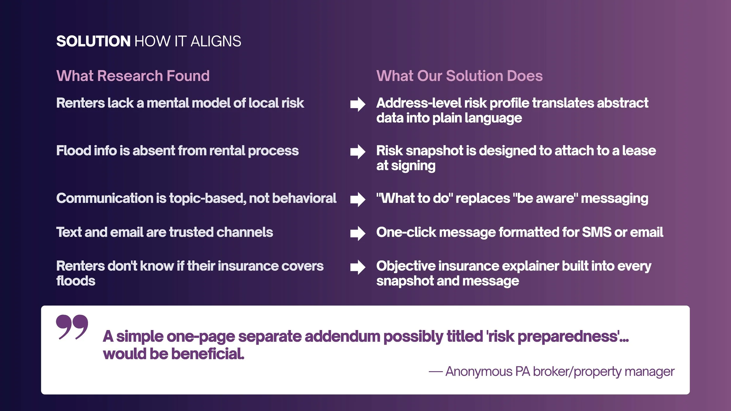
Despite the growing risk of flooding in Pittsburgh, standard residential leasing processes omit flood risk entirely, leaving renters uninformed and vulnerable. Existing solutions, like FEMA flood maps, are technical and inaccessible, or, like city emergency alerts, arrive only after risk is already imminent. For the estimated 72,000 renter households in Pittsburgh, that gap is a systemic failure to deliver information at the moment it would matter most. The Residential Risk Disclosure System is designed to close that gap by embedding flood risk awareness directly into the rental process. The system translates public data from FEMA, PA DCNR, USGS, and Allegheny County into a plain-language, address-level risk profile that landlords can generate in seconds. From that profile, they can download a one-page tenant risk snapshot formatted to attach to a lease, copy a ready-to-send message for email or SMS, or use an AI-assisted editor to tailor the communication before sending. Survey research with Pittsburgh renters and an expert interview with a PA broker and property manager confirmed that delivery, not data, is the core gap in this system. The rental process is the most reliable touchpoint in a renter's life, and it should not be silent on risk.

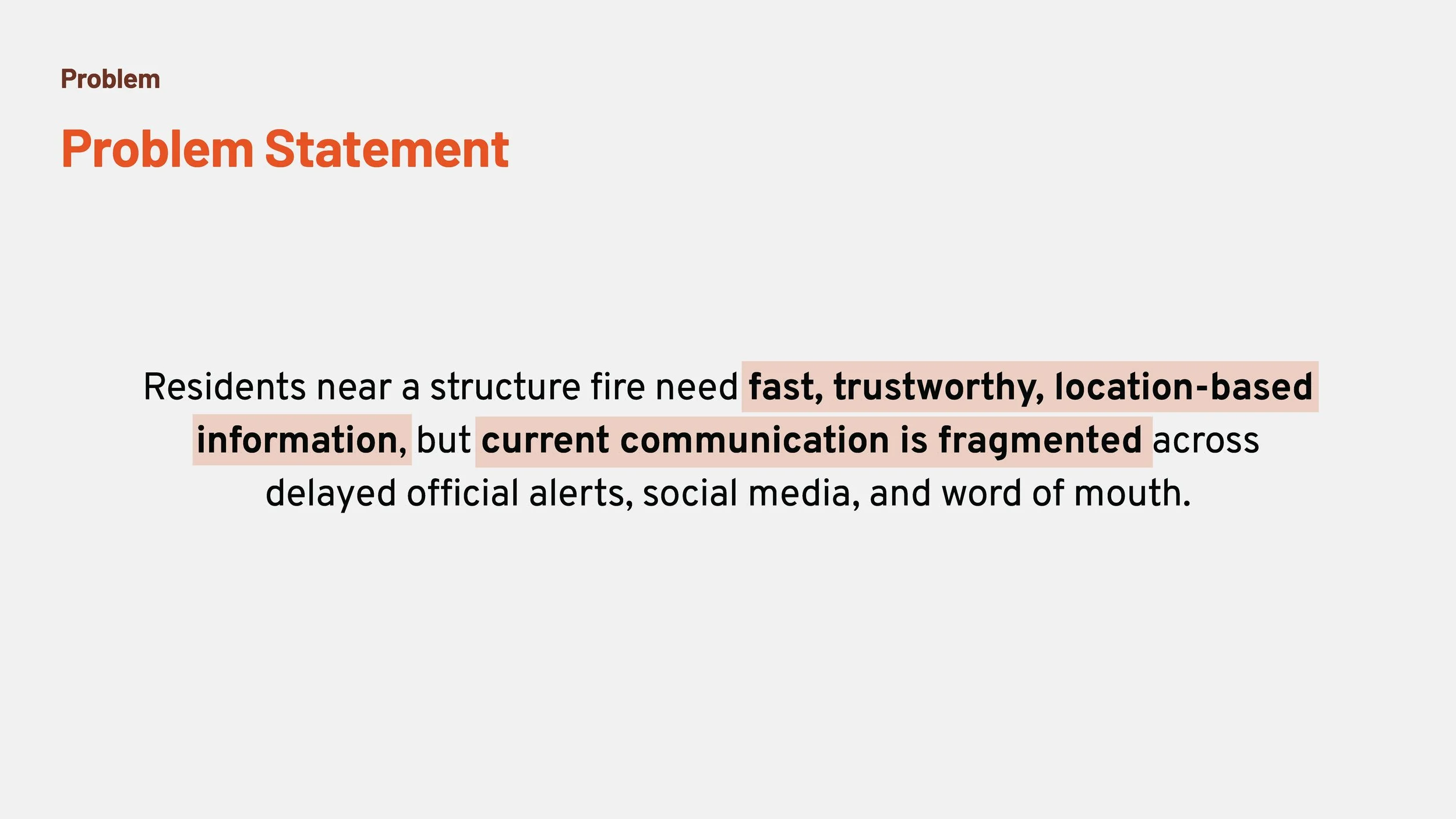
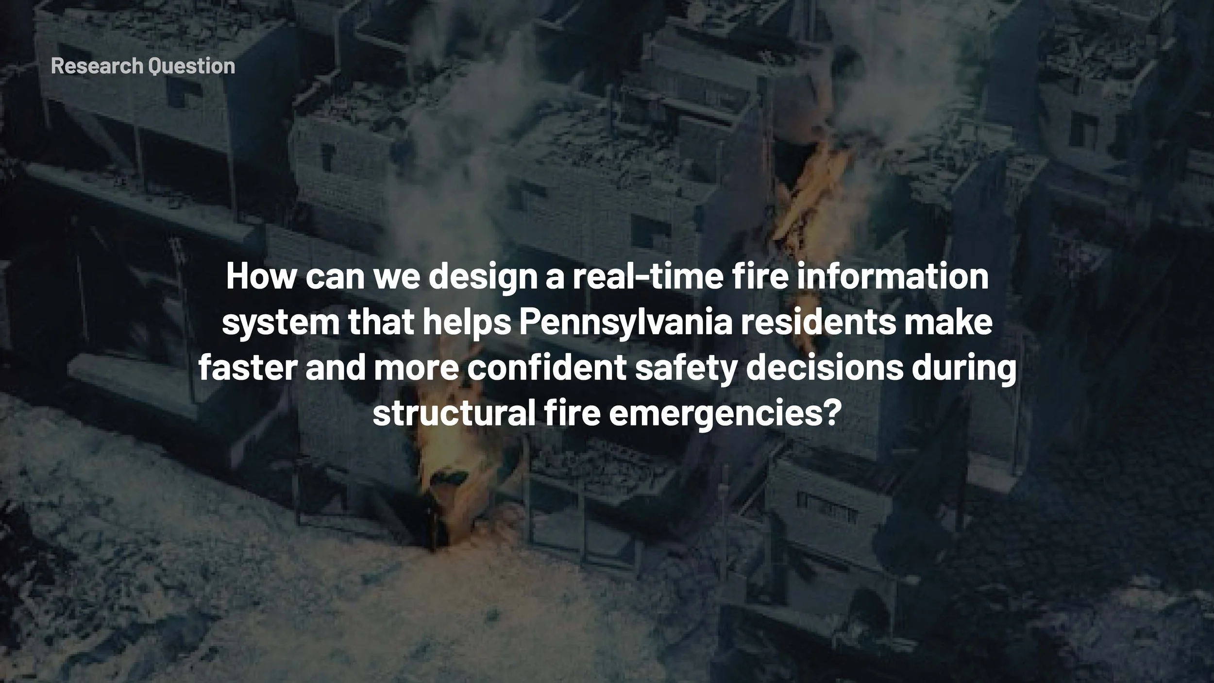
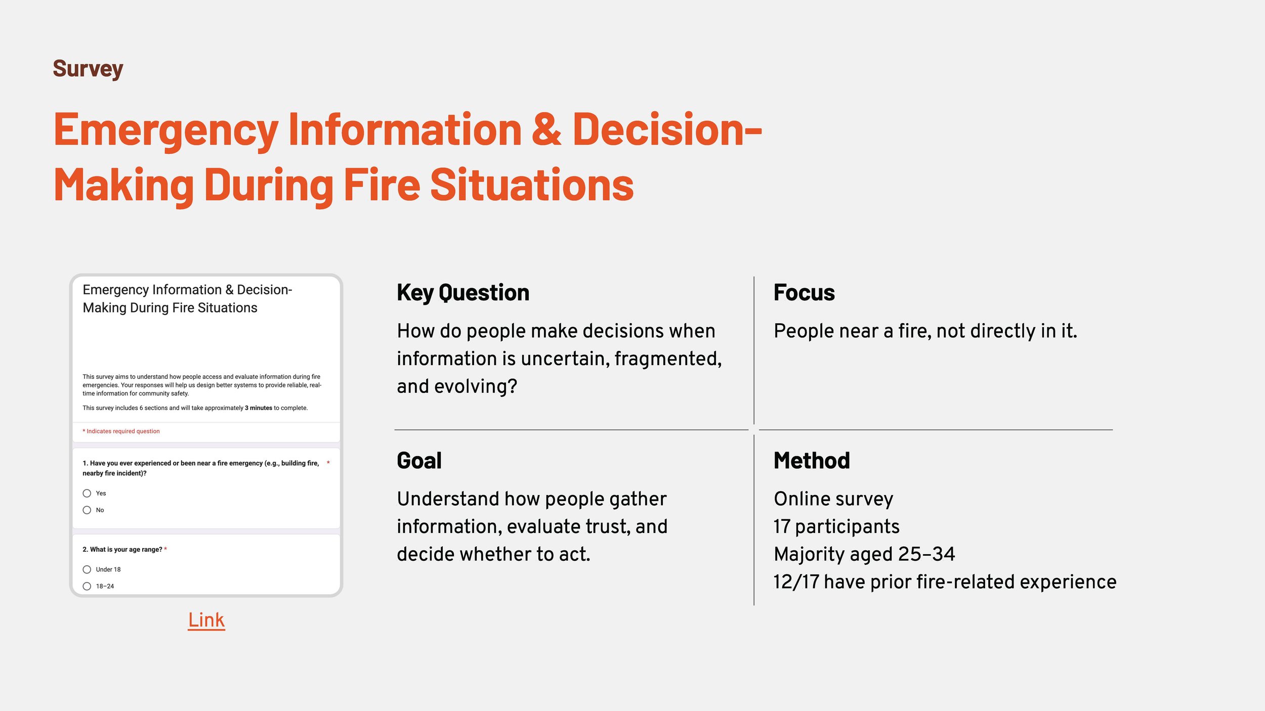
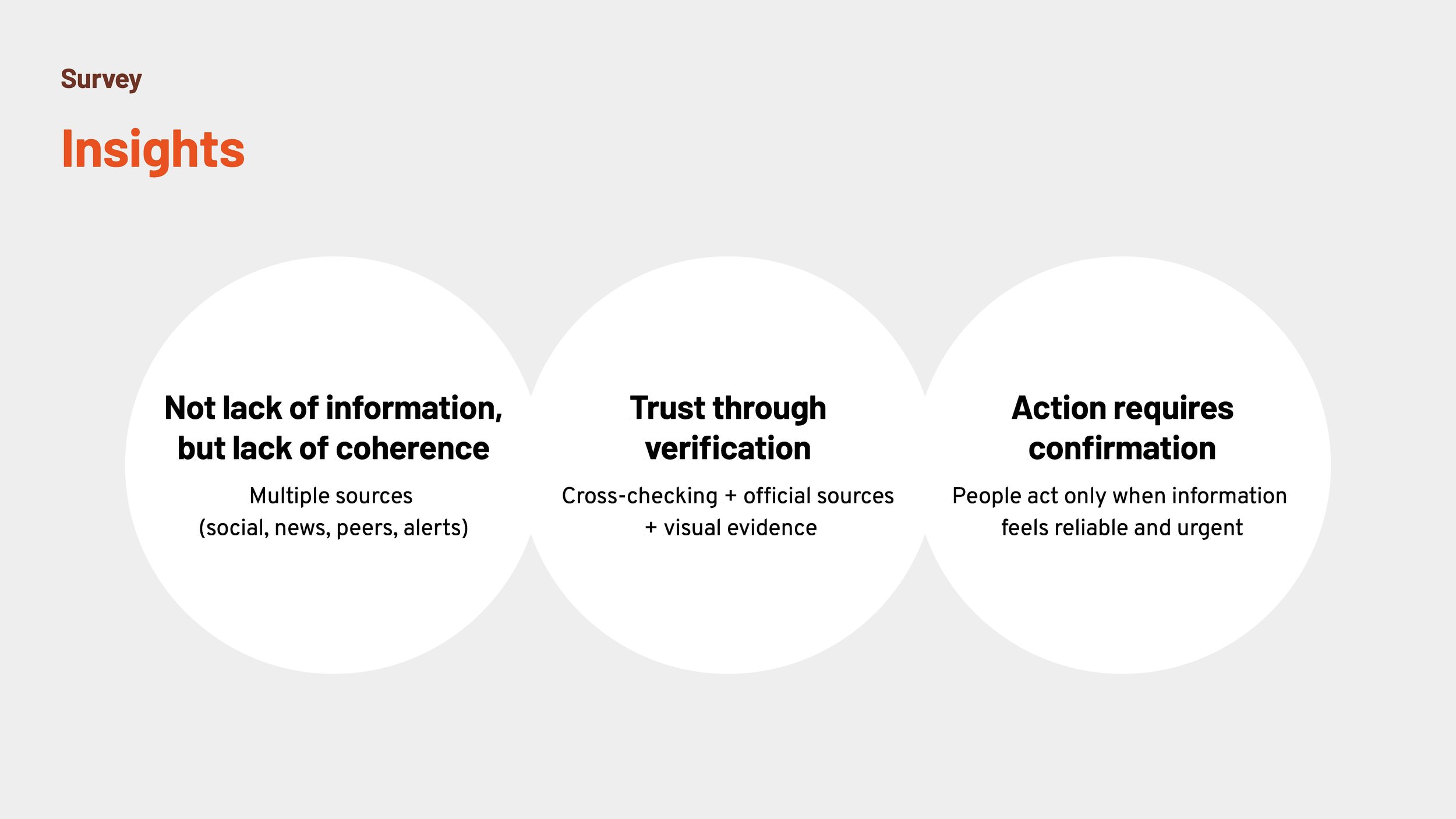
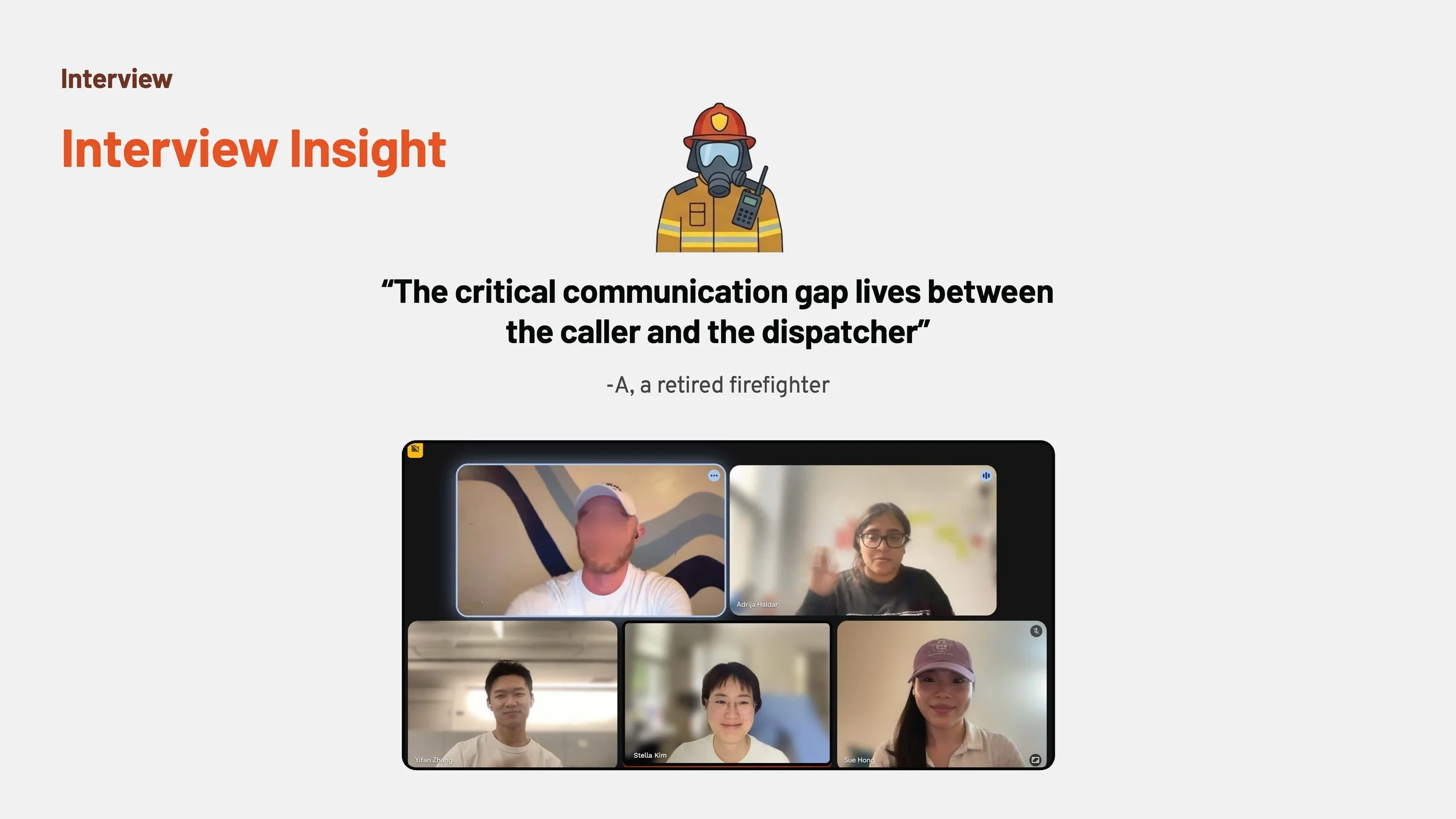
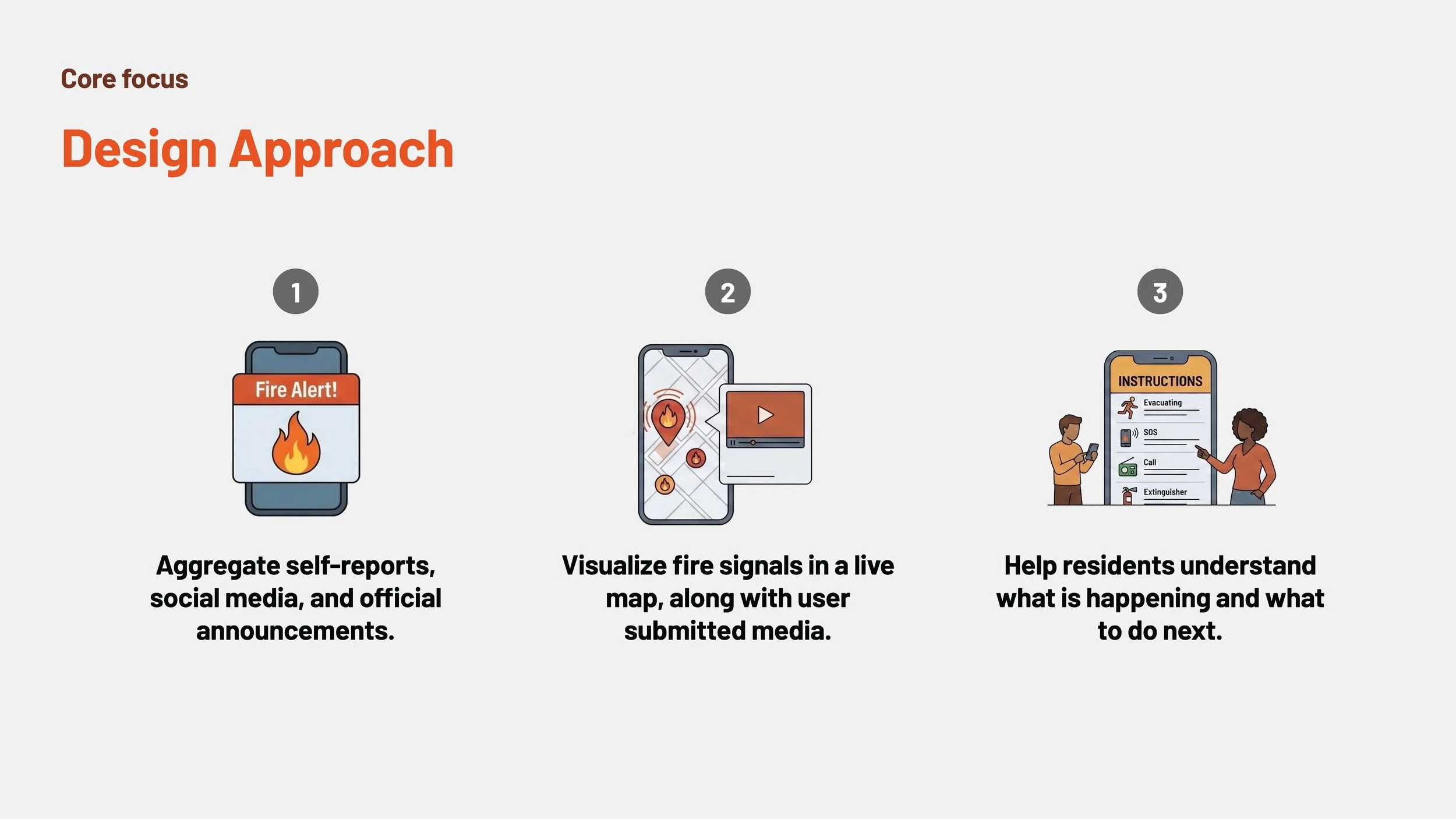
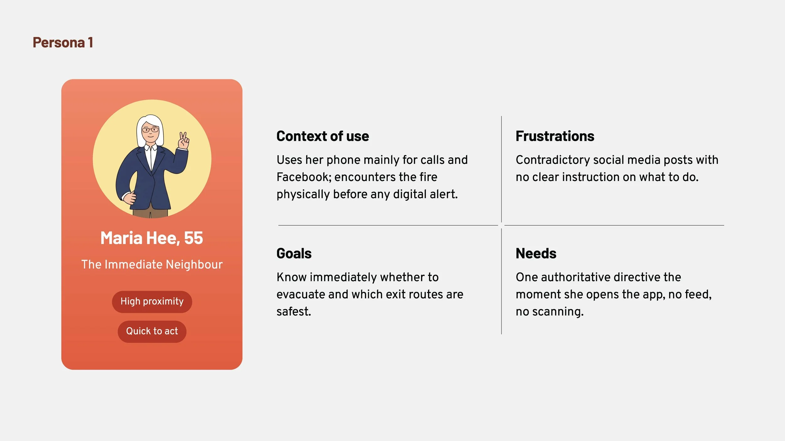
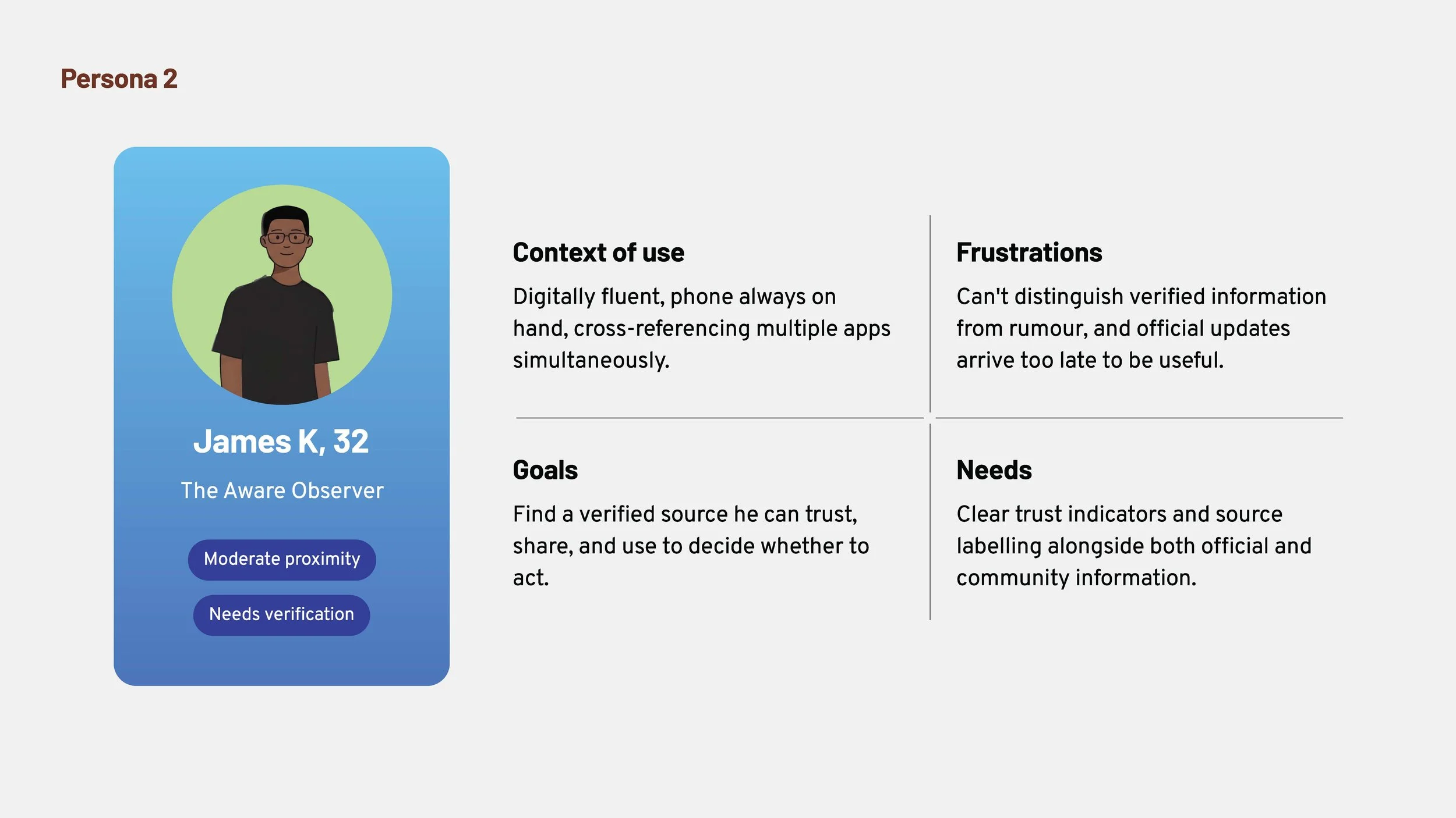
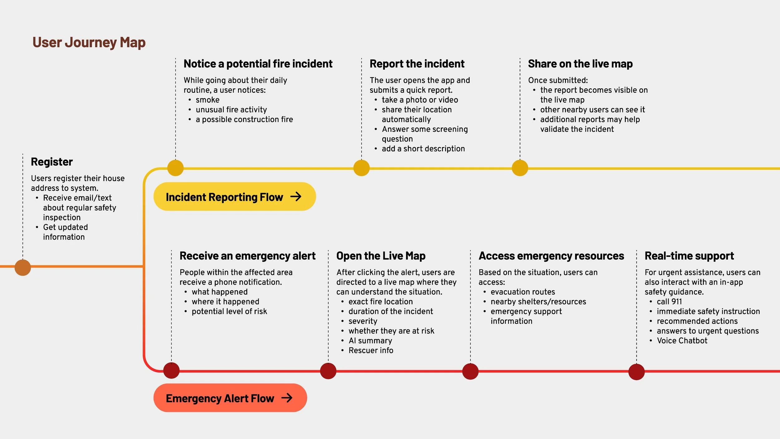
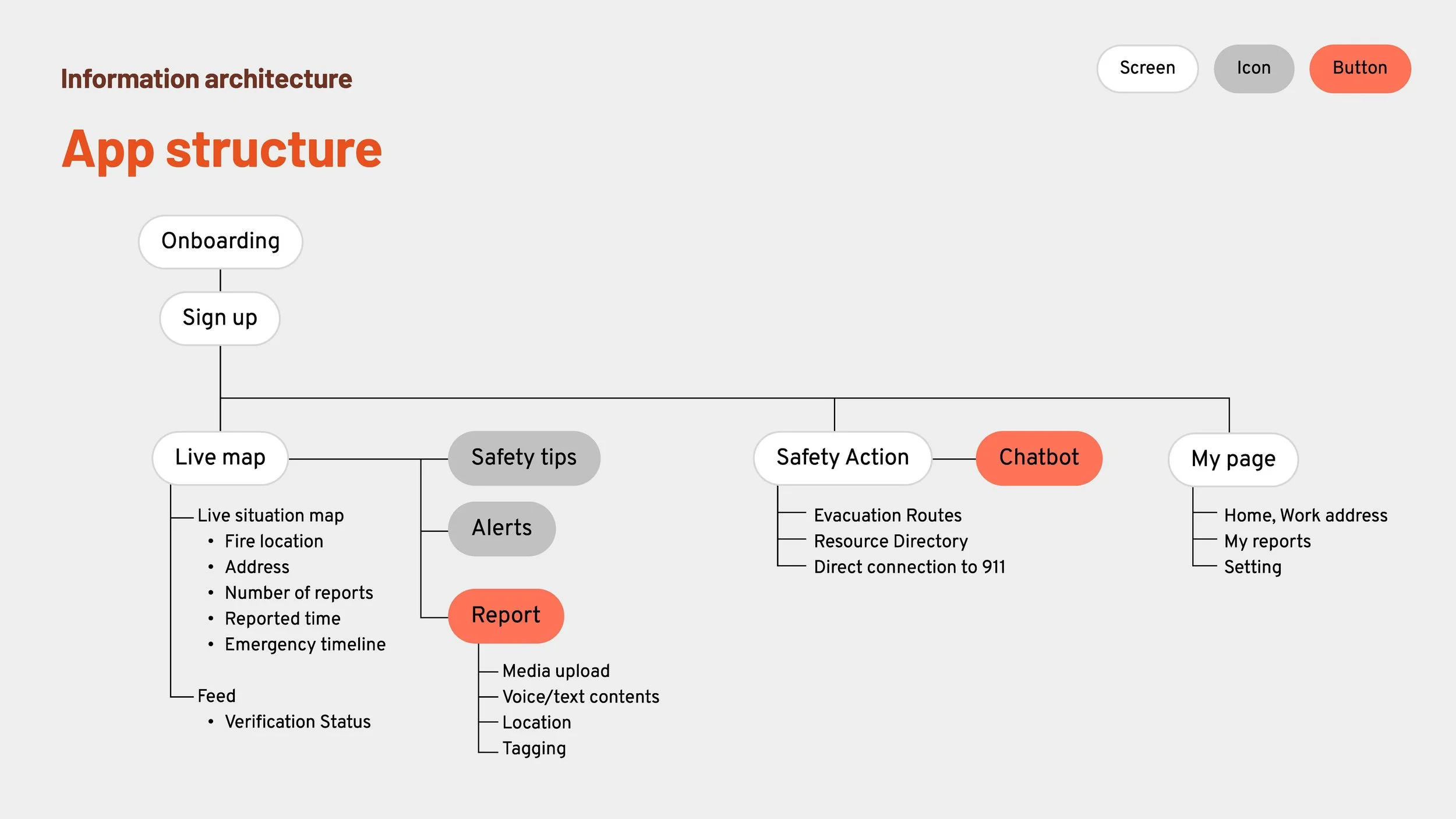
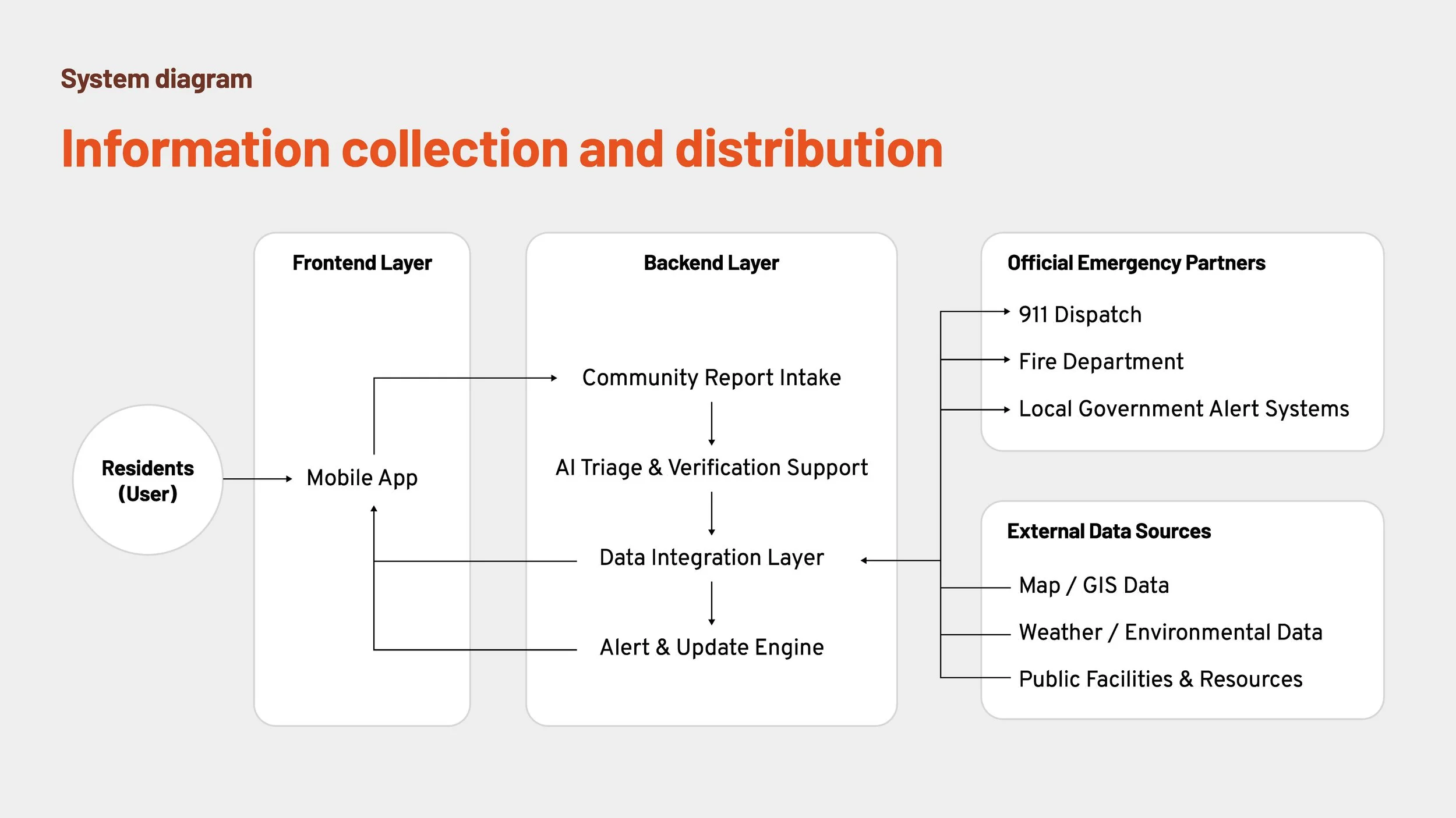
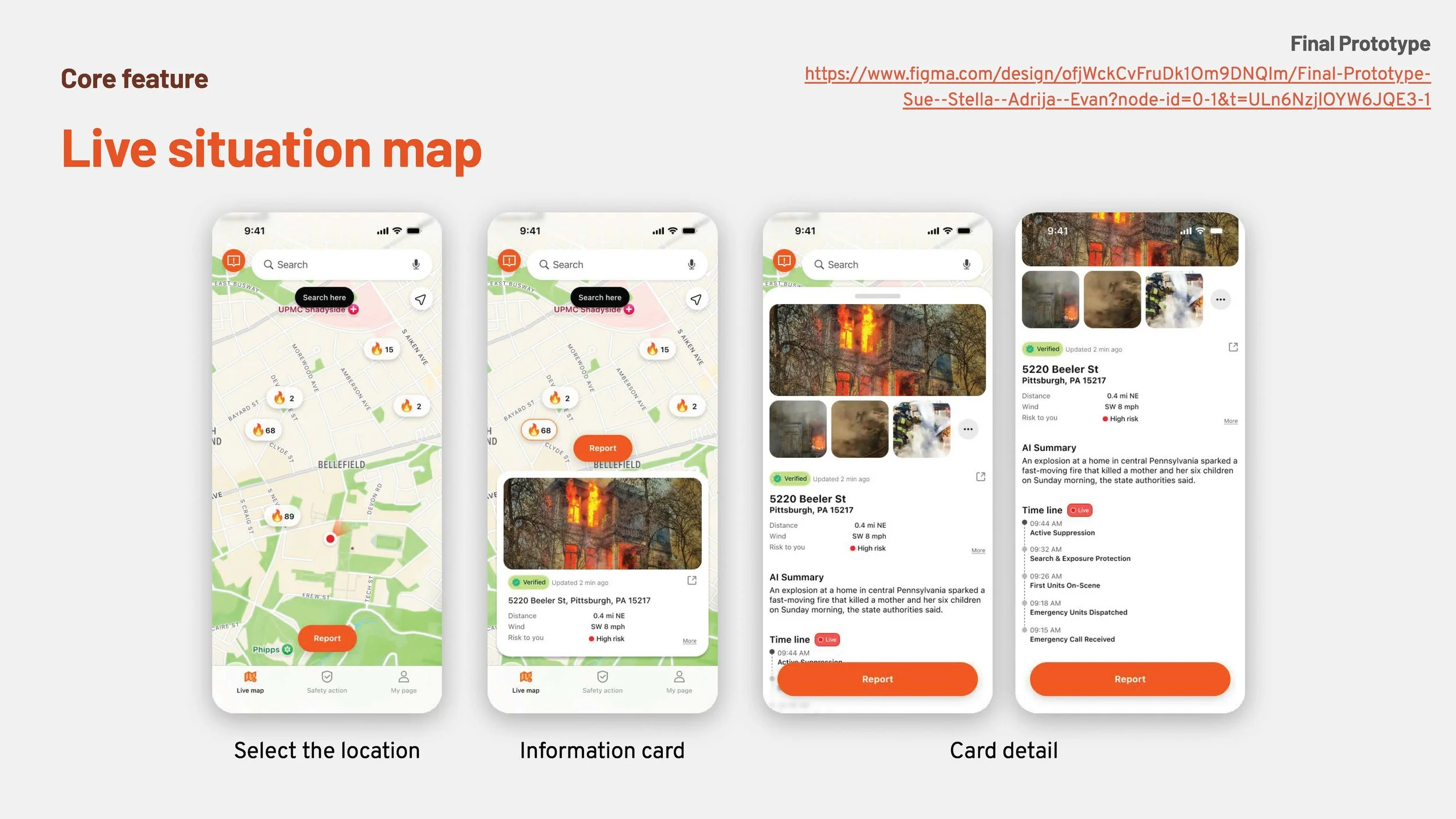
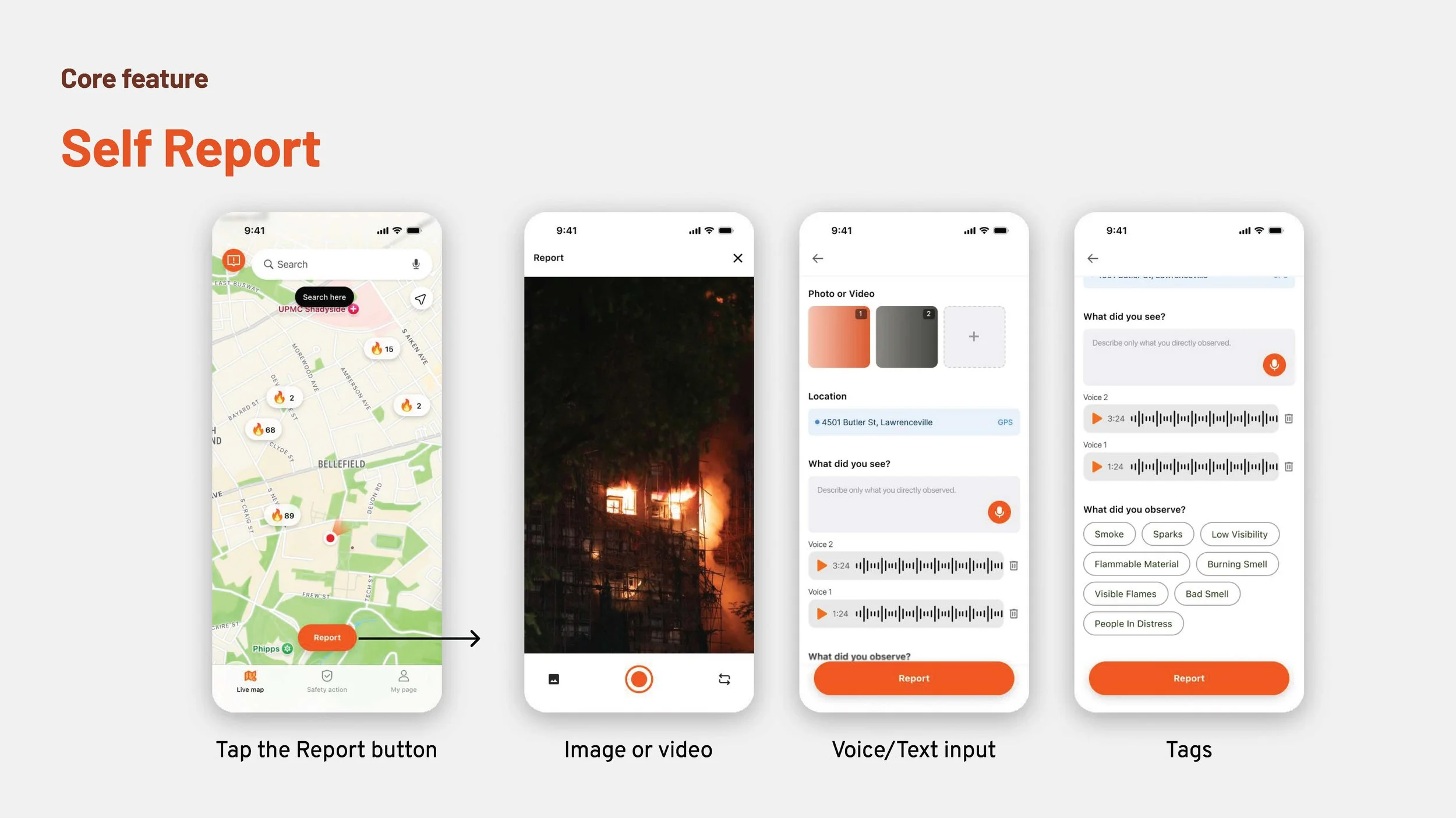
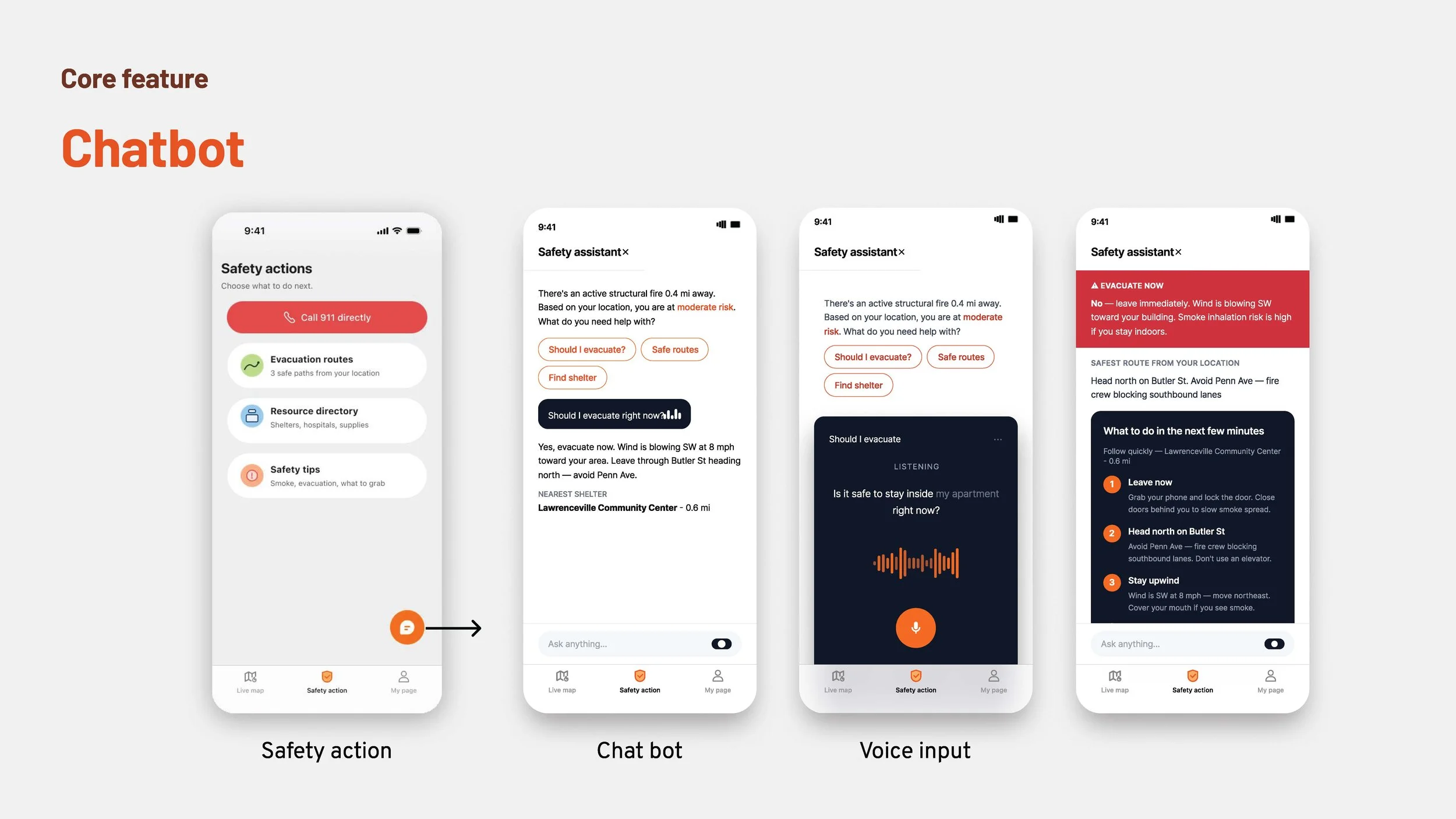
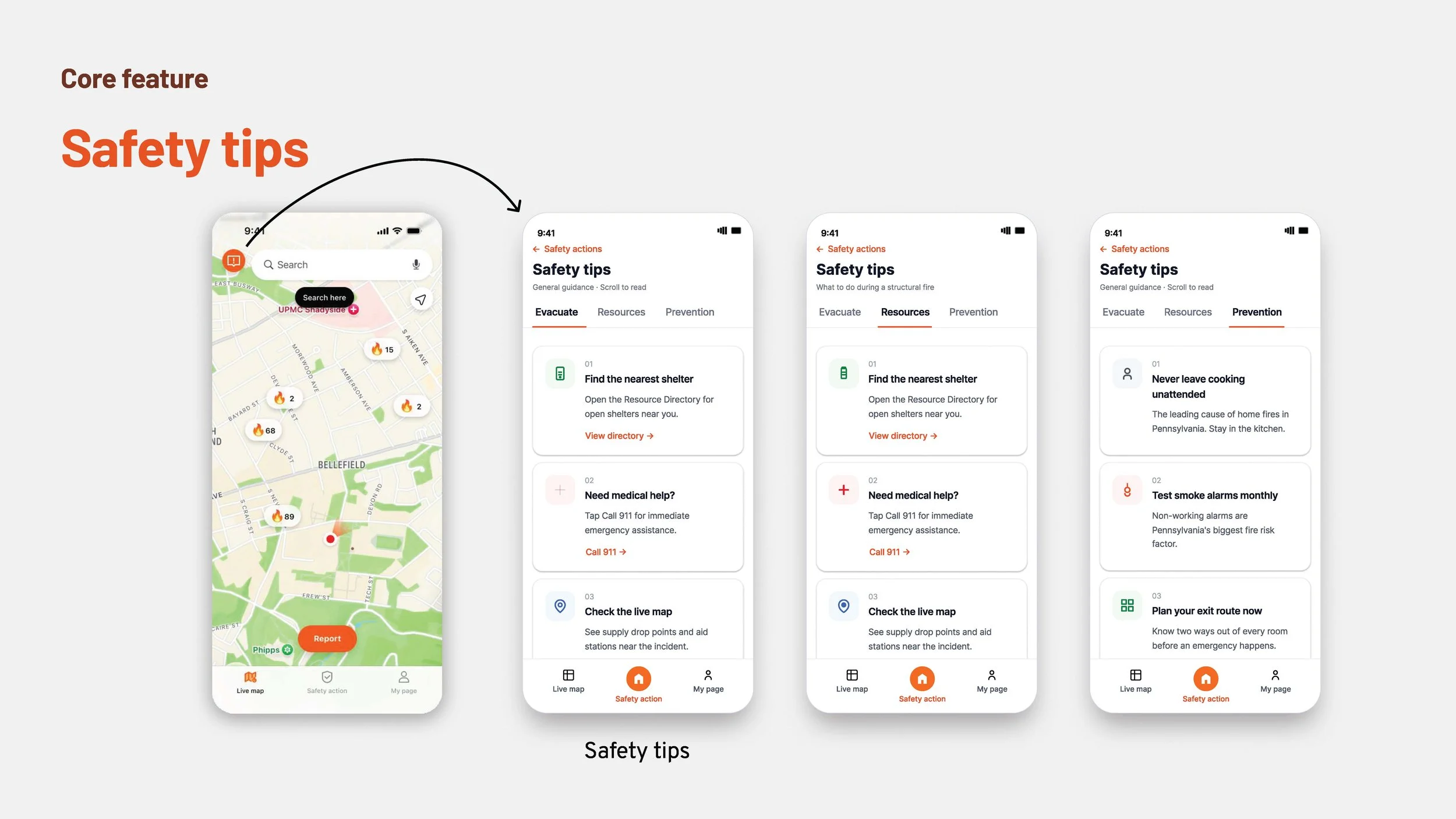
INTERACTIVE FIRE SIGNAL: STRUCTURAL FIRE INFORMATION COMMUNICATION FOR WESTERN PENNSYLVANIA CITIZENS
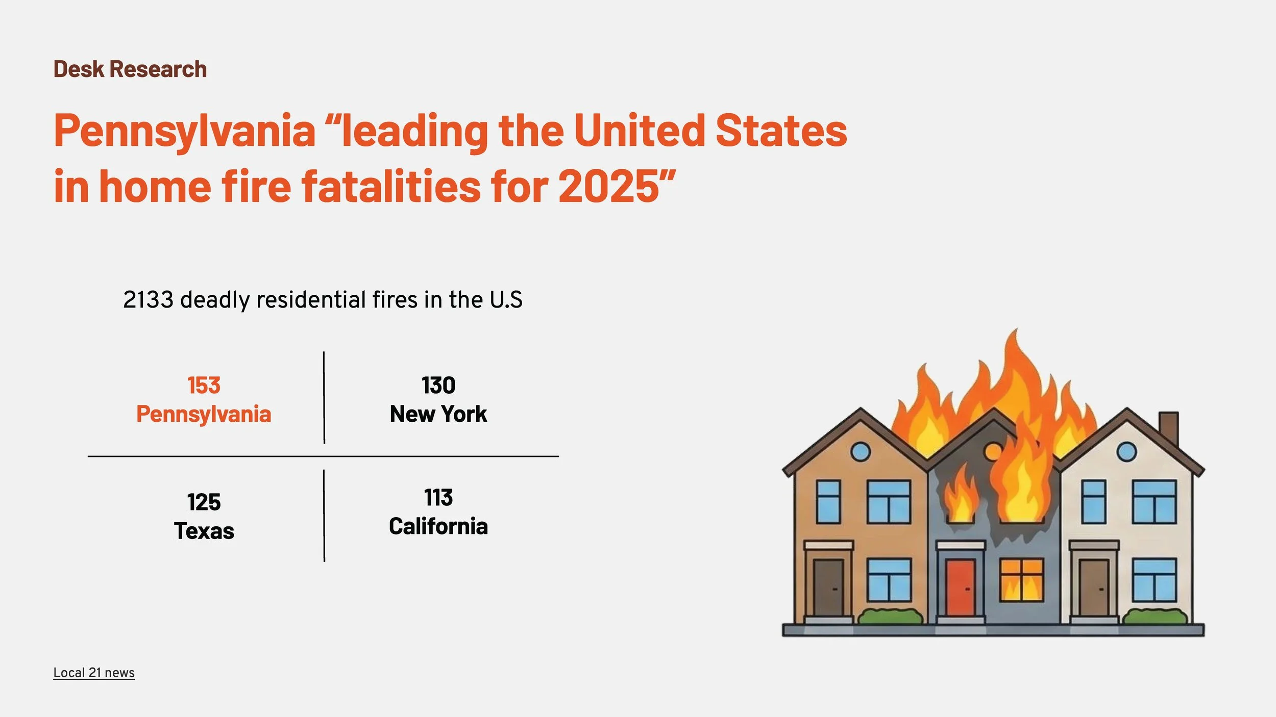
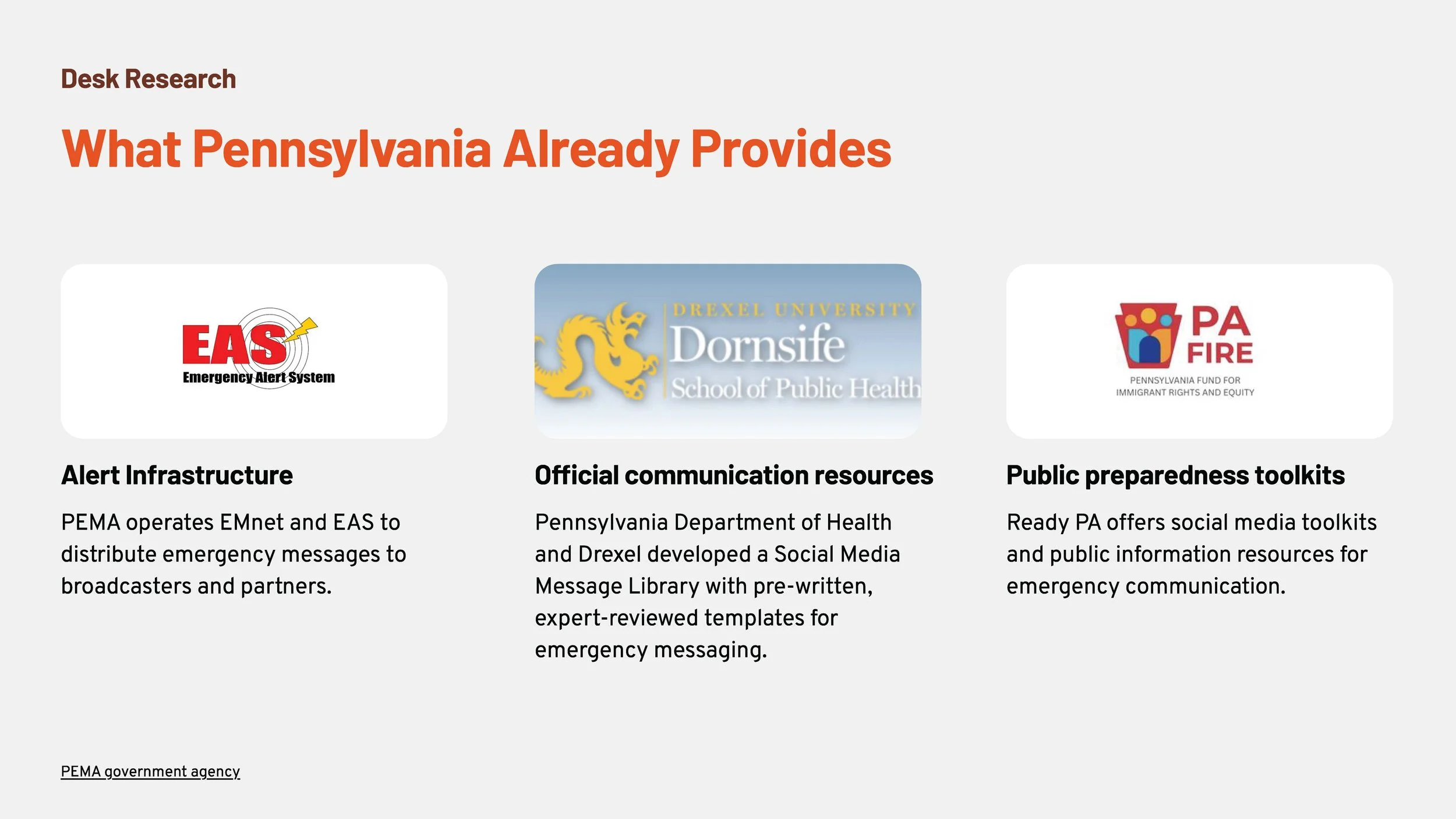
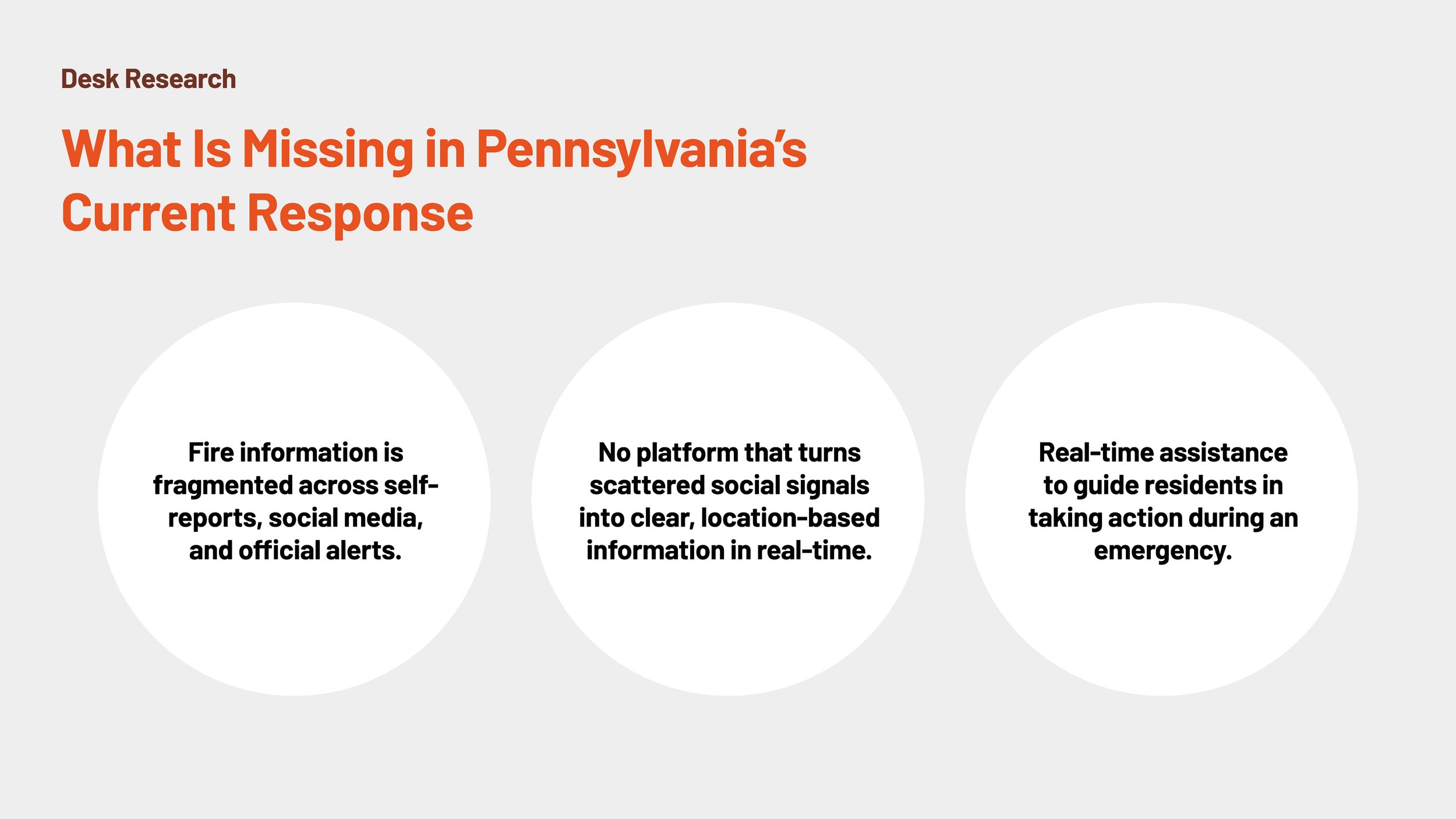
Interactive Fire Signal is a mobile app that helps residents quickly understand fire emergencies through a real-time, map-based view of community reports, official alerts, and verified updates. It addresses the gap between delayed official communication and fragmented social media information by organizing fire signals into one trustworthy, location-based interface. With AI-supported verification and voice-based access to information, the app helps users assess risk and take action faster during the critical first minutes of an emergency.


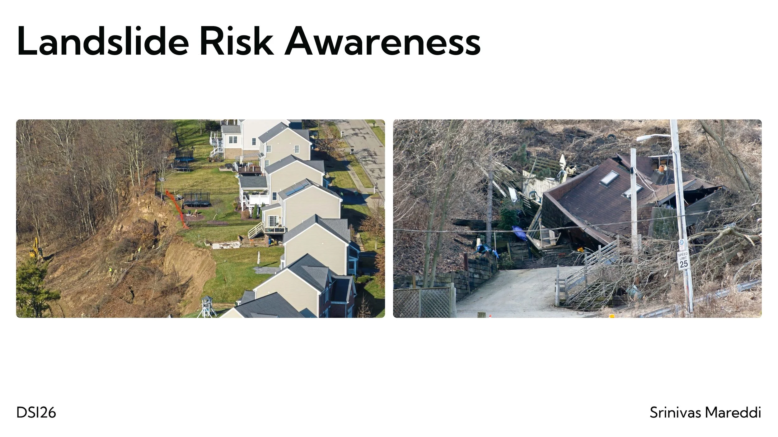
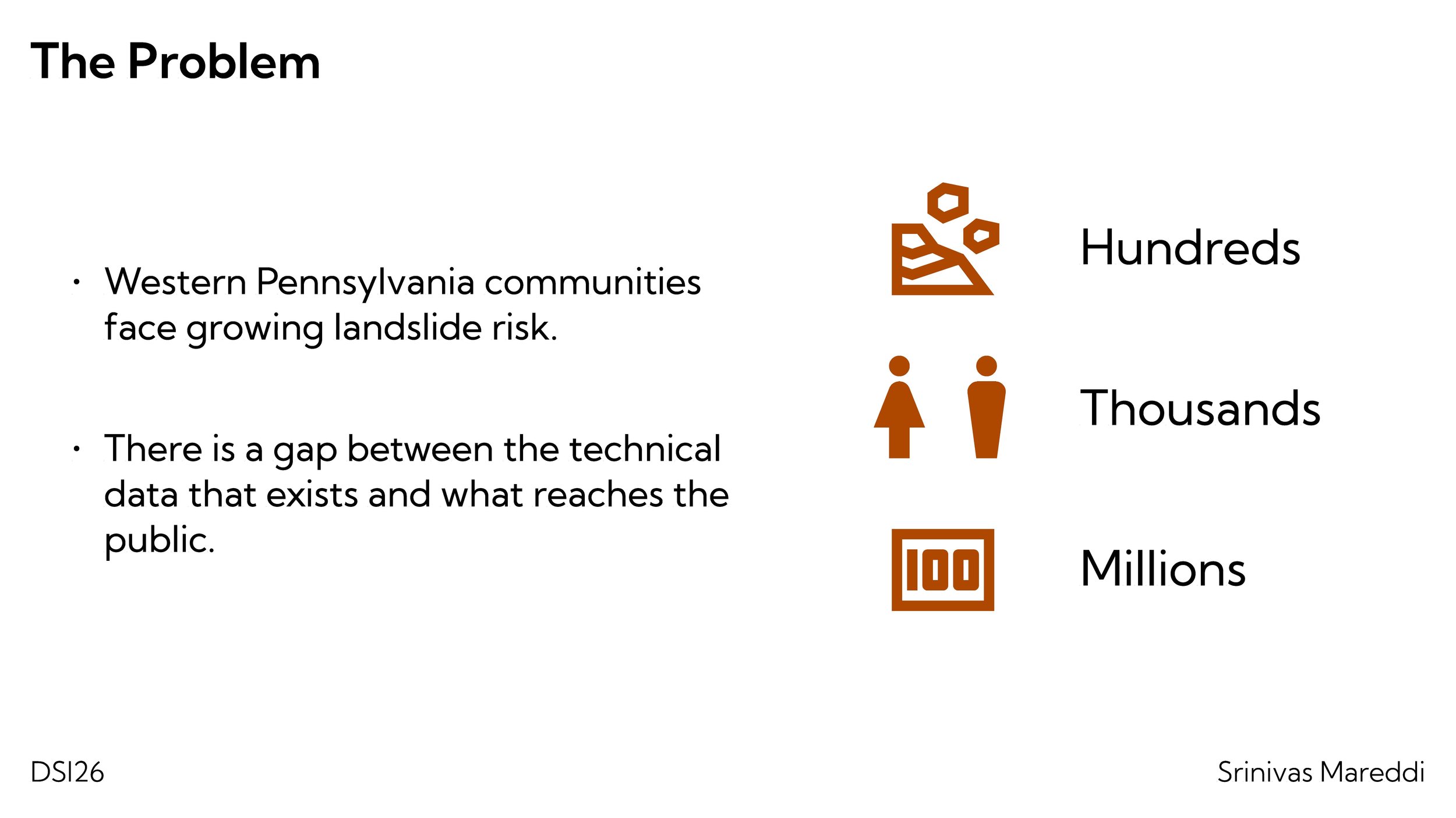
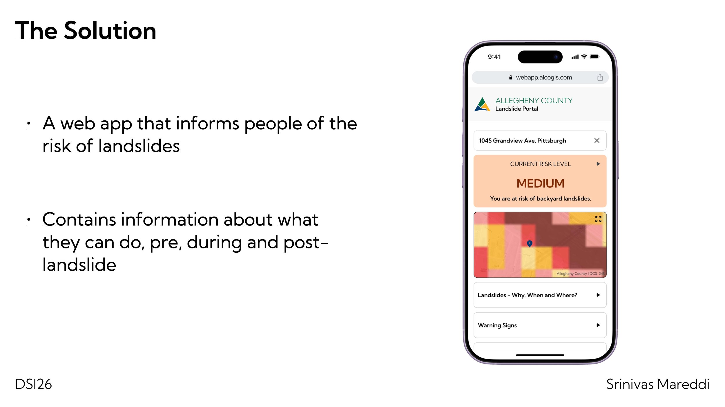
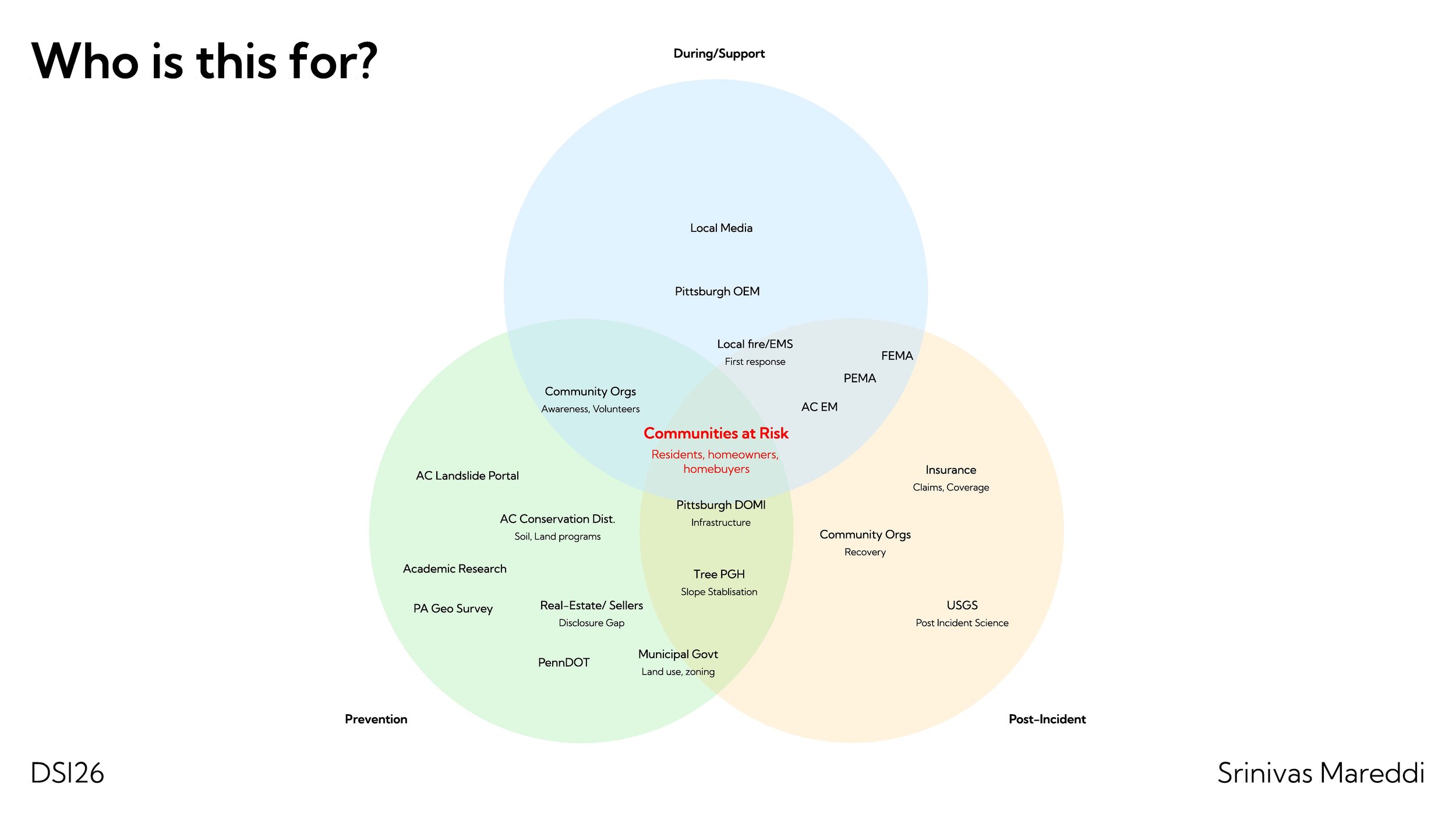
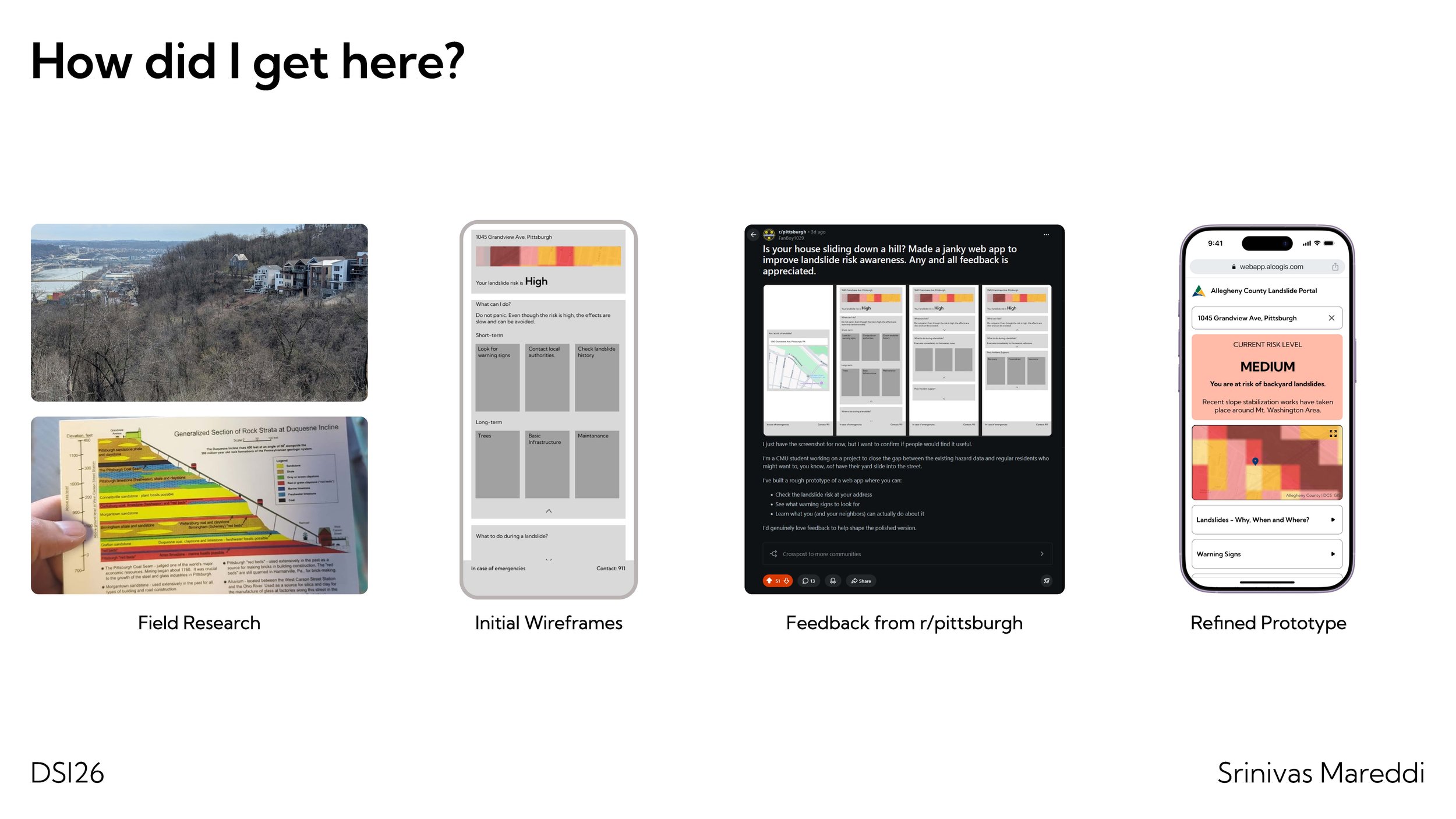
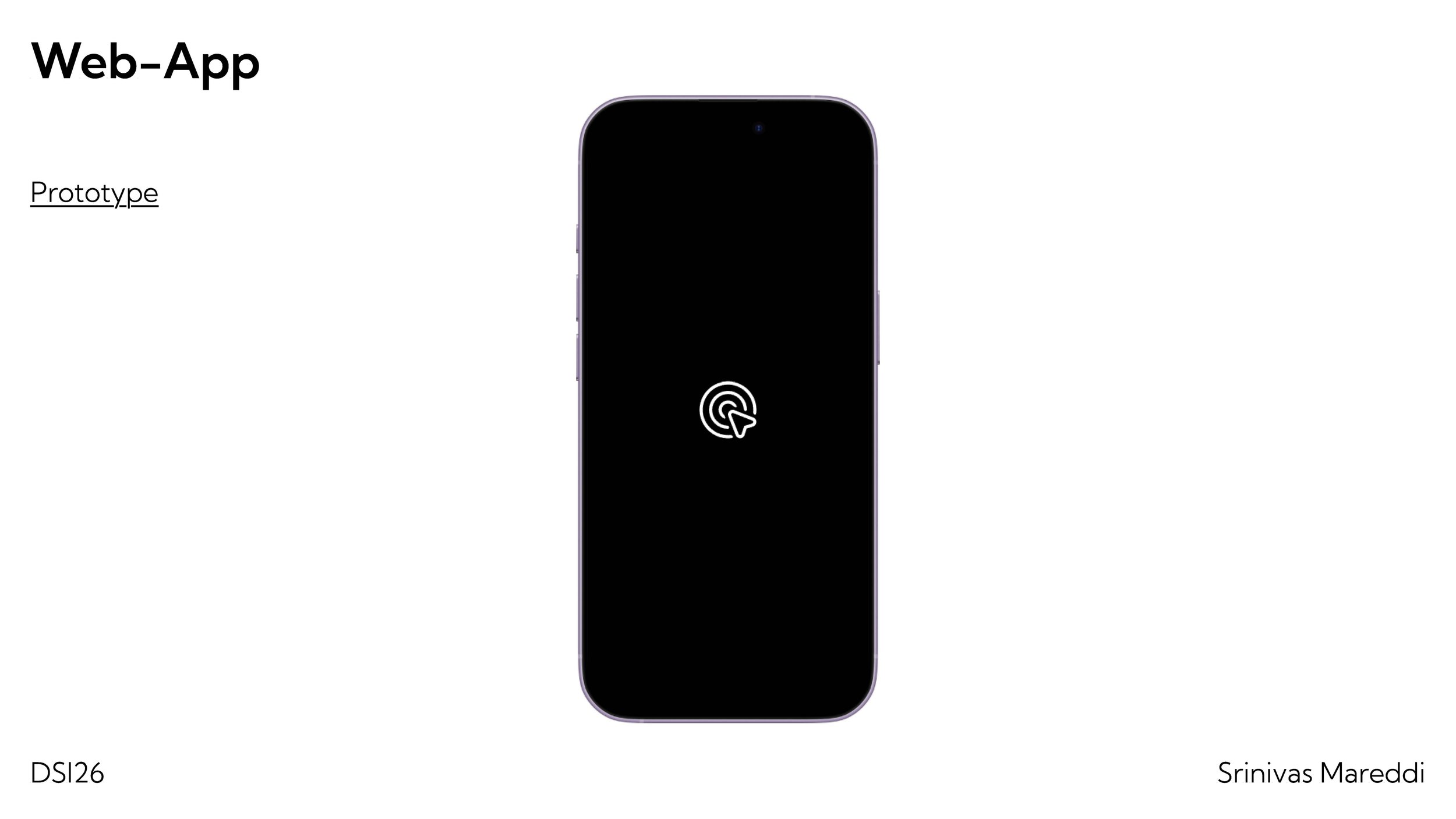
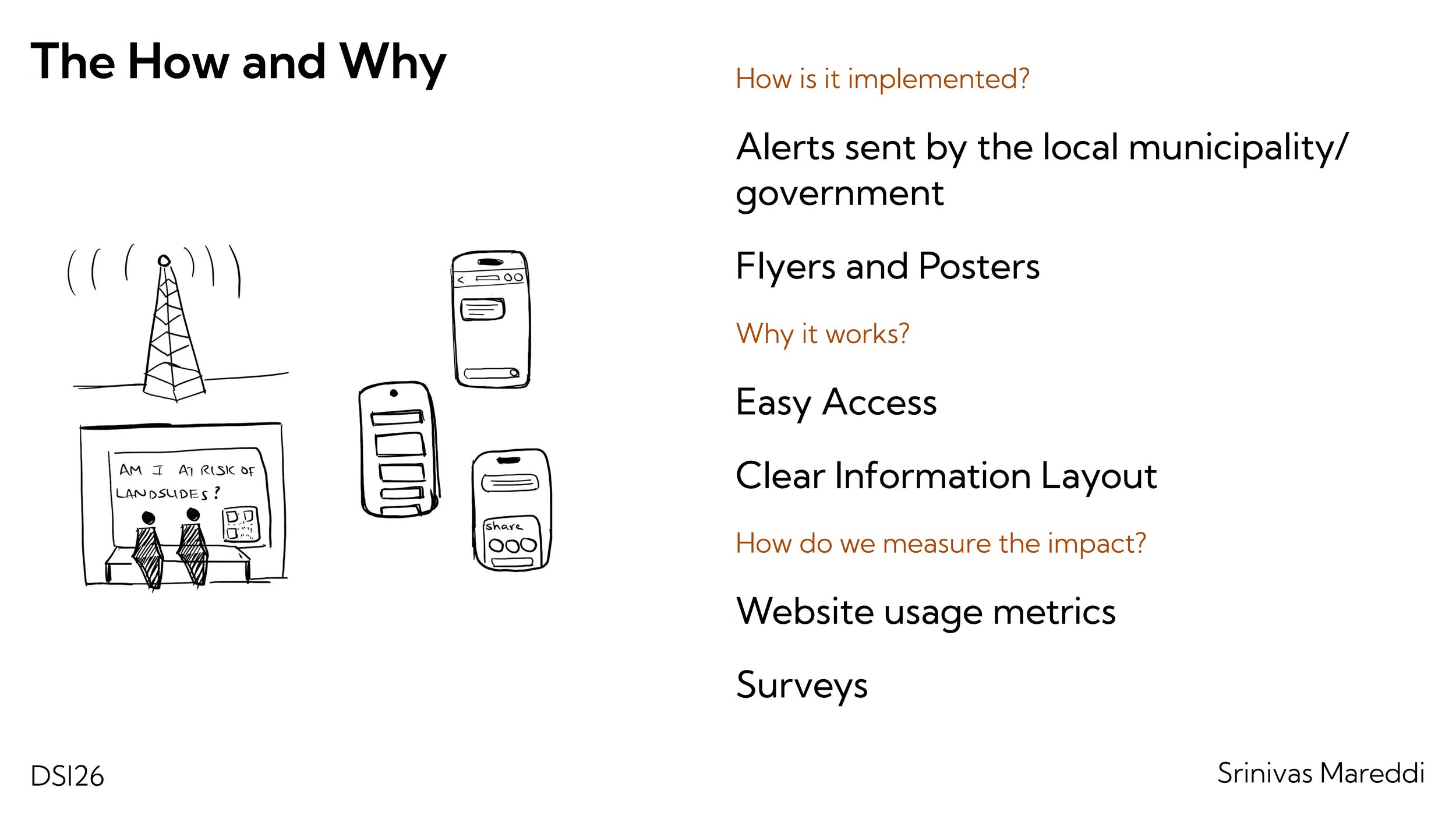
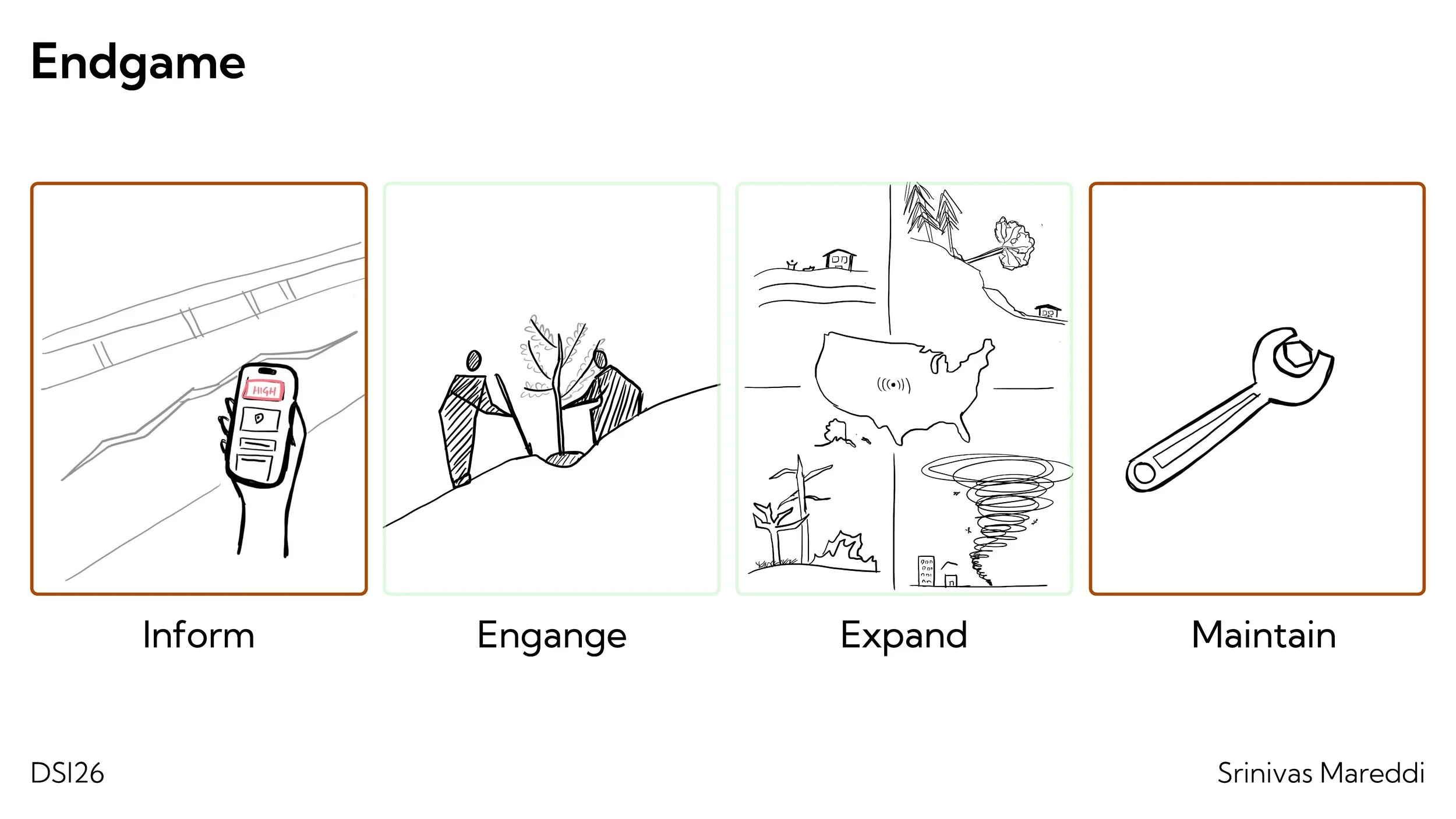
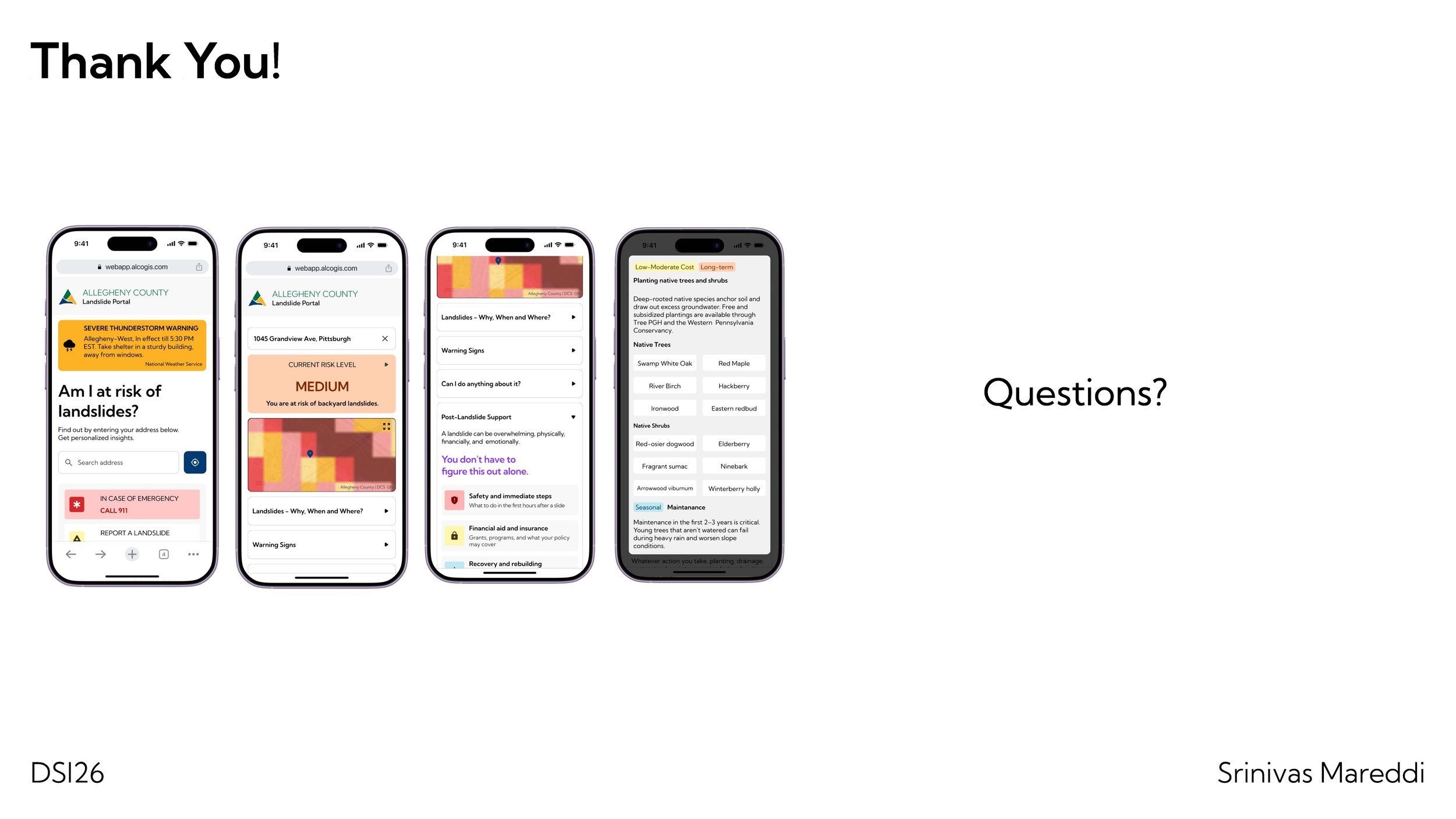
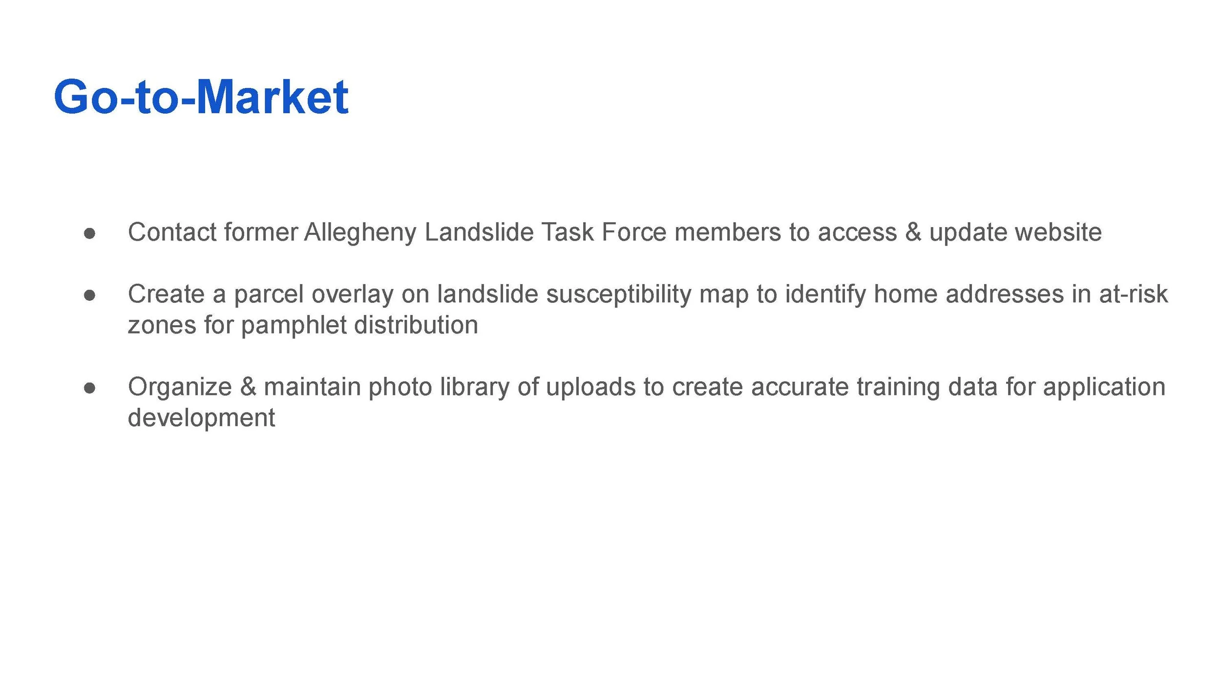
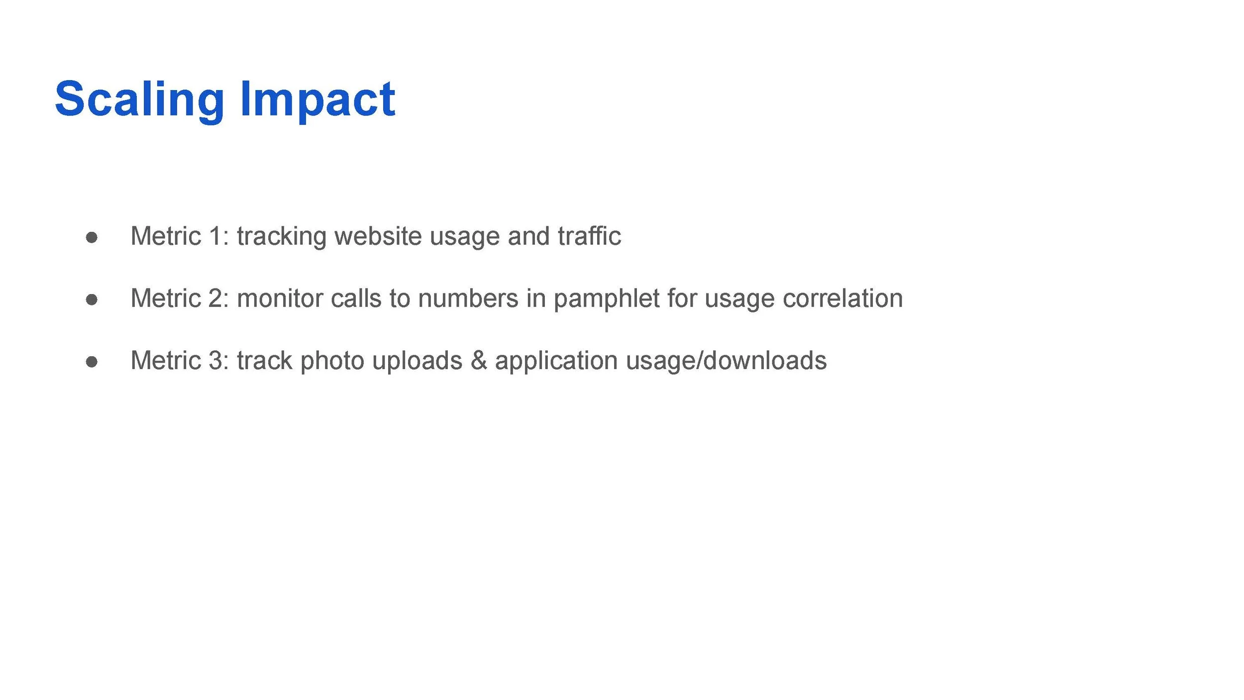
LANDSLIDE RISK AWARENESS
Western Pennsylvania faces increasing landslide risk driven by climate change and the region's unstable geological conditions, yet residents in at-risk communities often lack awareness of early warning signs and basic preparedness practices. To address this, I developed a resident-facing mobile web application that provides accessible, practical guidance organized around the before, during, and after phases of a landslide event. It helps communities prepare, respond, and recover while also connecting residents with local agencies and resources.
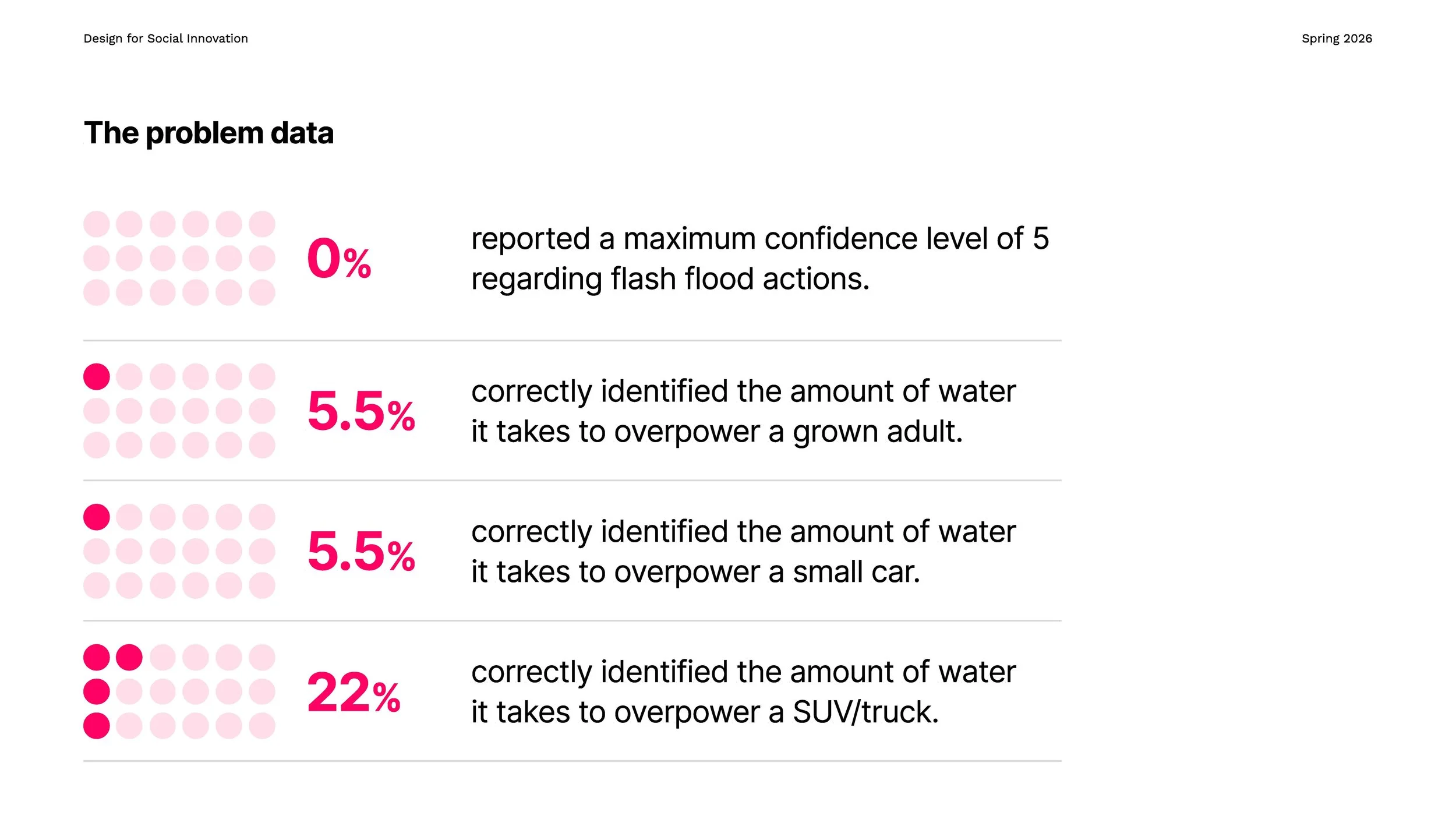
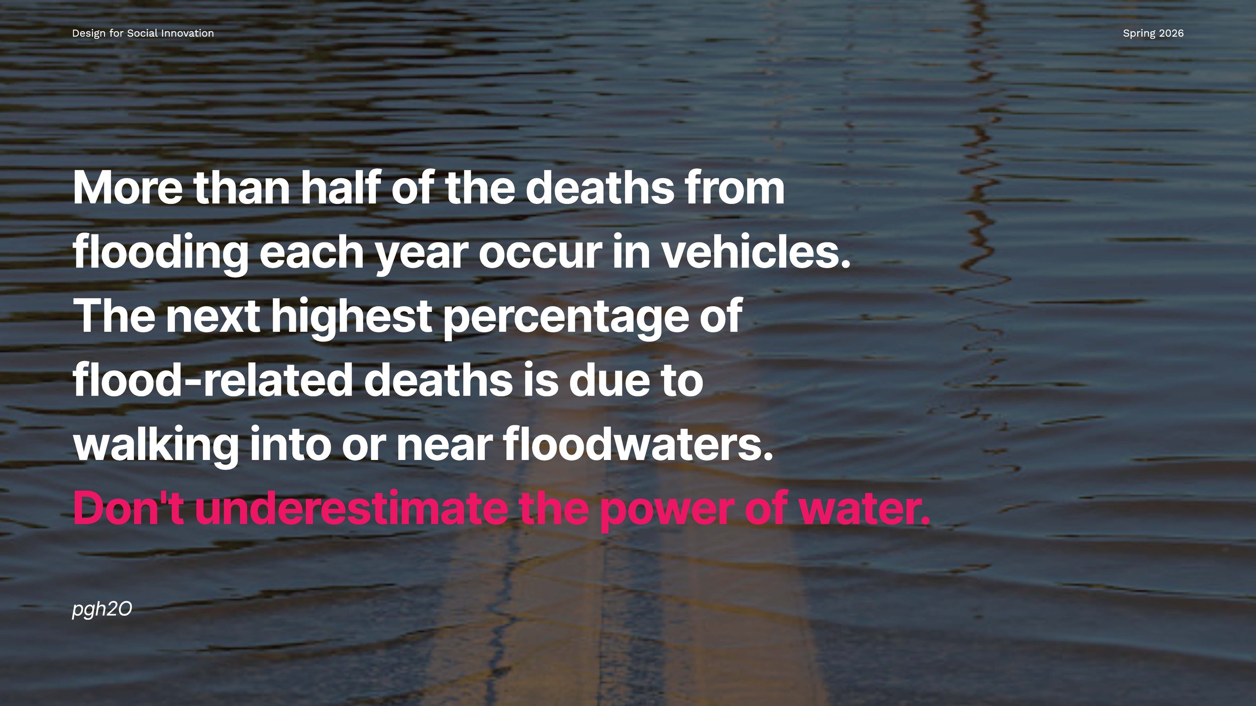
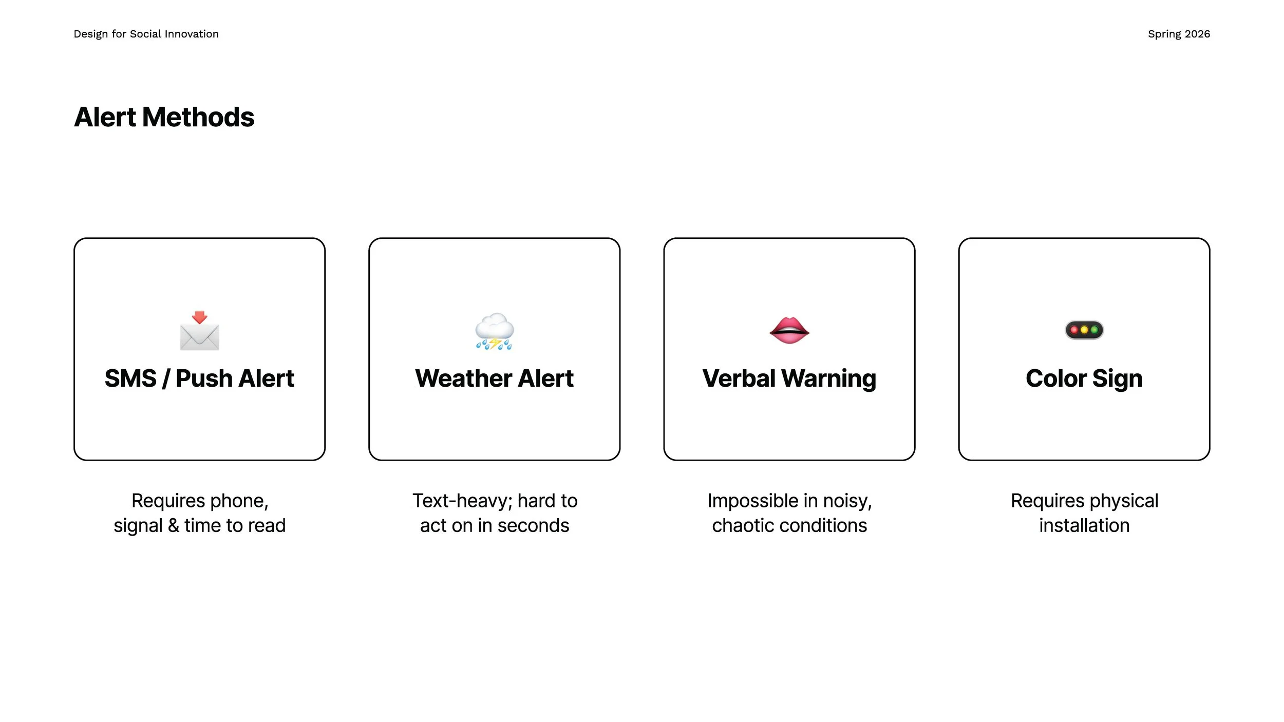
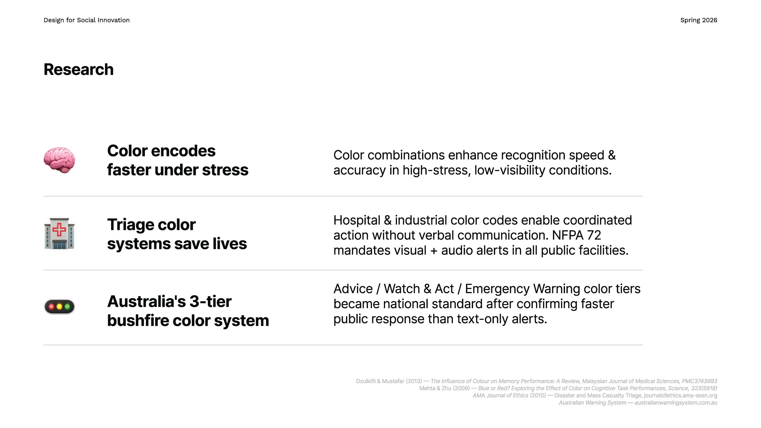
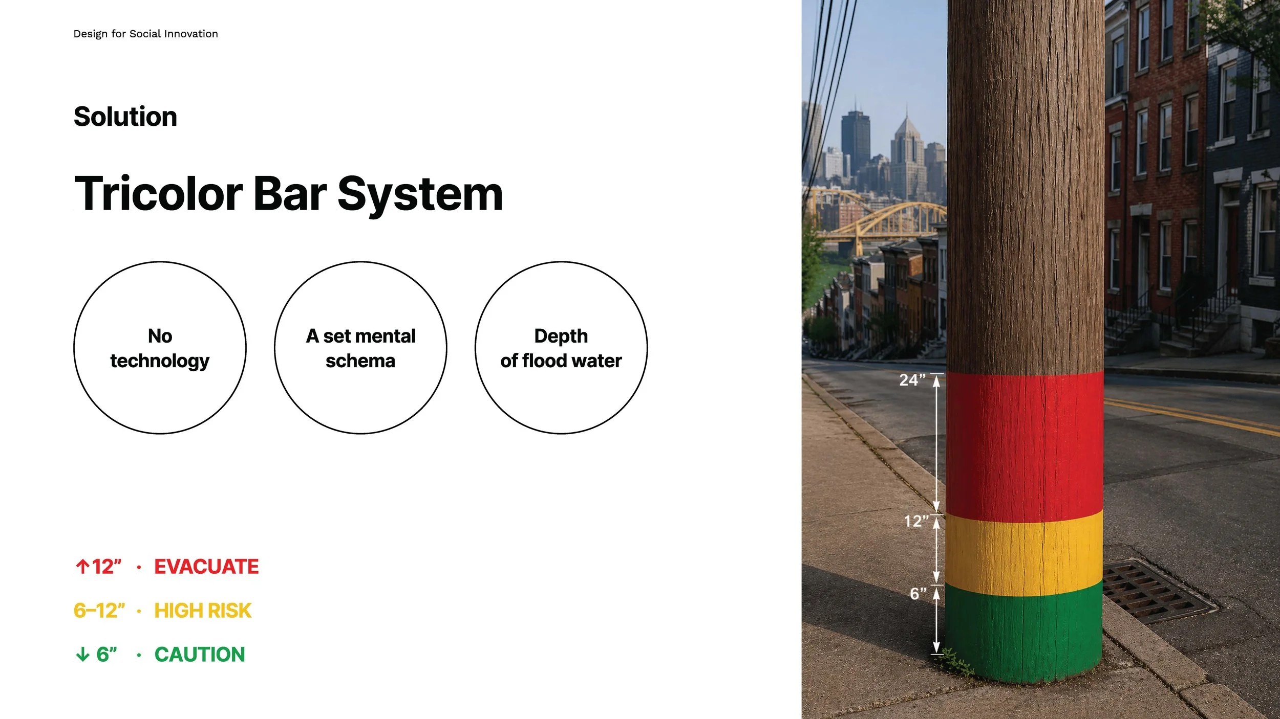
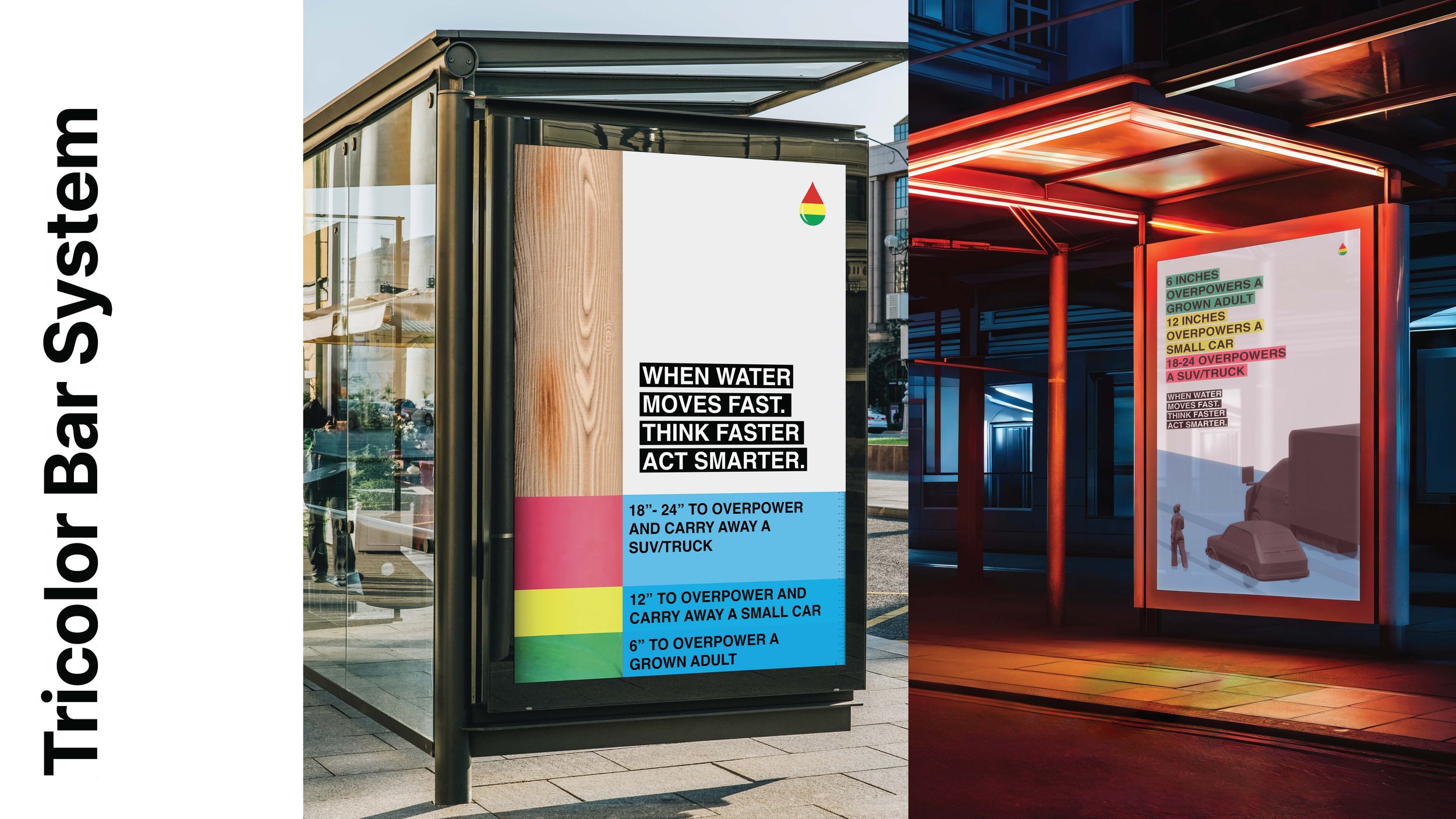
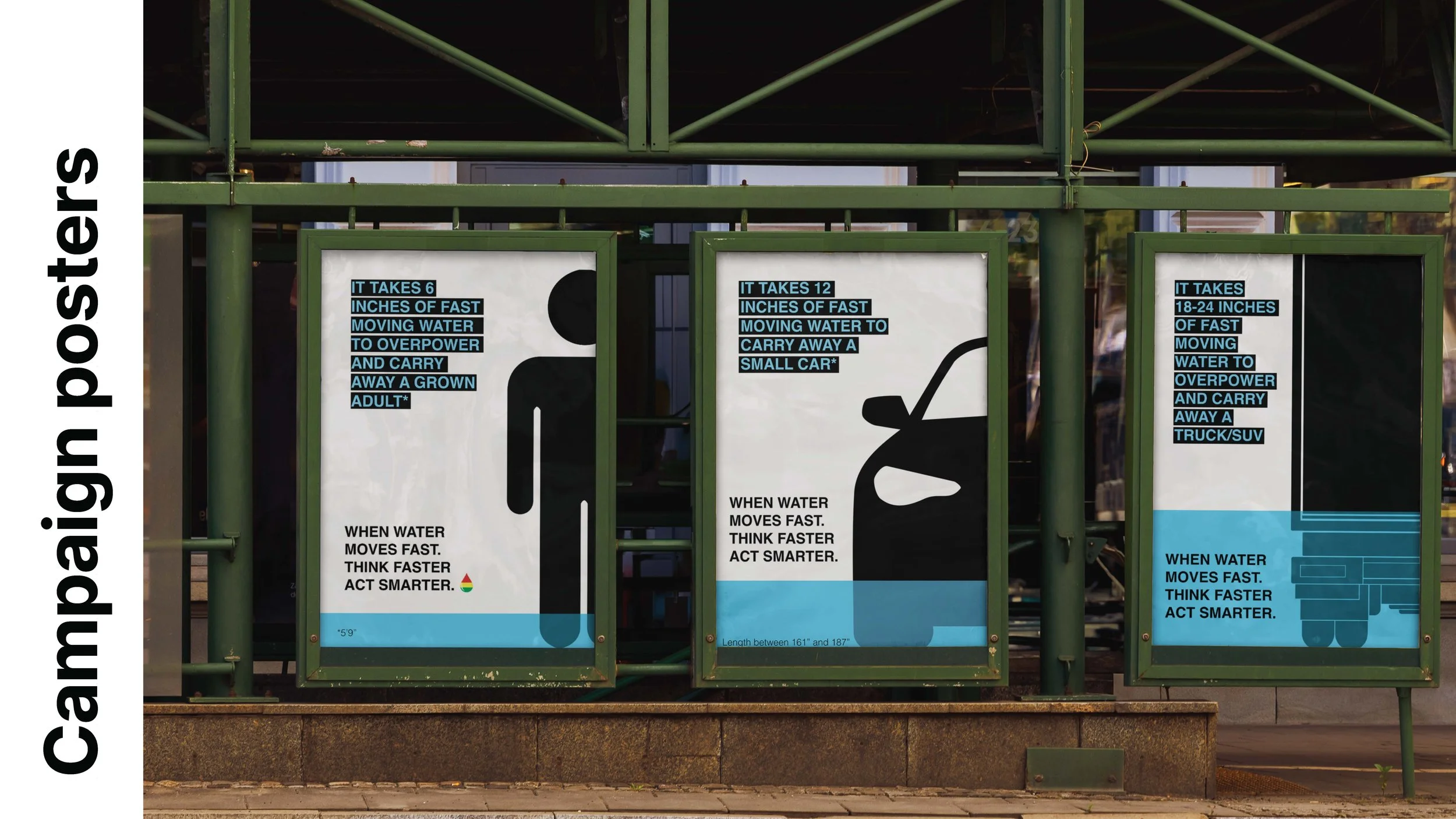
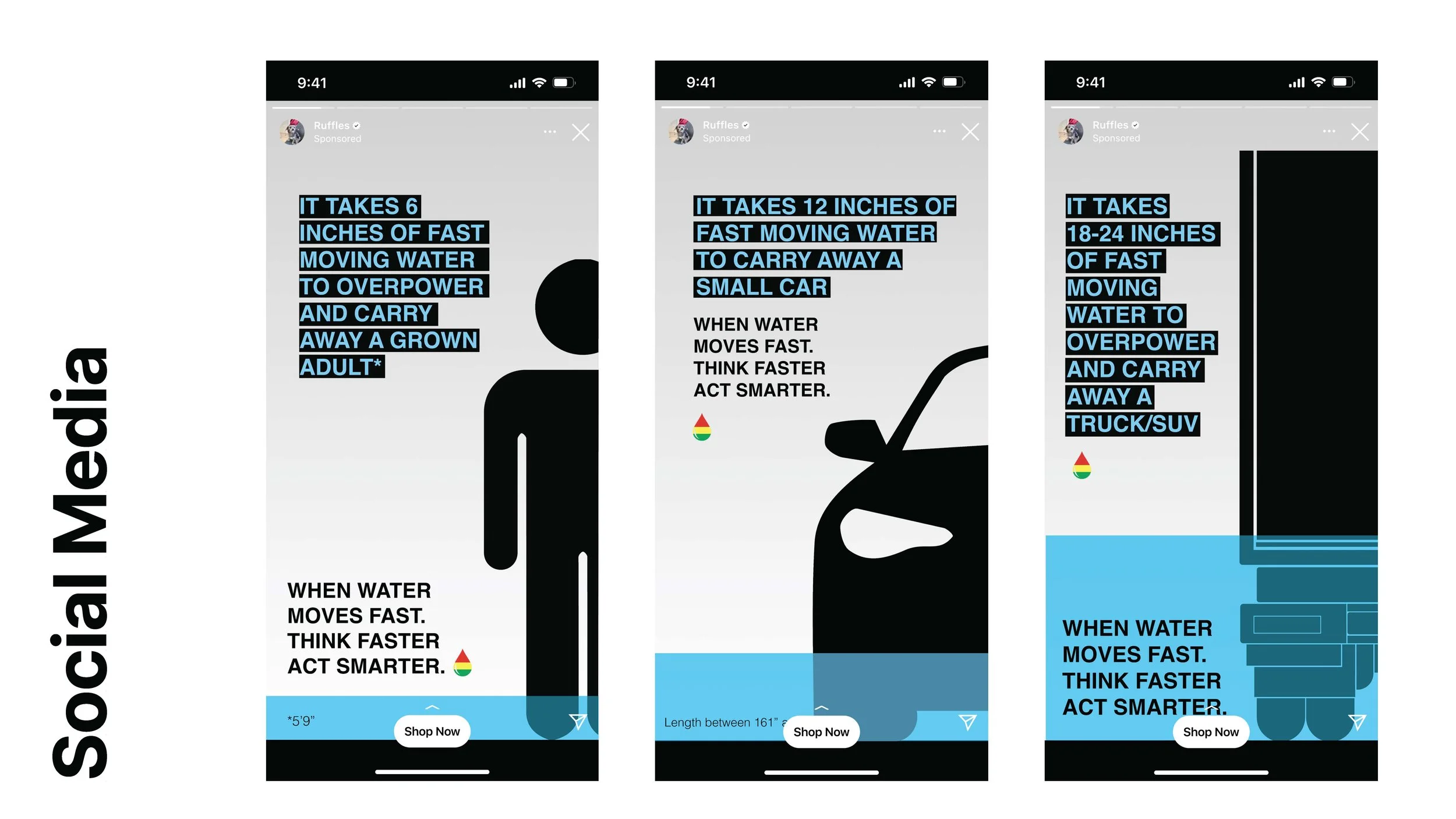
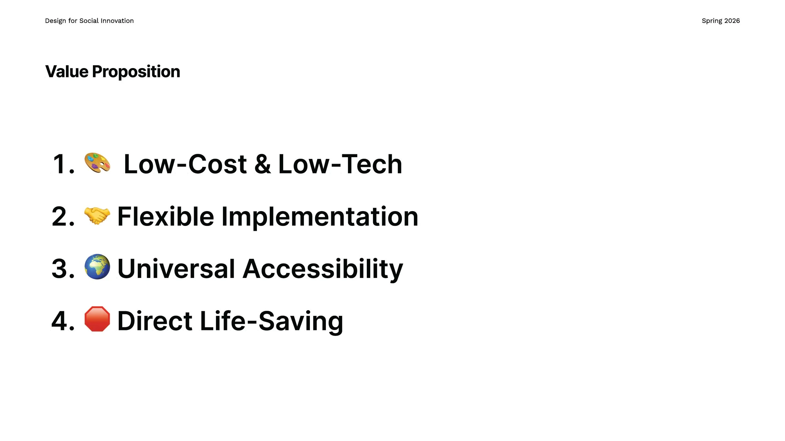
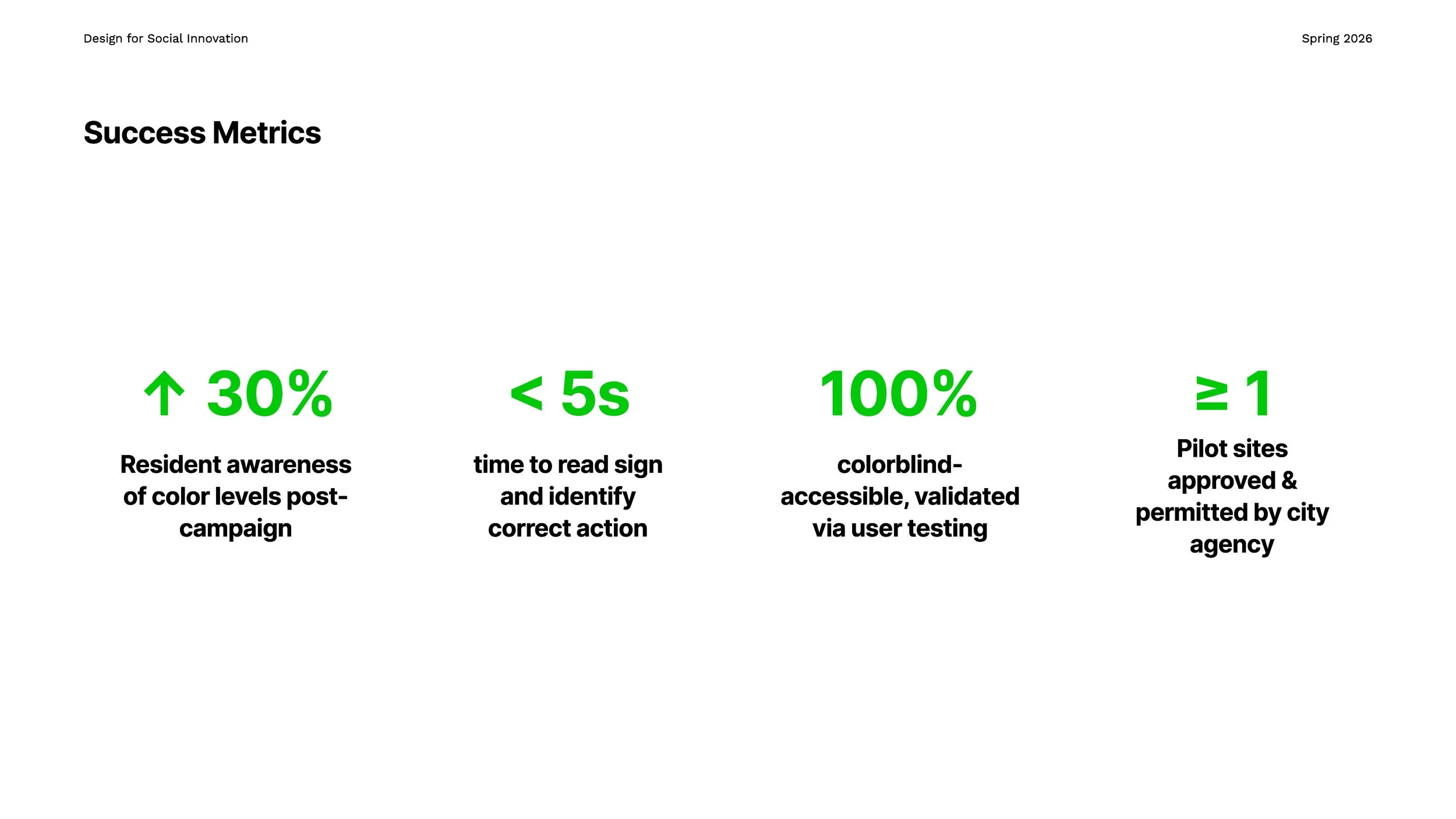
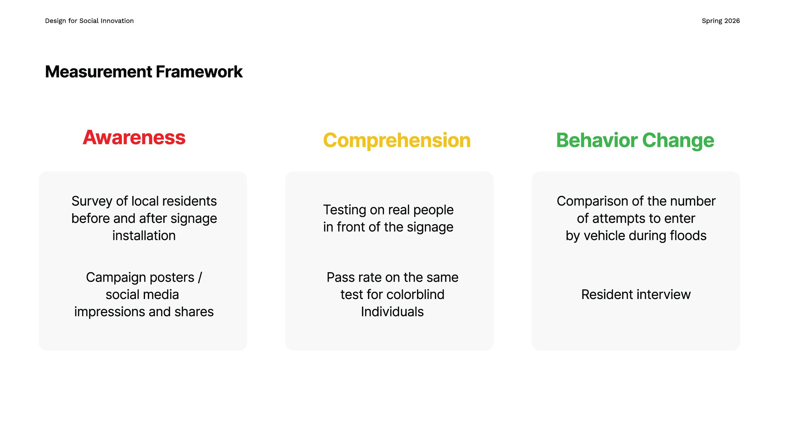
VISUALIZING FLOOD SAFETY


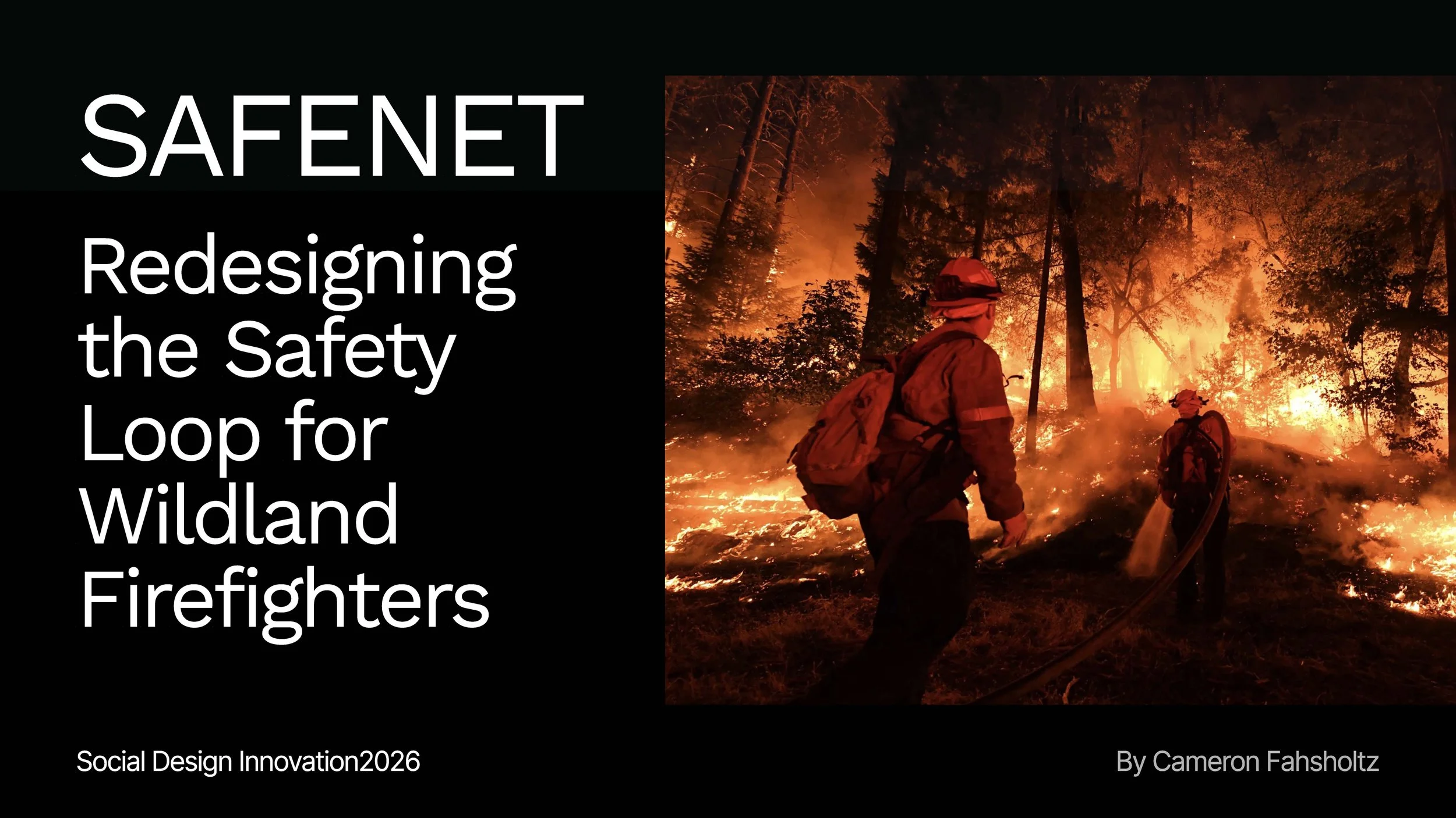
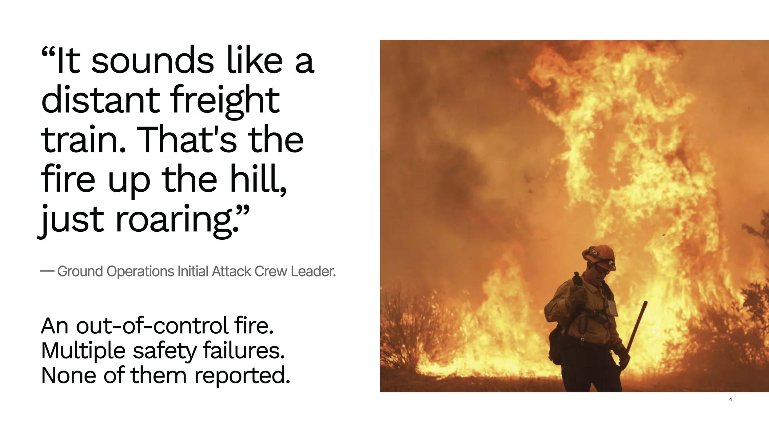
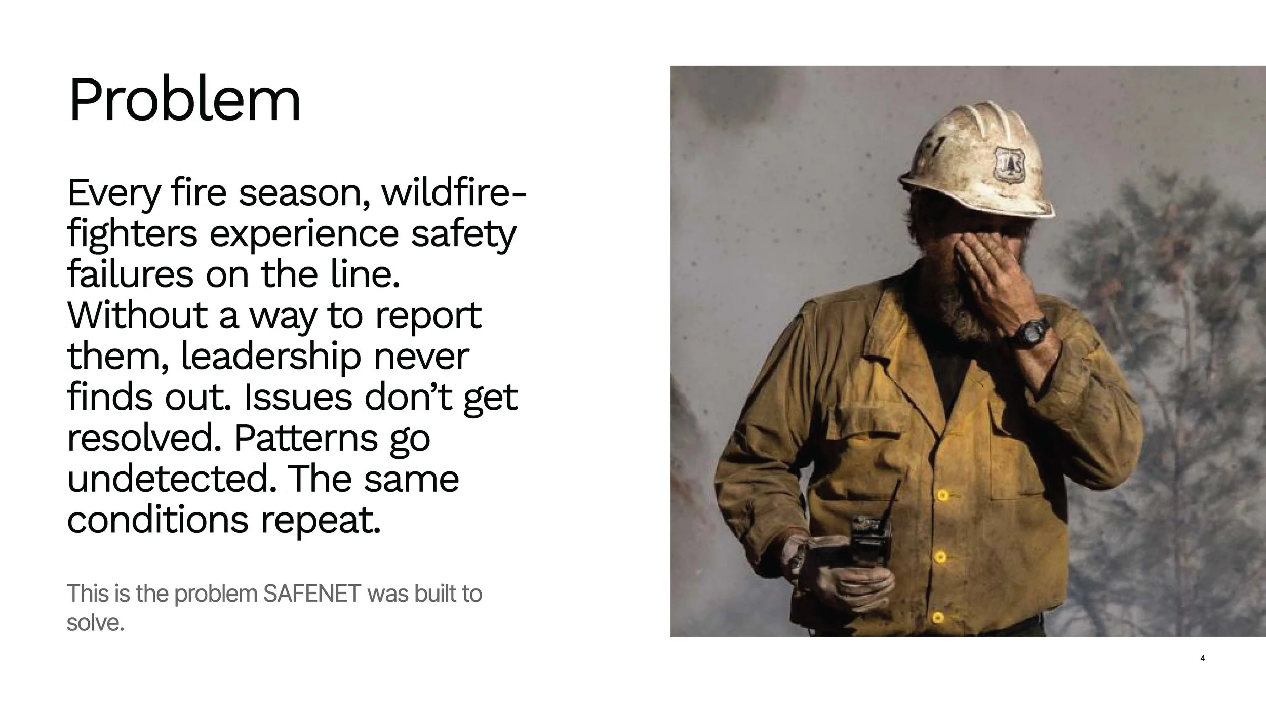
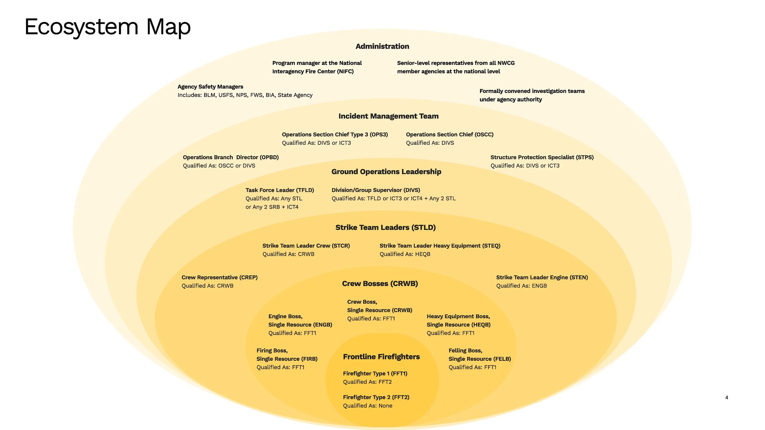
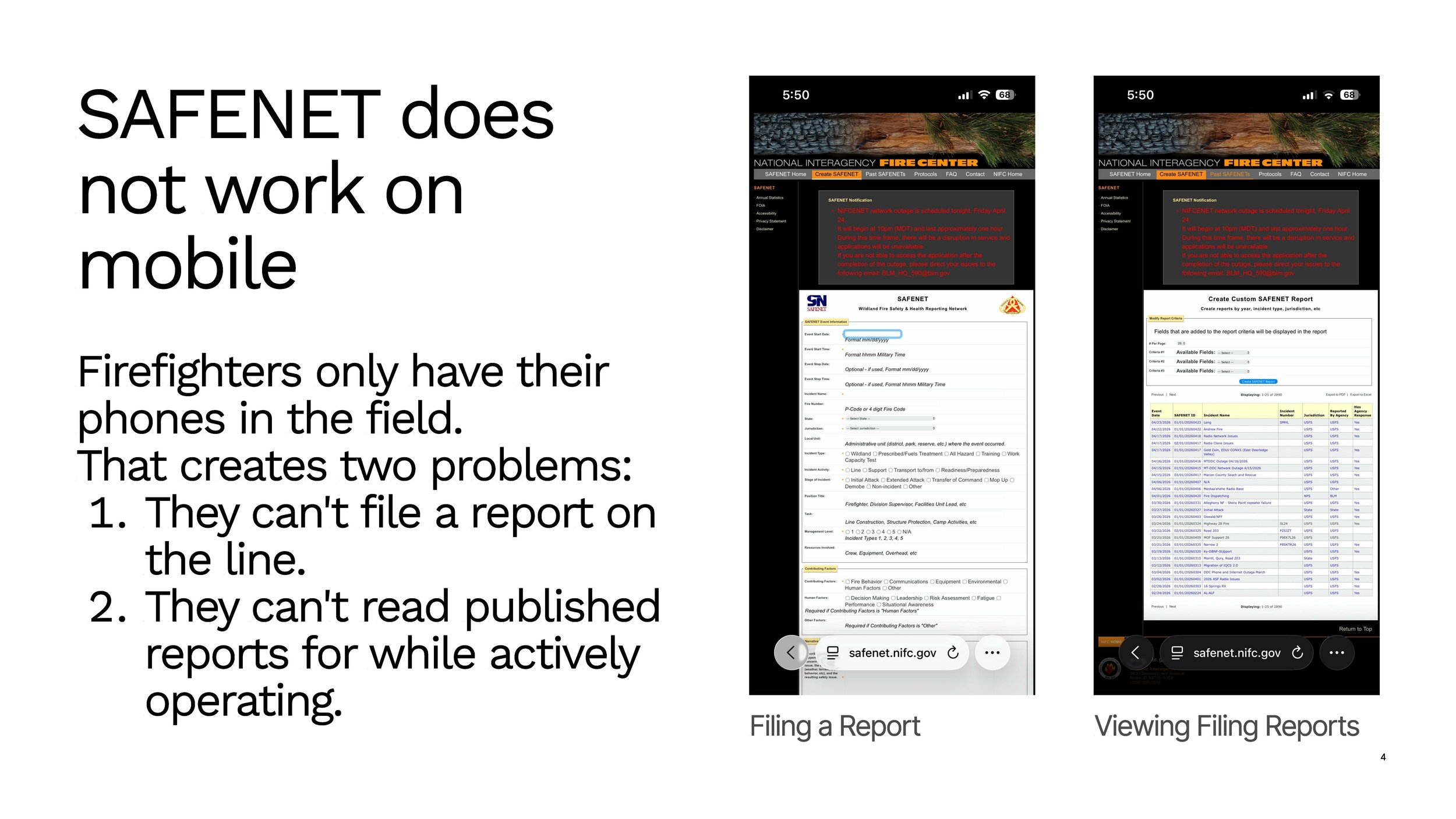
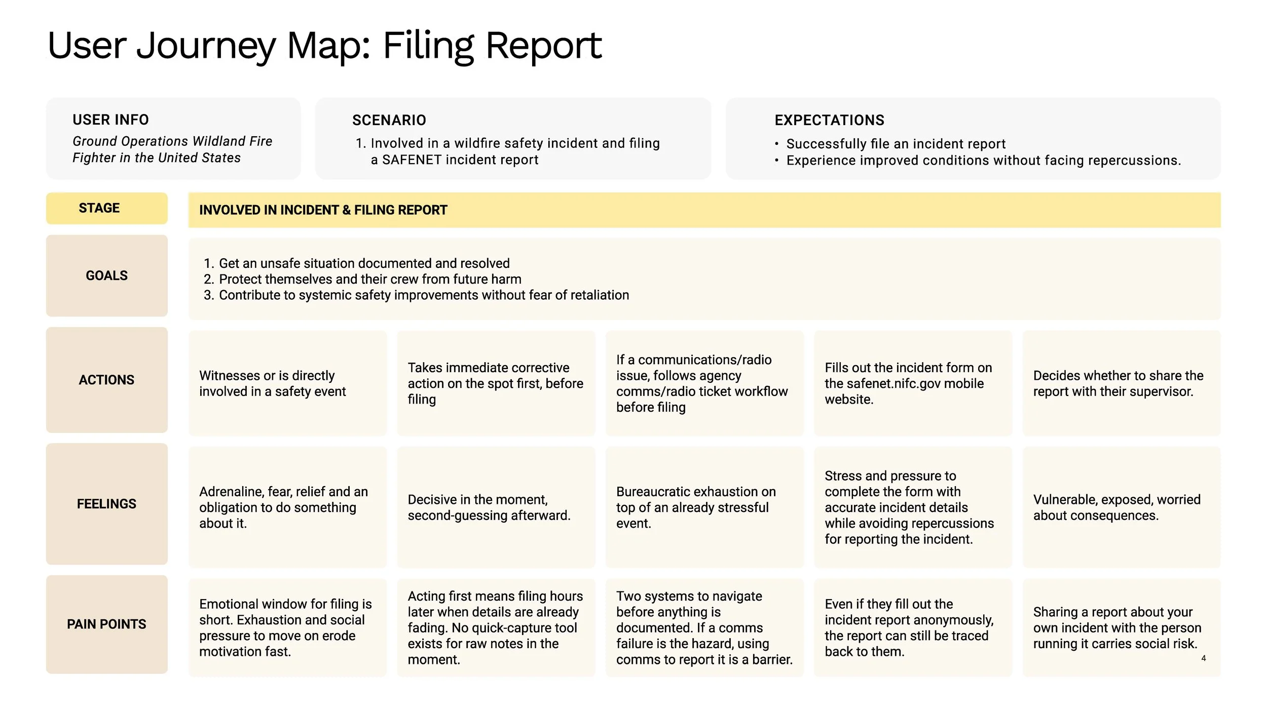
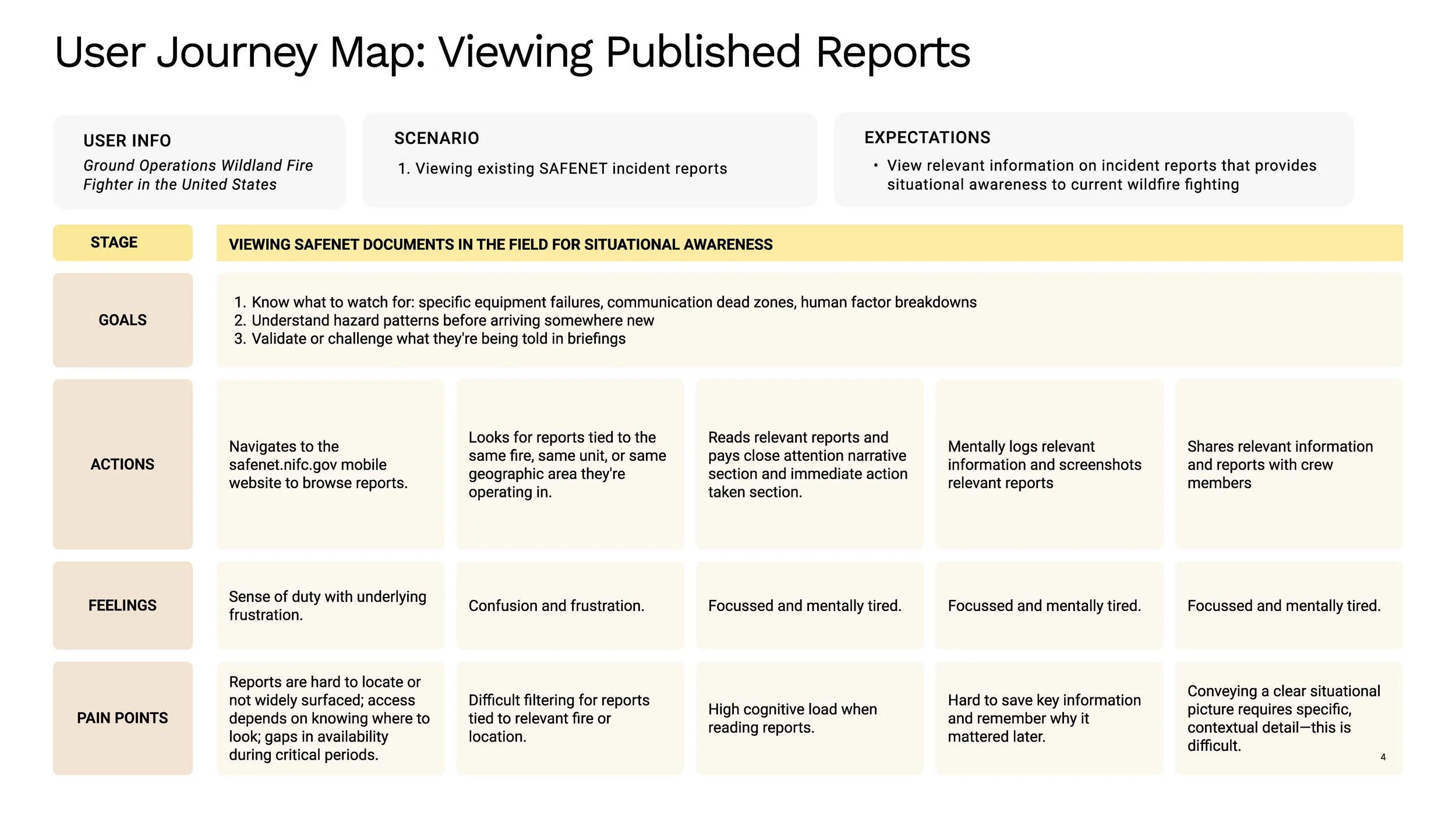
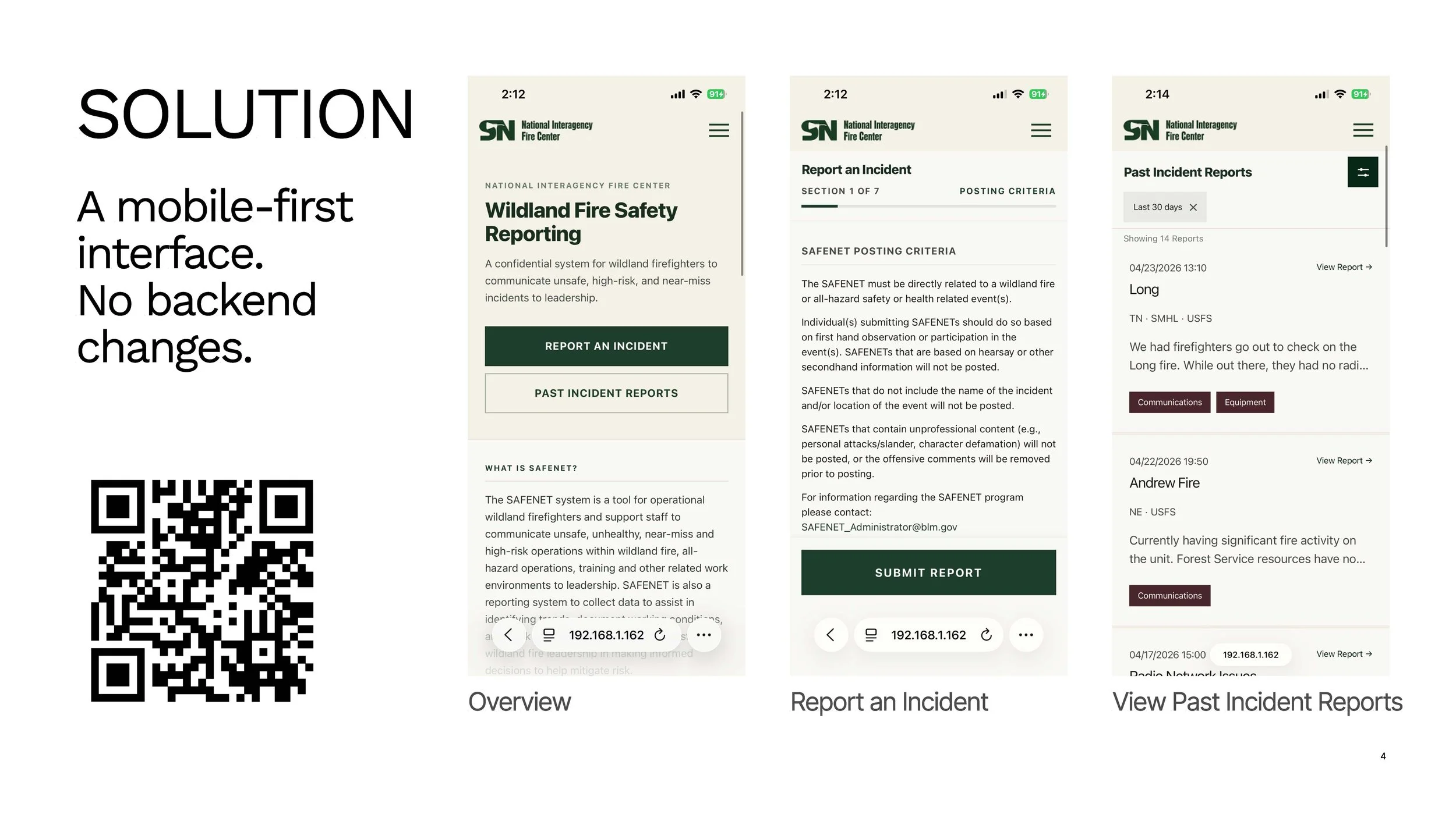
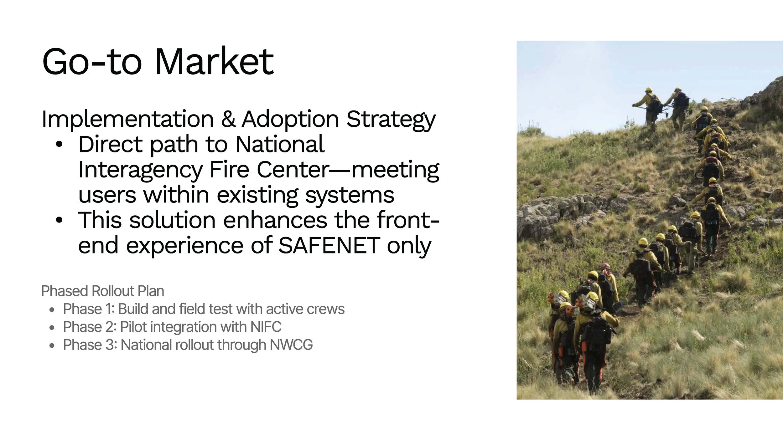
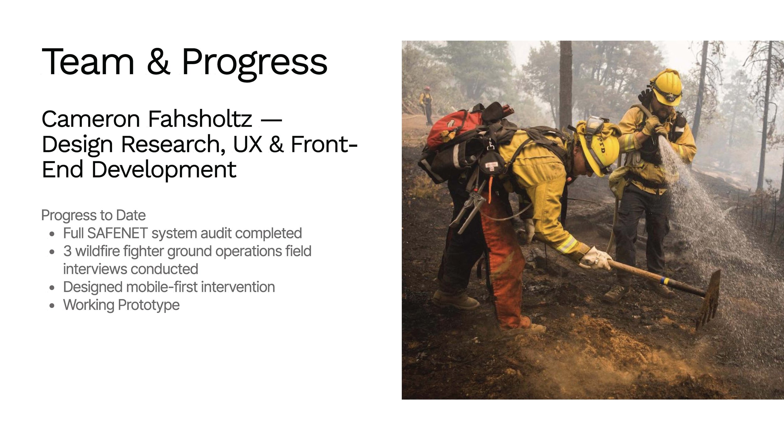
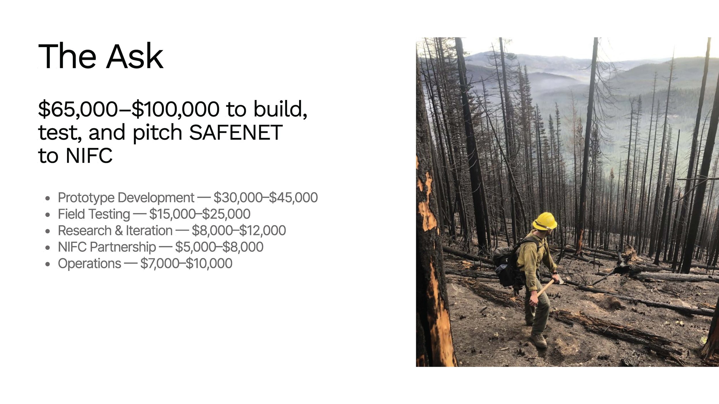
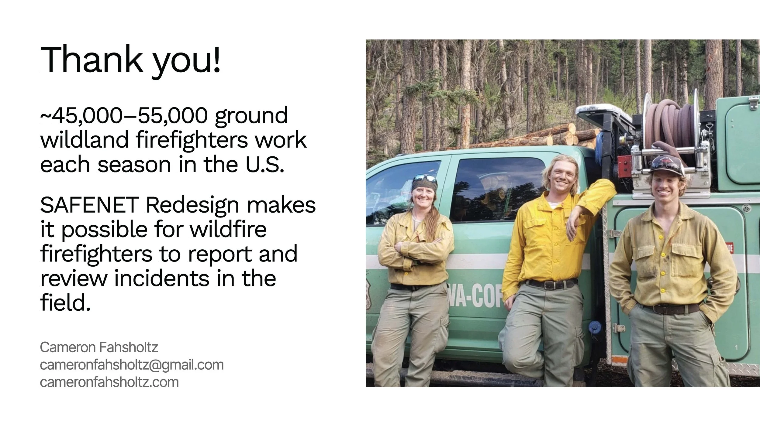
SAFENET: REDESIGNING THE SAFETY LOOP FOR WILDLAND FIREFIGHTERS

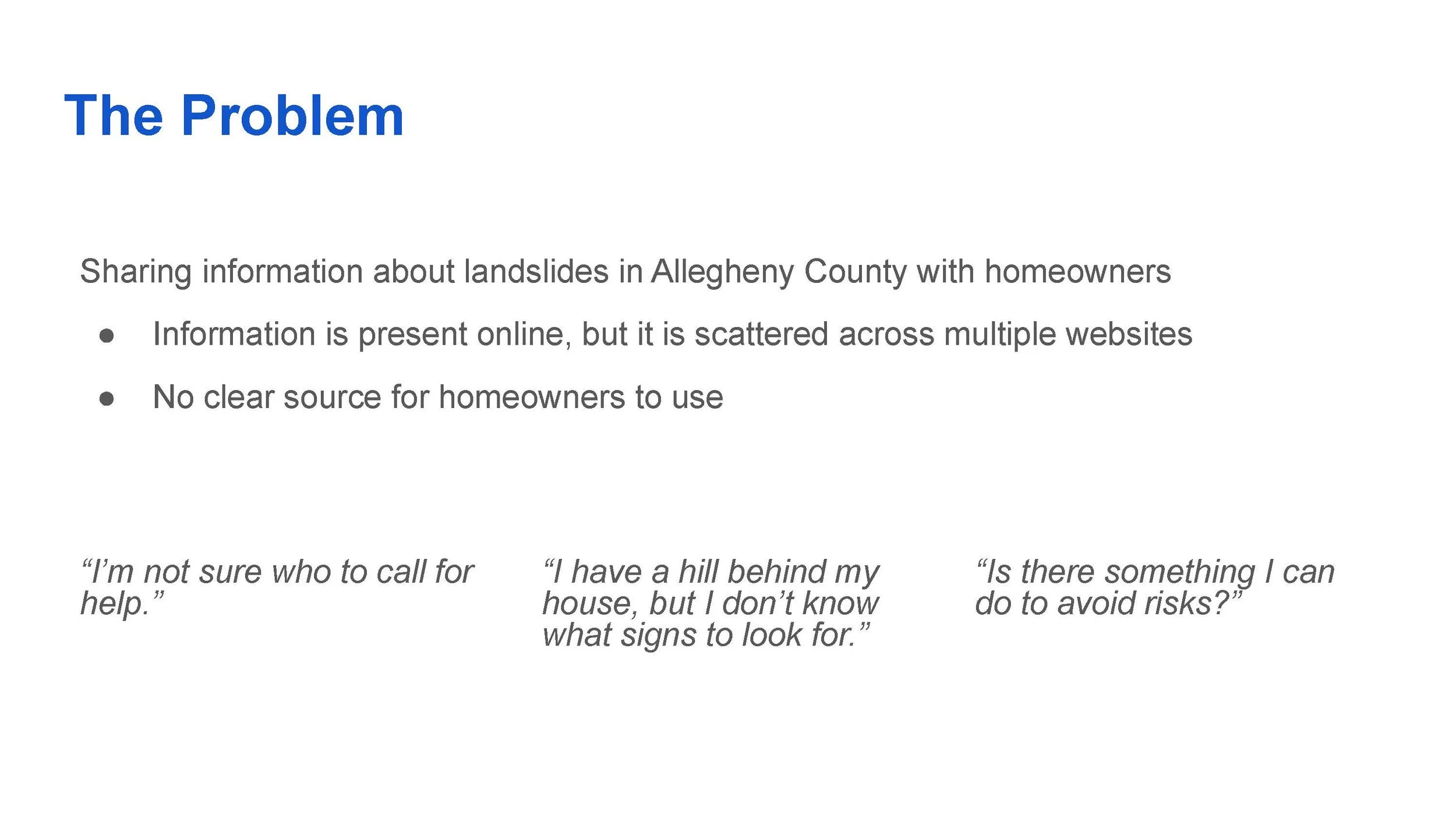
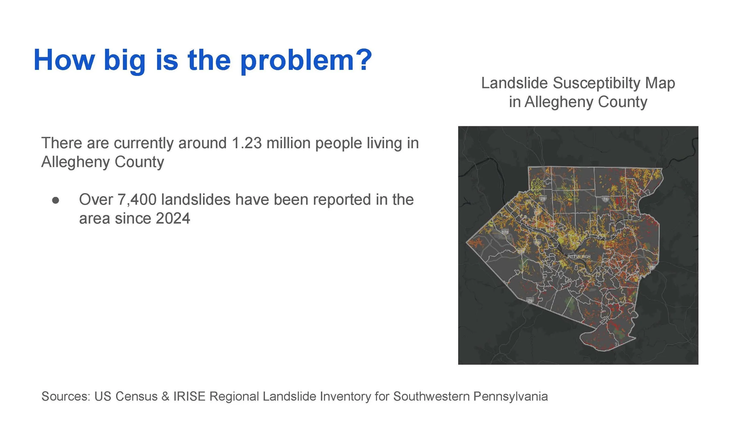
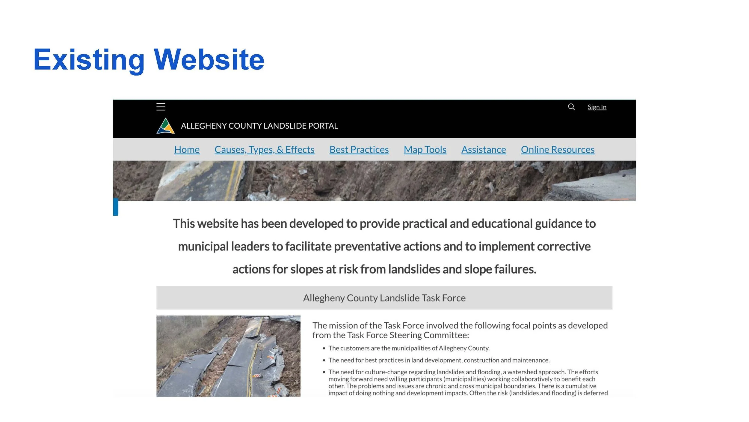
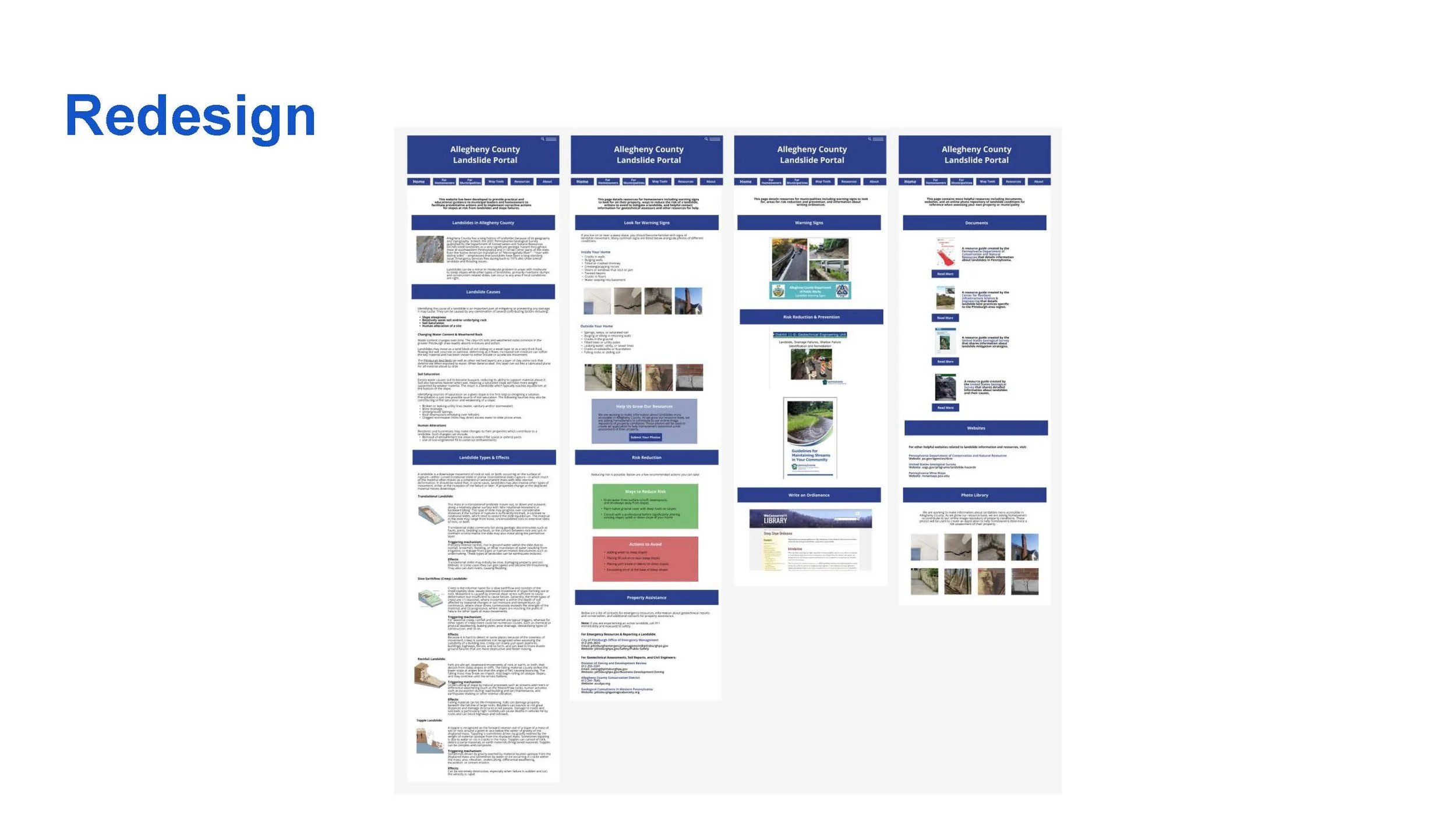
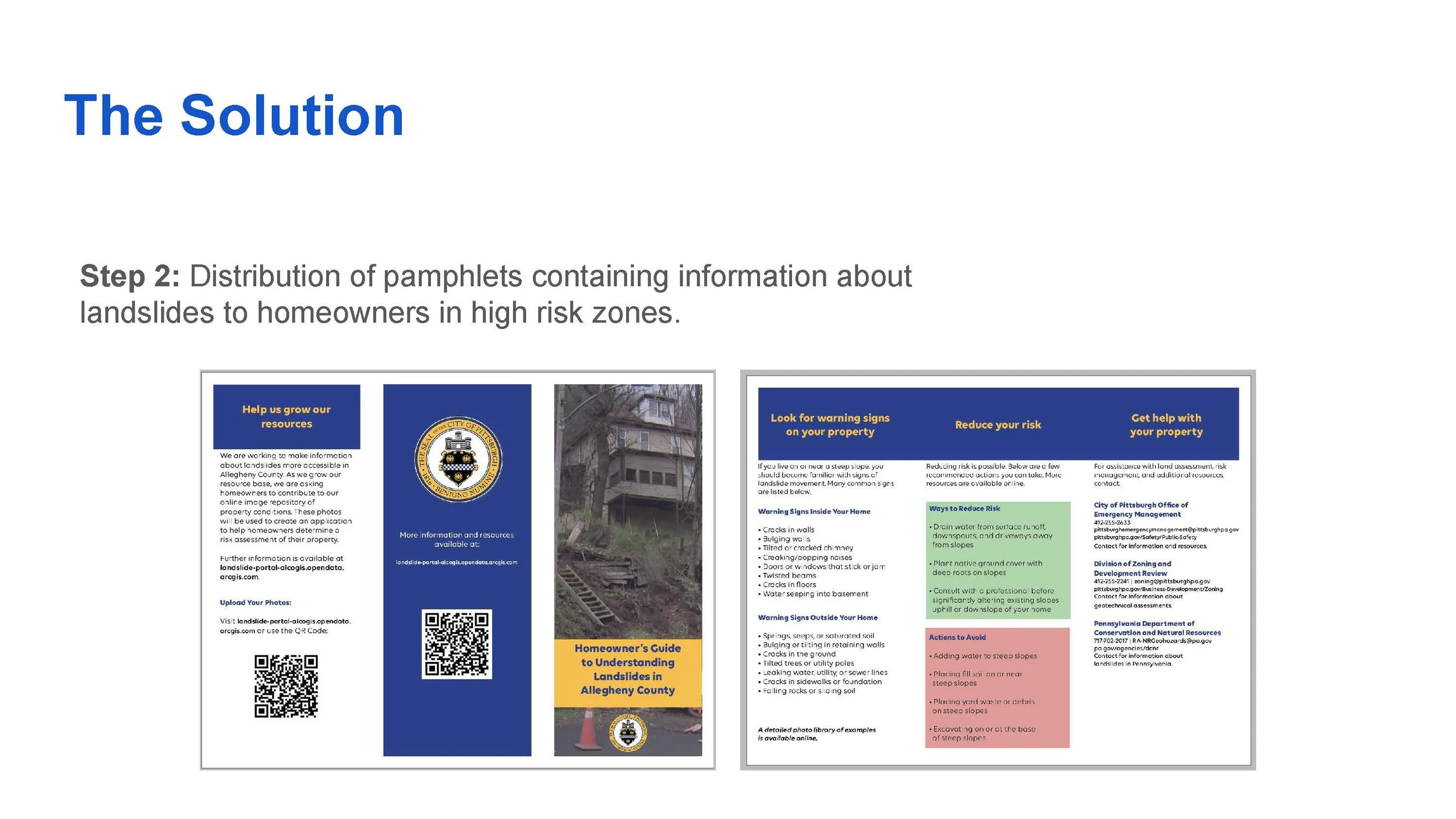
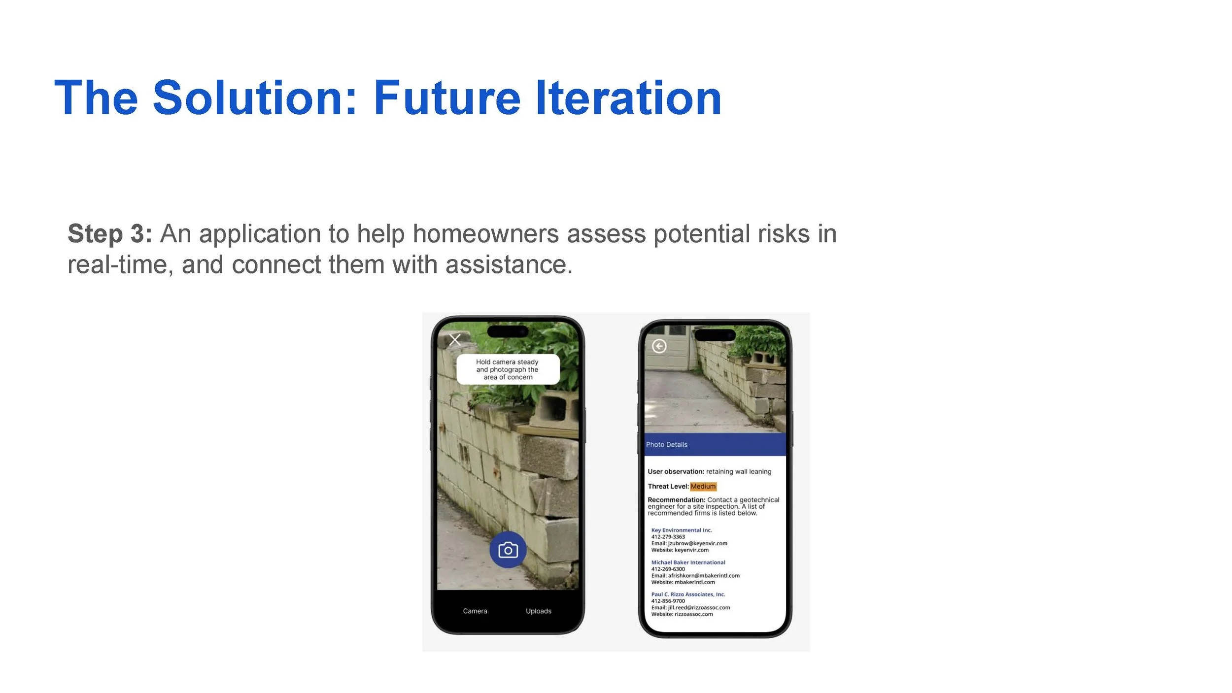
INFORMING HOMEOWNERS ABOUT LANDSLIDES IN ALLEGHENY COUNTY

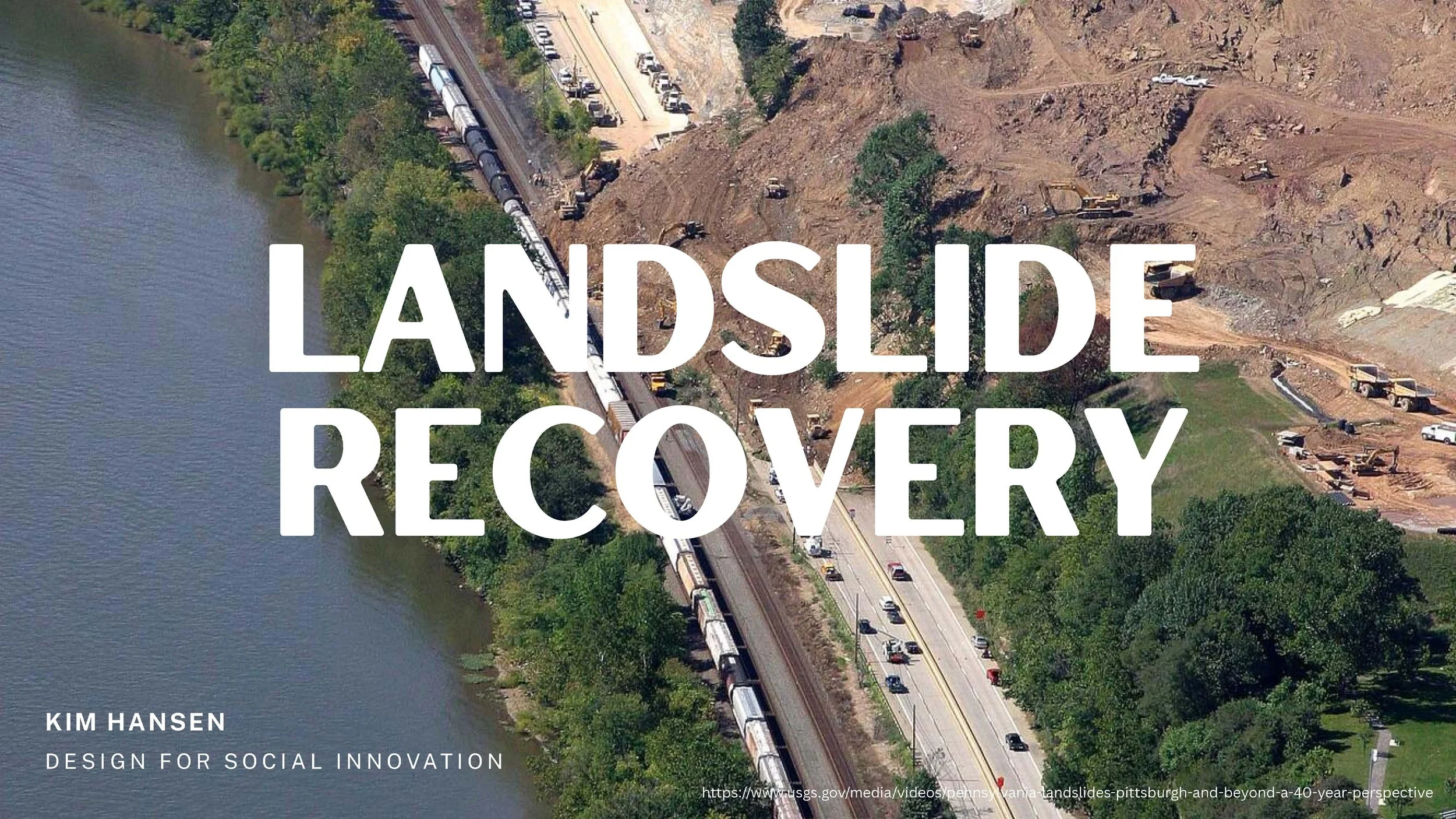
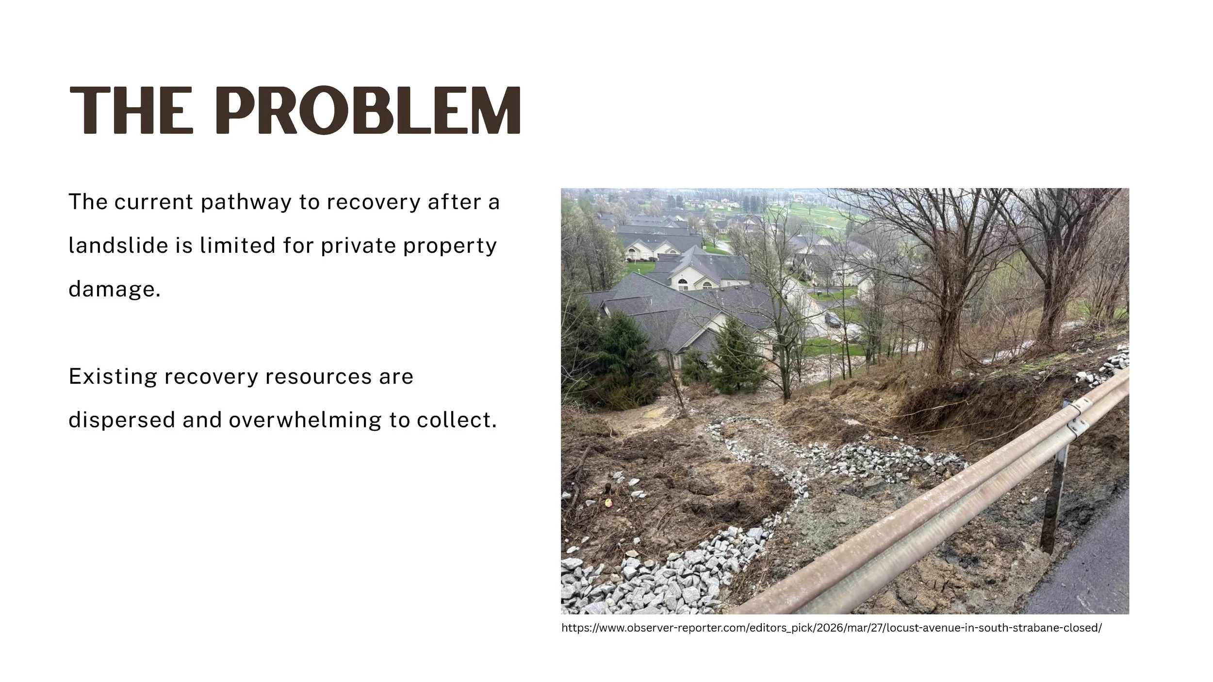
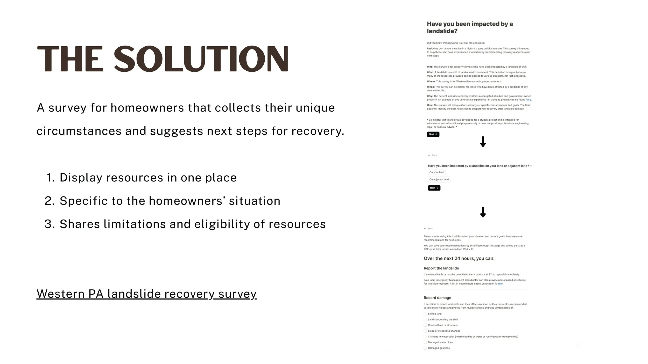
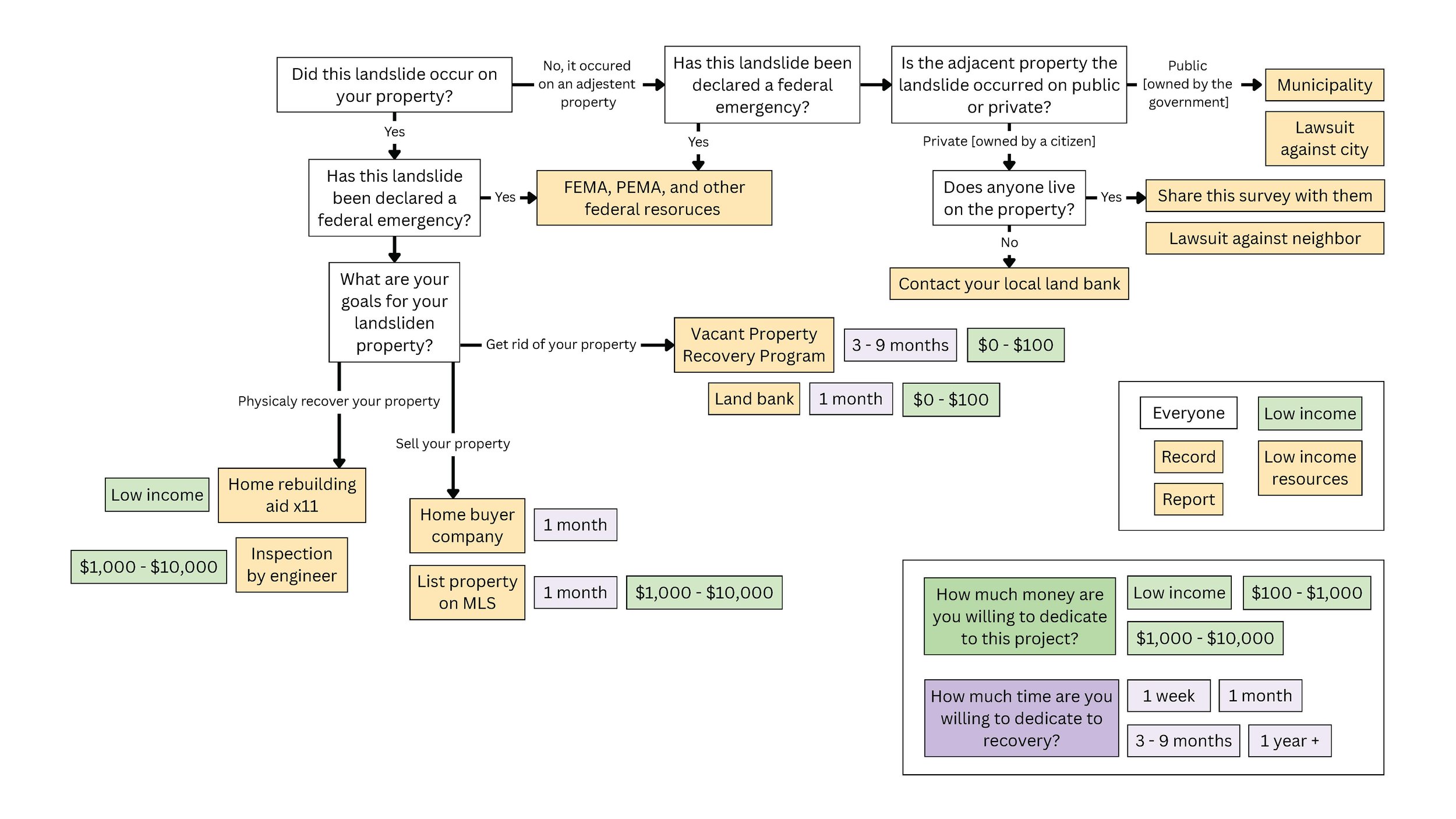
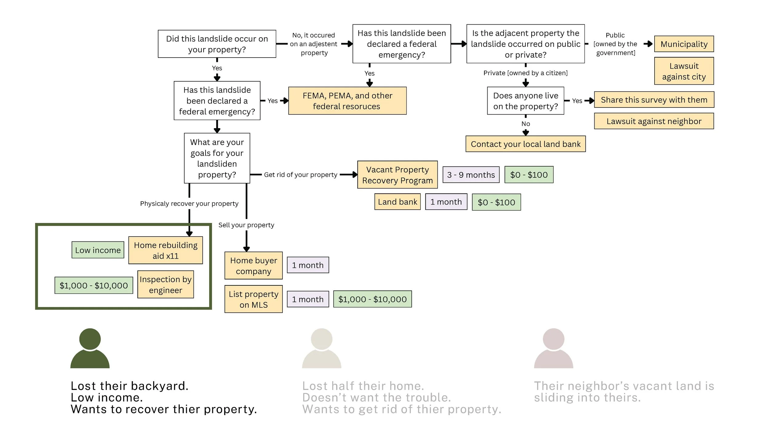
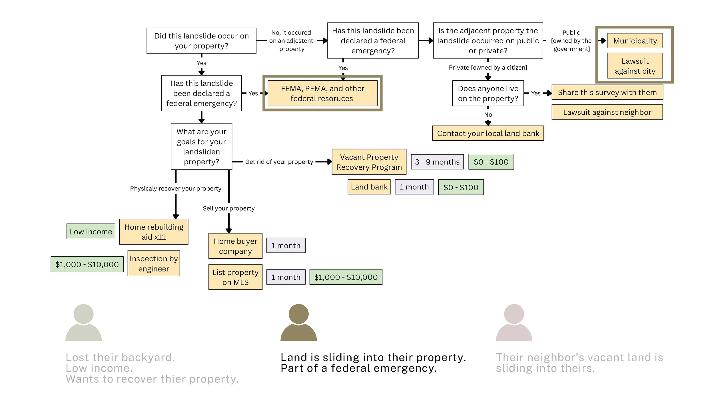
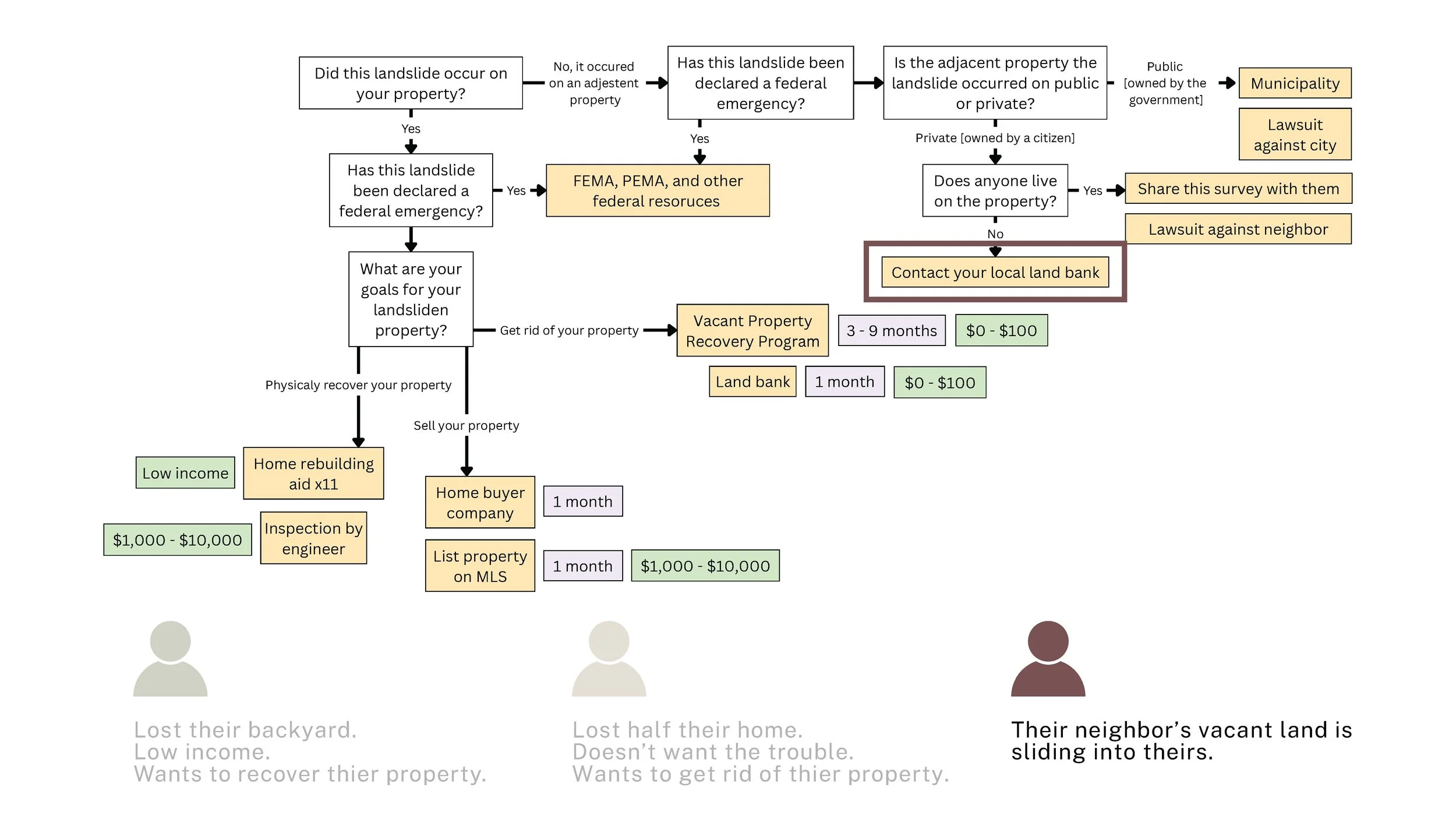
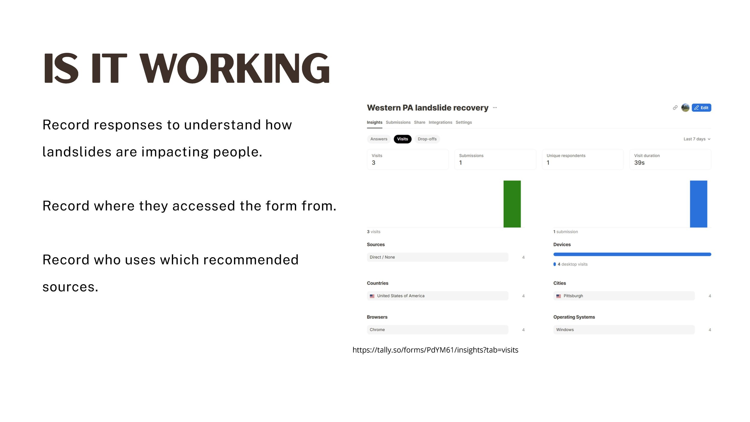
LANDSLIDE RECOVERY

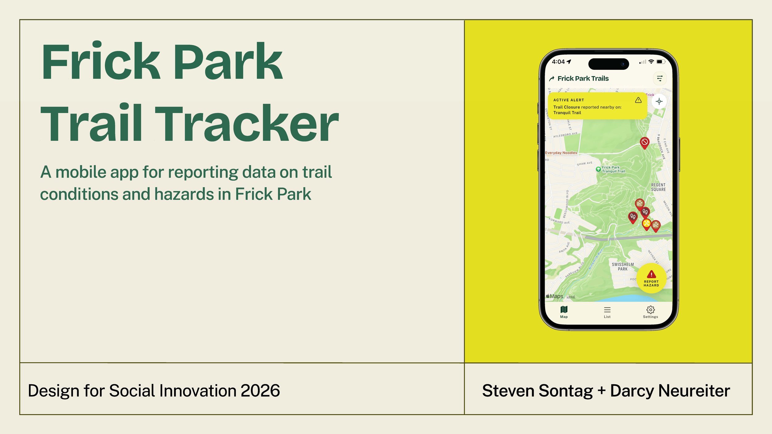
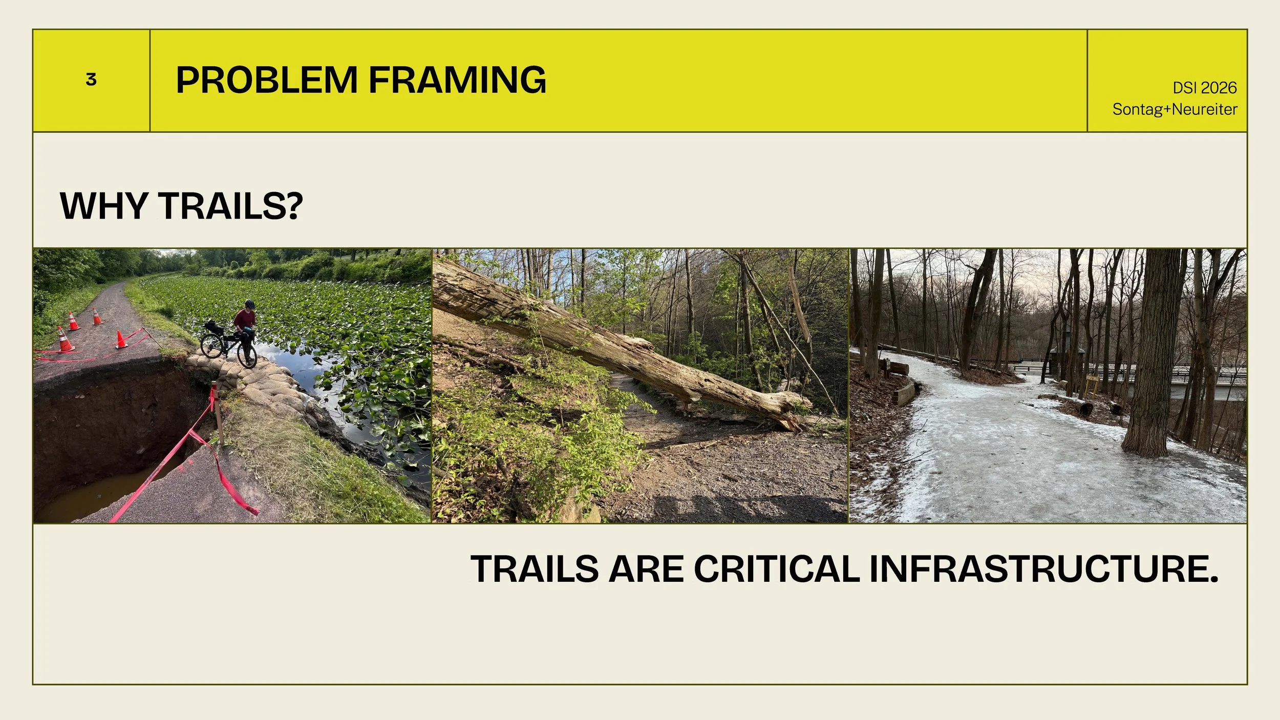
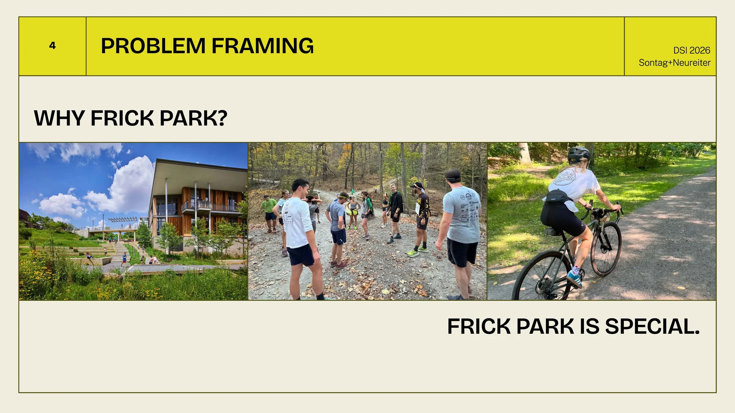
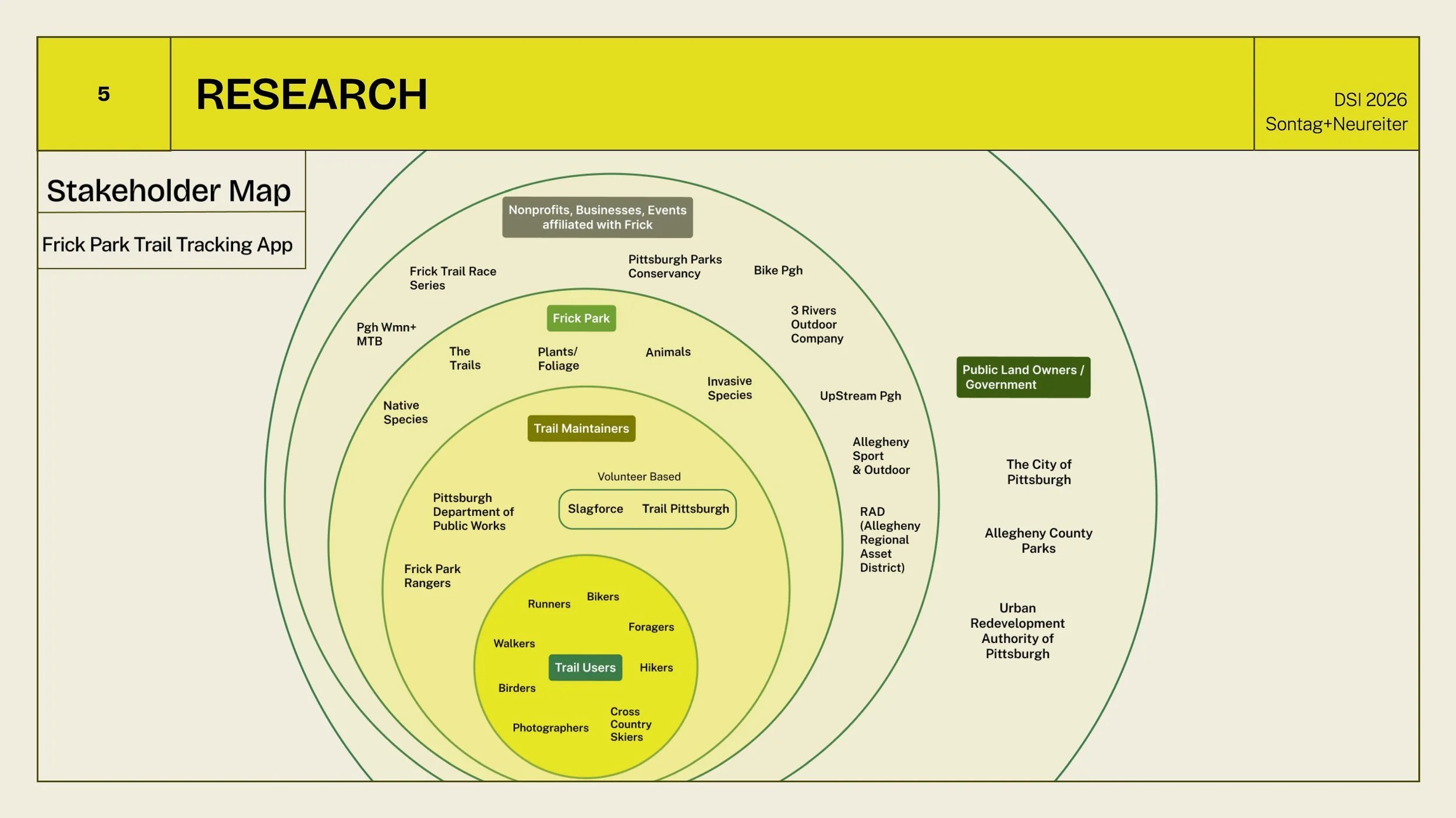
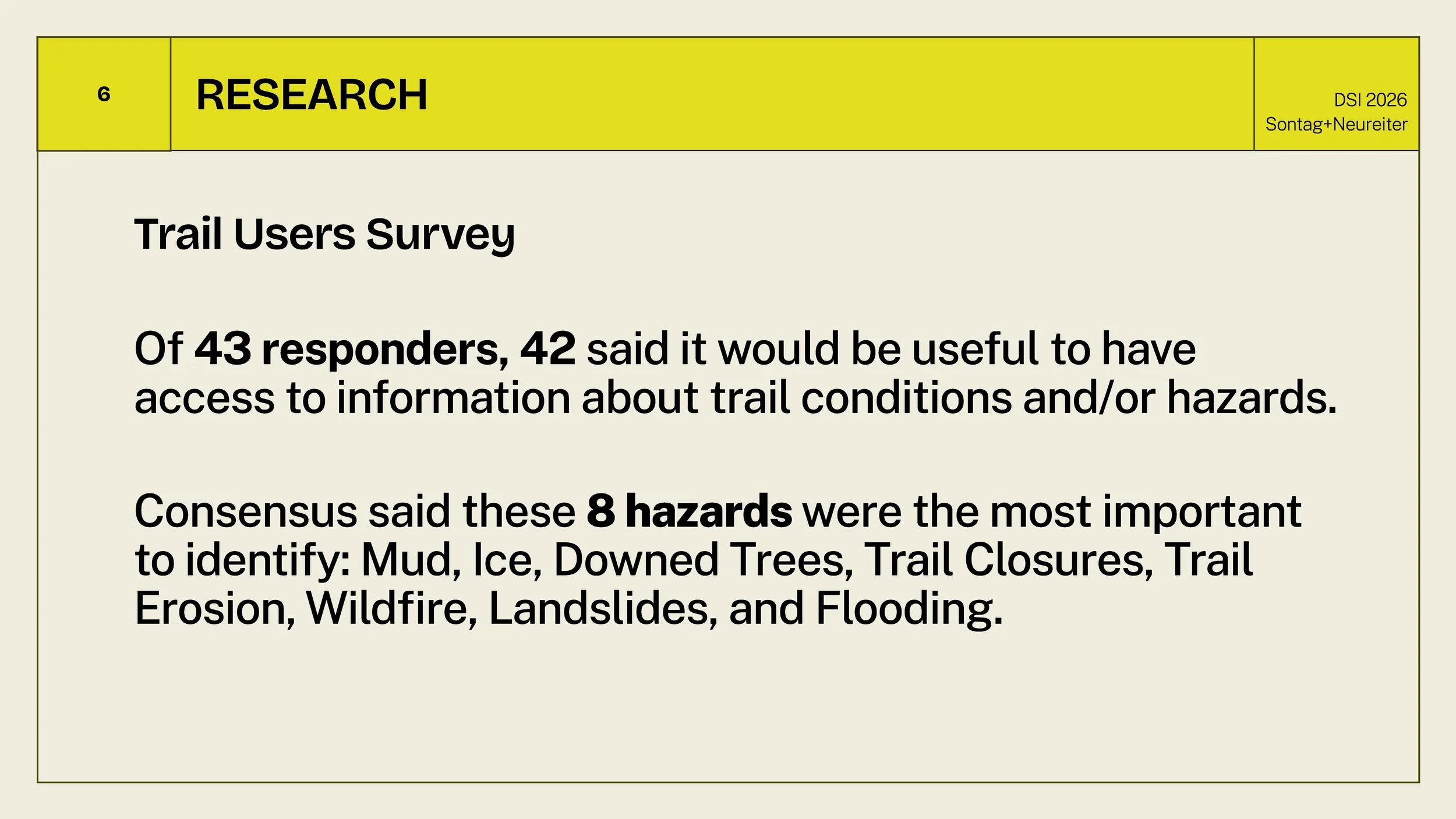
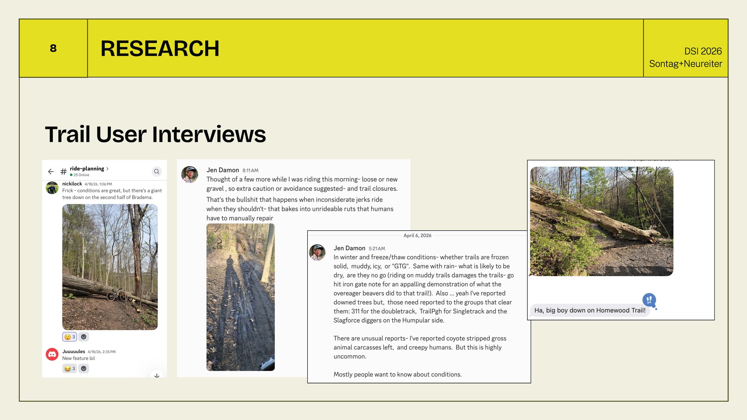
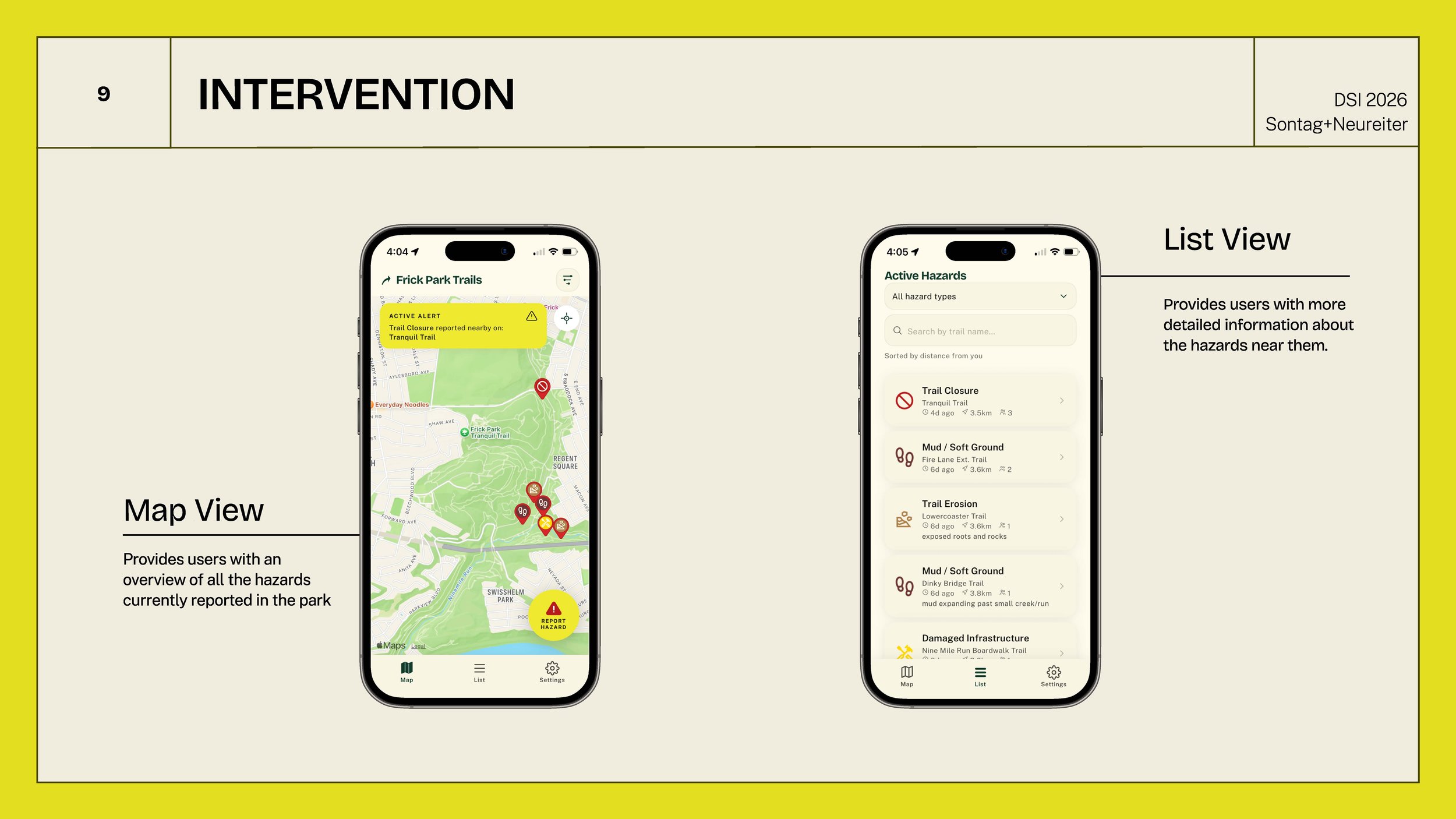
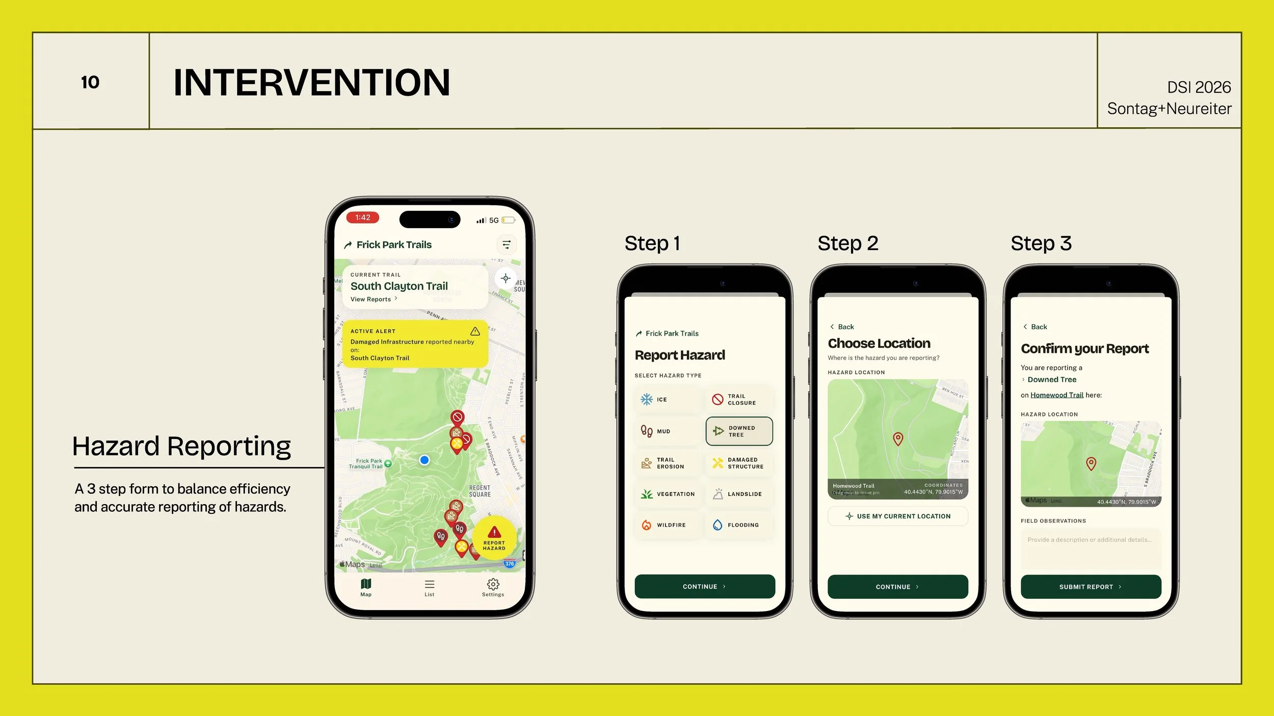
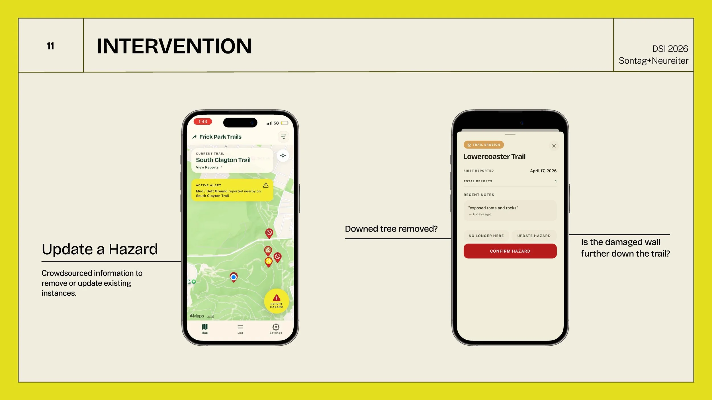
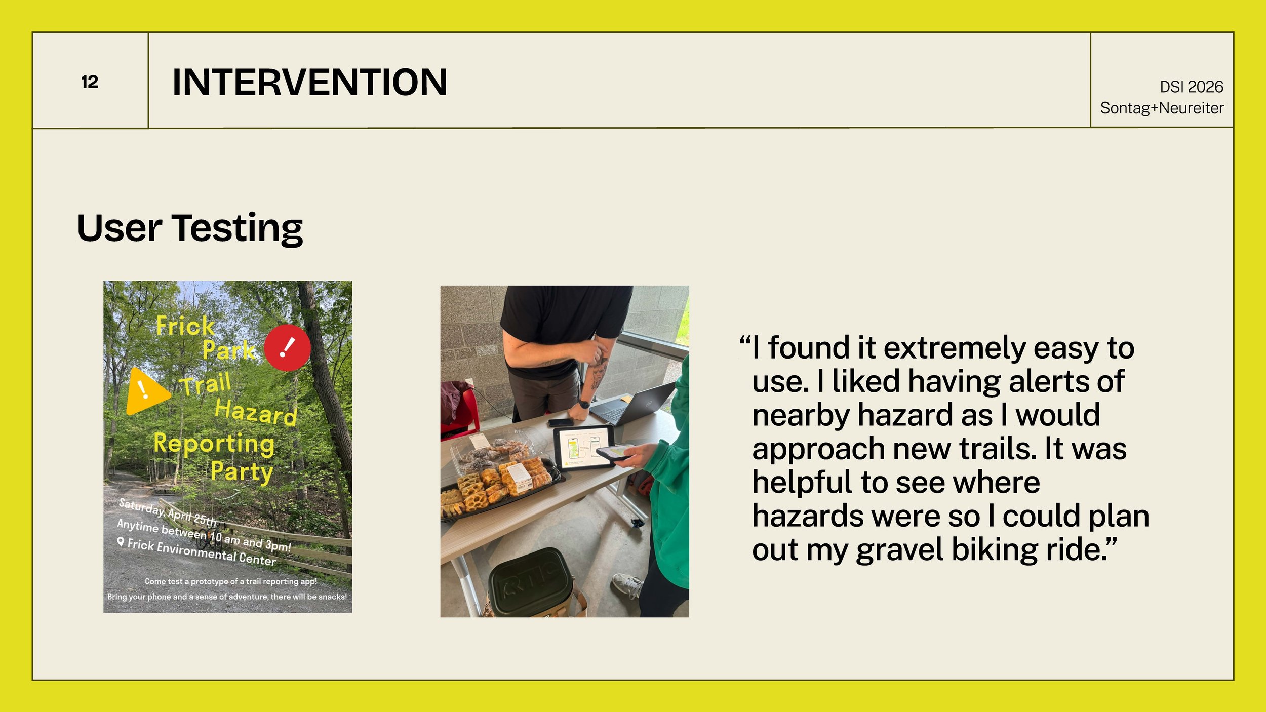
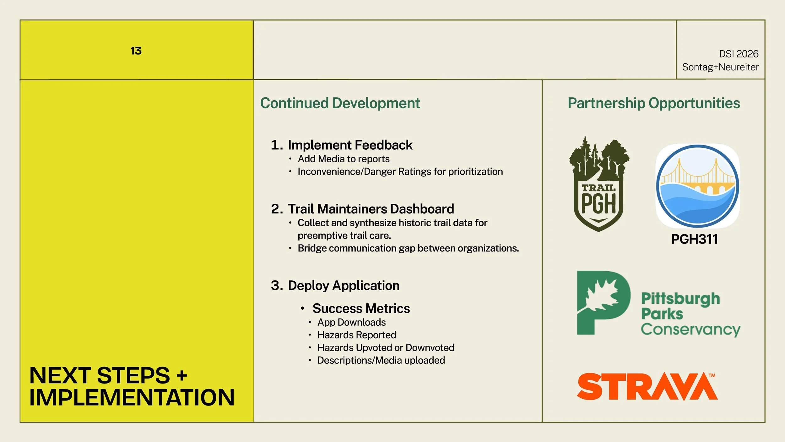
FRICK PARK TRAIL TRACKER: A MOBILE APP FOR REPORTING DATA ON TRAIL CONDITIONS AND HAZARDS IN FRICK PARK